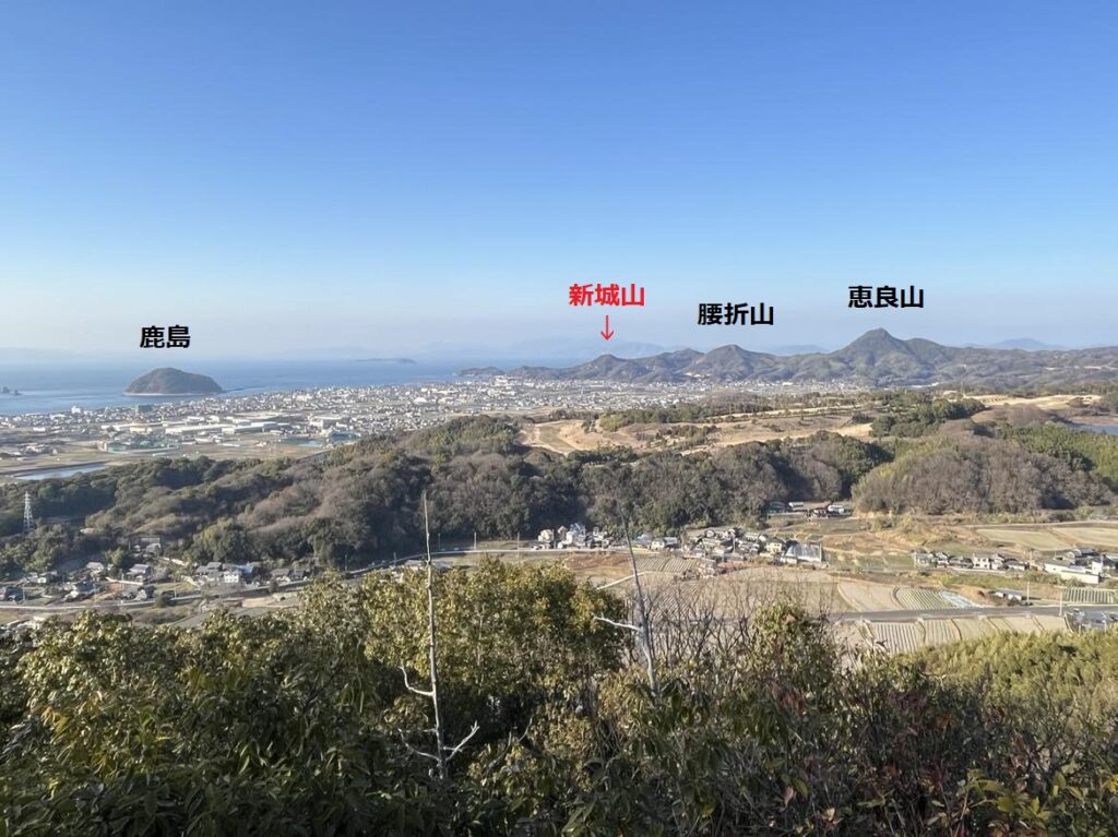
新城山 360度大パノラマ眺望の穴場低山(愛媛県松山市)標高161m
北条3山こと、恵良山、腰折山、鹿島。
いやいや、よく見なくても、腰折山と鹿島の間にもう1山ありますよね?
あの山は何?
ということで登ってきました新城山。
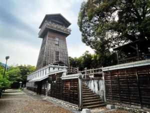
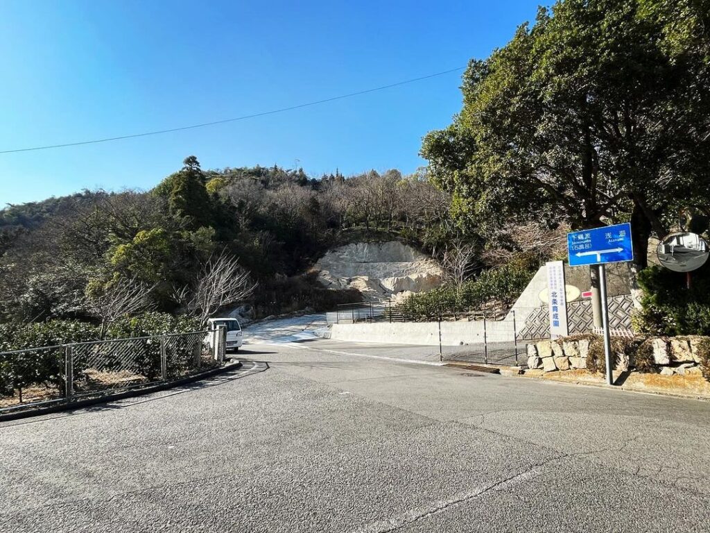
腰折山の登山口の奥、北条あかつきの郷さん、北条育成園さん、風早偕楽園さんの入口から、ぐるっと道を折り返します。
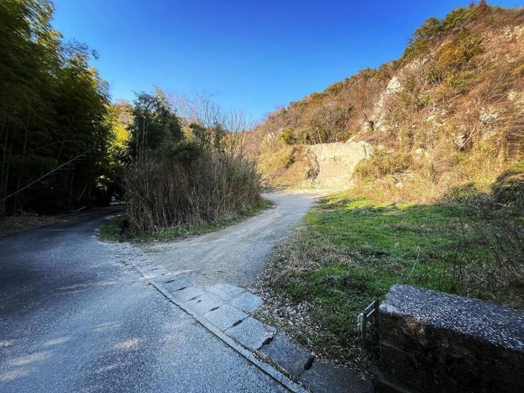
みかん畑の上を通ってしばらく歩くと、土砂採集場が見えてきます。
ここが新城山の登山口です。
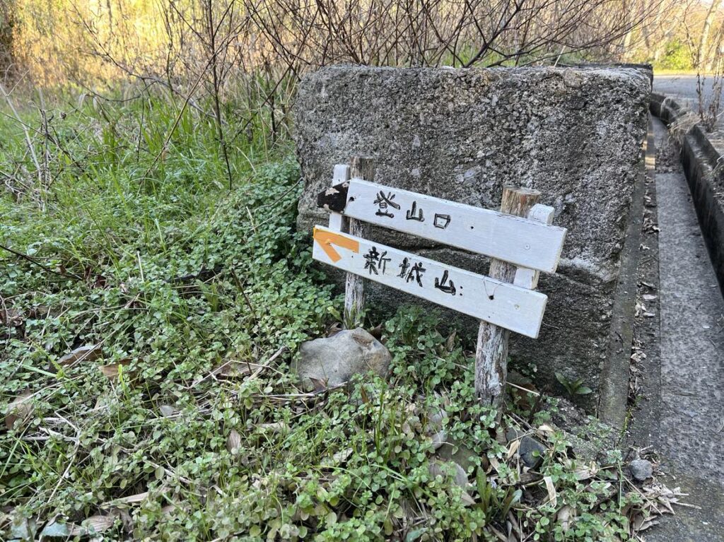
入口に小さな標識もあります。
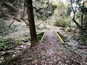
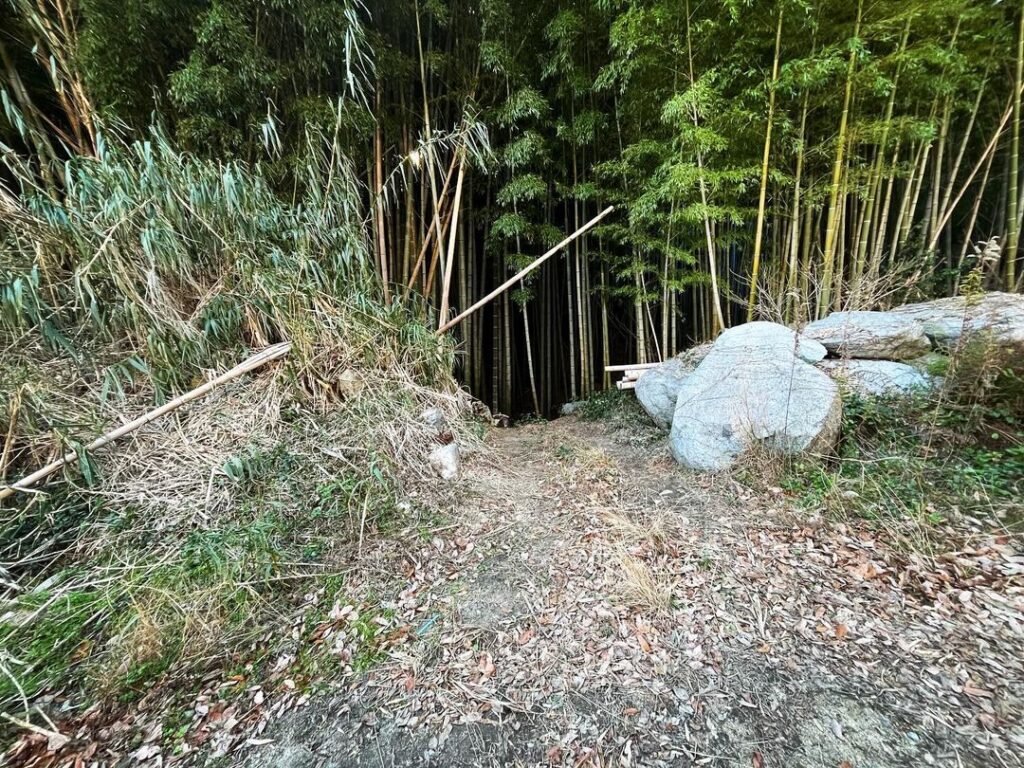
まずは採集場の左横の竹林の中に突入します。
入り口がわかりにくいですが、一度わかると簡単です。
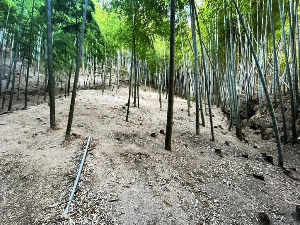
竹林を進んでいくと。トラロープがかかってある登り口が見えてきます。
急ですが、トラロープに沿って登っていきます。
トラロープがクロスするように張られていますので、沿いながら、くぐりながら登っていきます。
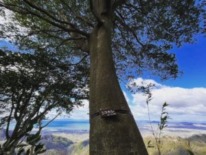
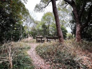
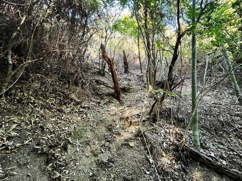
しばらく登ると尾根に。
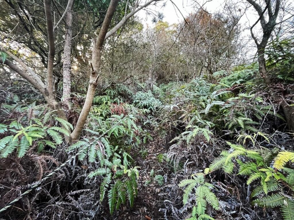
道がシダに覆われていますが、歩きやすいしっかりとした道です。
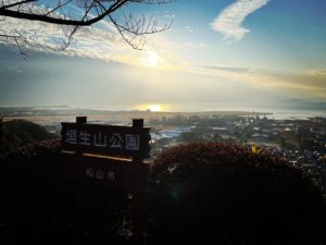
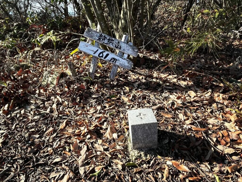
最後の登りを終えると、三角点と新城山の小さな標識があります。
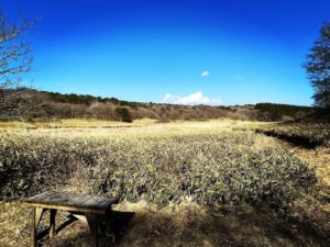
眺望はありません・・・が、ここからが本番です!
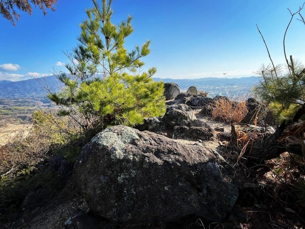
さらに奥に進むと岩場が待っています。
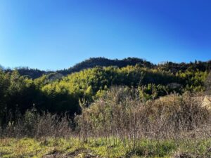
第1段の岩場、眺望が開けます。
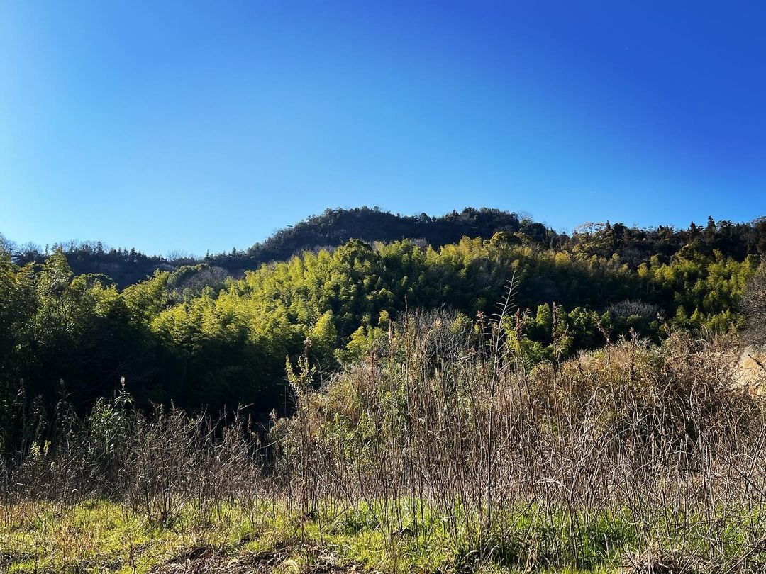
さらに奥に進むと第2段の岩場に。
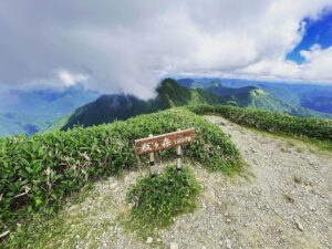
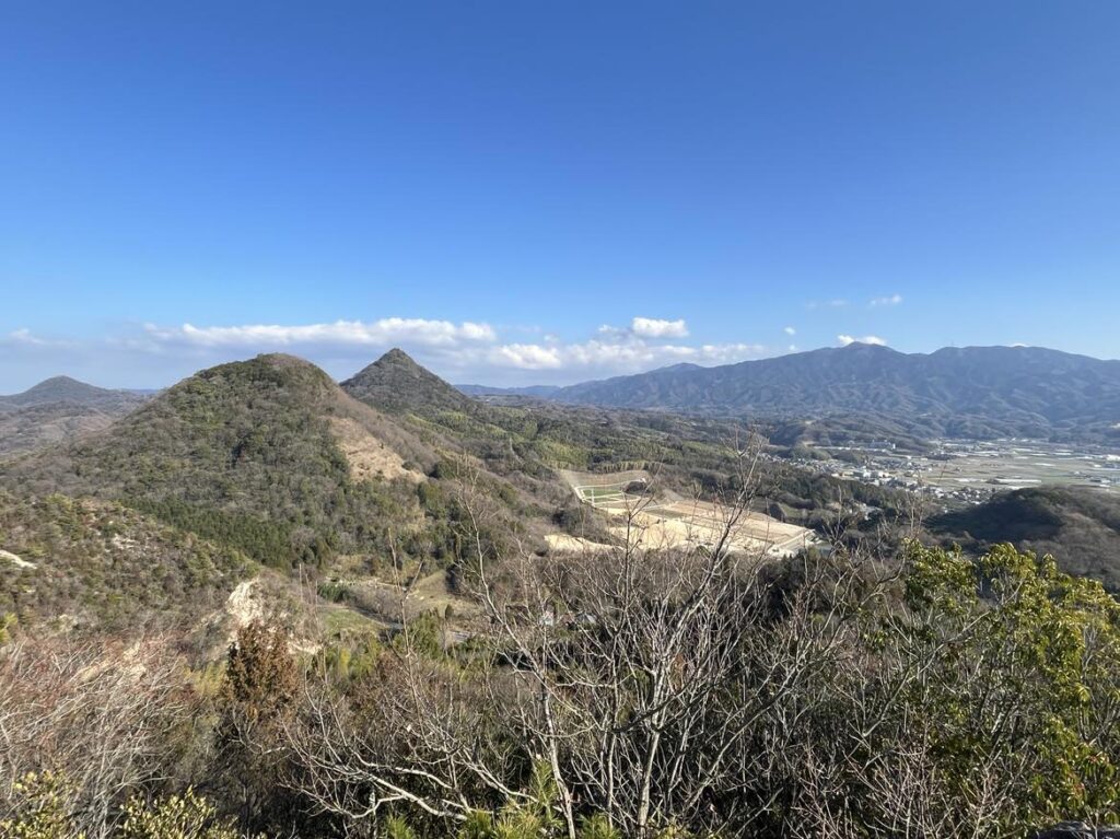
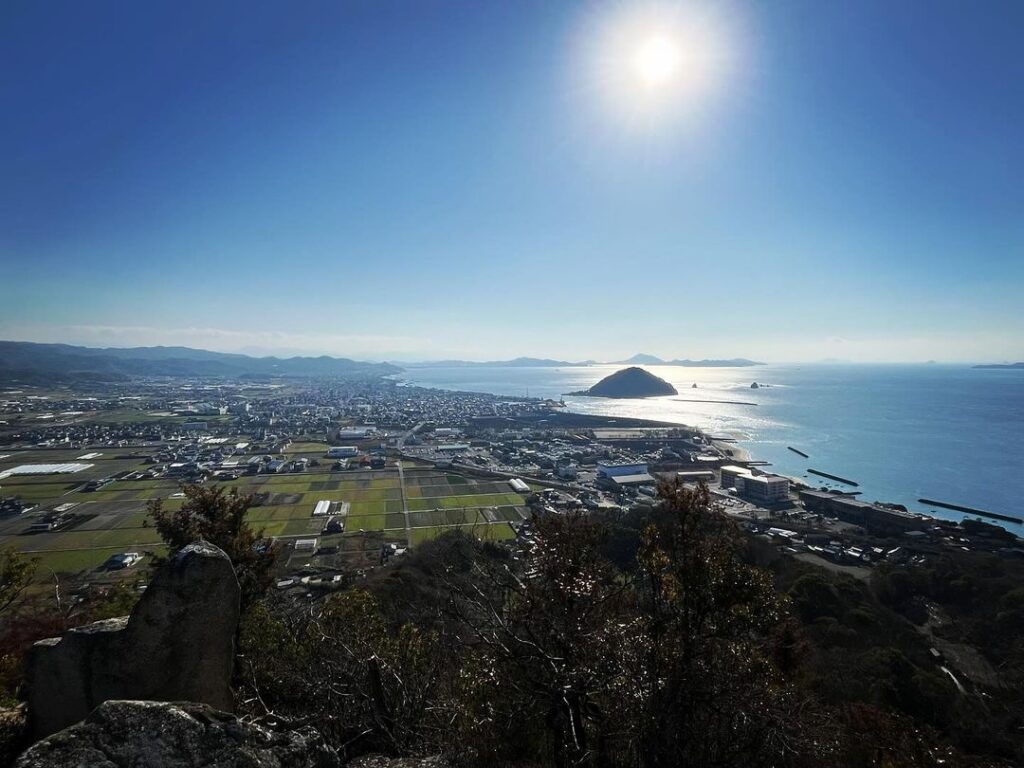
ここからの眺望が最高なのです!
尾ノ峰、腰折山、恵良山、高縄山、そして鹿島と、360度の大パノラマの眺望が楽しめます!
マイナーな山ですが、ここの眺望は凄いです!
標高161mですぐに登れますので、ぜひ登ってみてくださいね。
飛ばさずにカウントしてあげてほしいですよね!
軽トラックの方向にぐるっと回ります
土砂採集場の中に入っていきます
360度パノラマの素晴らしい眺望を楽しめます!
#新城山
#しんじょうやま
#標高161m
#腰折山
#愛媛の小山登り
#小山登り
#愛媛県
#松山市
#下難波
#北条三山
#北条3山
#土砂採集場
#三角点
The three Hojo mountains, Mt. Eryou, Mt. Koshiore, and Mt. Kashima.
No, no, no, you don’t have to look closely, but there is another mountain between Koshi Oriyama and Kashima, isn’t there?
What is that mountain?
So we climbed up Mt. Shinjo.
From the entrance of Hojo Akatsuki no Sato, Hojo Ikuseien, and Kazahaya Kairakuen, at the back of the trailhead of Koshioreyama, turn around on the path.
After walking for a while over the tangerine fields, you will see a sediment collection site.
This is the trailhead for Mt. Shinjo.
There is a small sign at the entrance.
First, enter the bamboo grove on the left side of the collecting site.
The entrance is not easy to find, but once you know it, it is easy.
After going through the bamboo grove, you will reach an entrance to a climb with a rope. You will see an entrance with a rope.
It is steep, but follow the rope.
The rope is crossed, so follow it and pass through it as you climb.
After climbing for a while, you will reach a ridge.
The path is covered with ferns, but it is a firm and easy trail.
After the last climb, you will see a triangular point and a small sign for Mt. Shinjo.
There is no view…but this is where the real fun begins!
Further in, a rocky area awaits.
The first rocky section with a view.
Further in, you will reach the second level of rocky terrain.
The view from this point is fantastic!
You can enjoy a 360-degree panoramic view of Onomine, Koshioreyama, Eryousan, Takanawasan, and Kashima!
Although it is a minor mountain, the views here are amazing!
It is only 161 meters above sea level and can be climbed quickly, so please try to climb it!
新城山山頂 岩場からのパノラマ眺望(動画)