笠松山 山林火災後の雨山登山(愛媛県西条市・愛媛県今治市)標高357m
仕事で今治に来たので、やはり登っておきたいのは笠松山です。
2025年3月23日~31日、笠松山、世田山の火災が発生しました。
笠松山は、2008年8月24日~26日にも火災が発生しているので2度目の火災ですね。
山を登る身としては、その原因を作らないためにも、この惨状をきちんと見ておかないとです。
とはいうものの…雨です。
昨日の予報では曇りだったのに(泣)
日曜日も山に登るので、登山靴は濡らしたくないし…
と悩んだ結果、車に積んであった雨合羽と長靴、そして傘をさして登ることに。
もう、こうなったら意地でも登ります!
長靴は靴底は滑り止めがしっかりしていますが、なかなか重いのですよね。
普段の登山靴のありがたさがわかります。
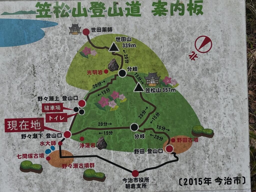
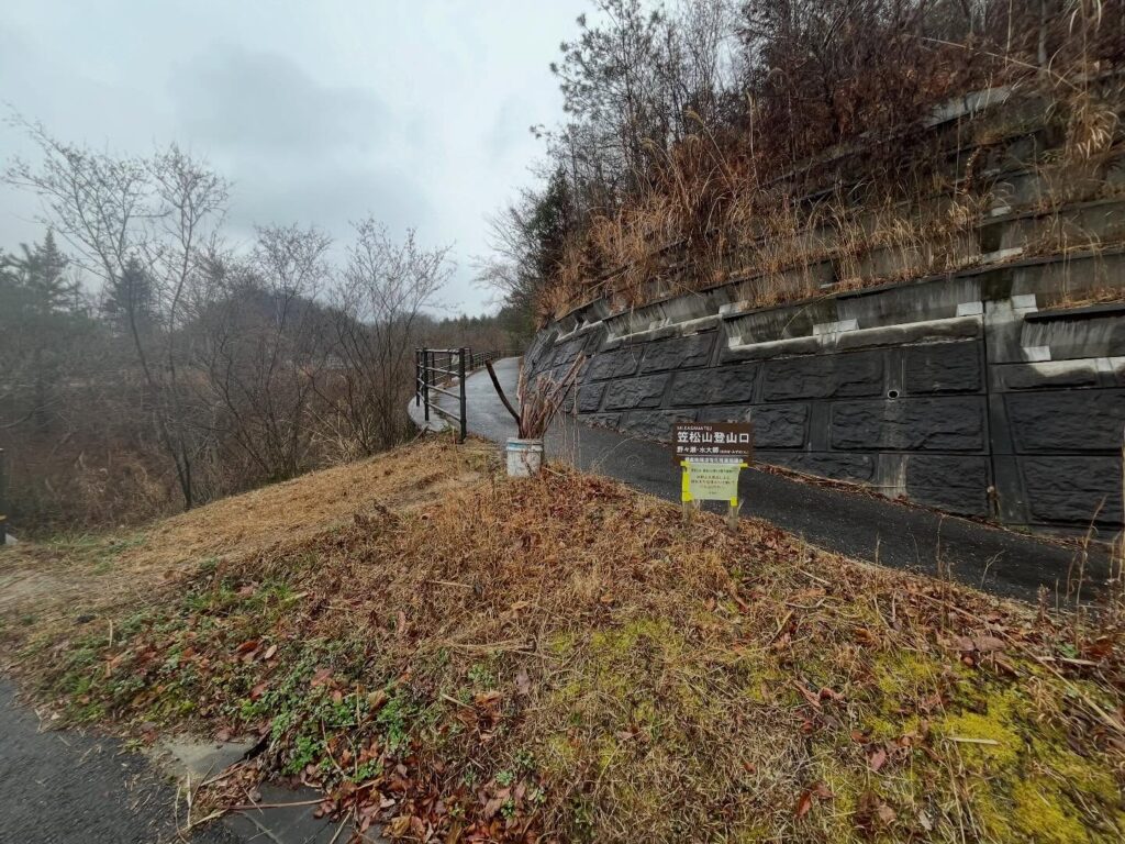
今回は野々瀬古墳群にある野々瀬・水大師登山口からスタート。
道がよく整備されており、ほぼ階段です。
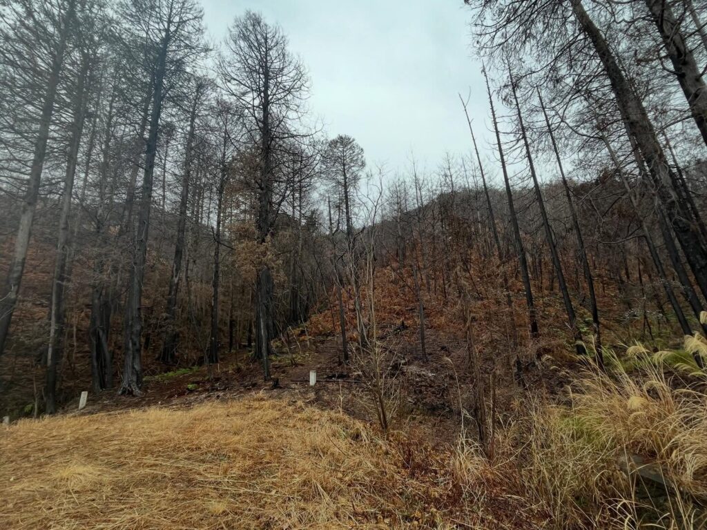
登山口の下の方から、道中見える景色は焼け跡だらけ。
火災のすさまじさがよくわかります。
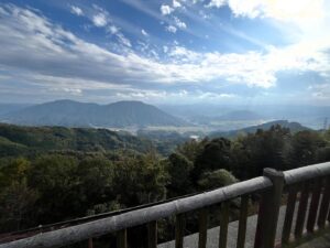
道中は何ヵ所か展望スポットがあります。
モヤで真っ白なのですが、うっすらと眺望を眺められます。
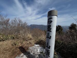
40分ほどで山頂の広場に到着、休憩所で少し雨宿り。
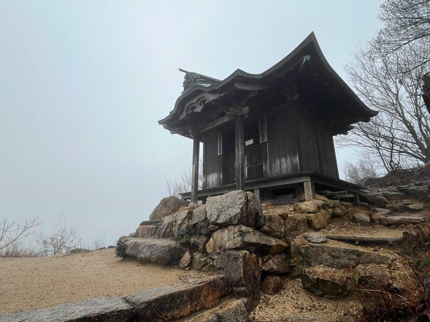
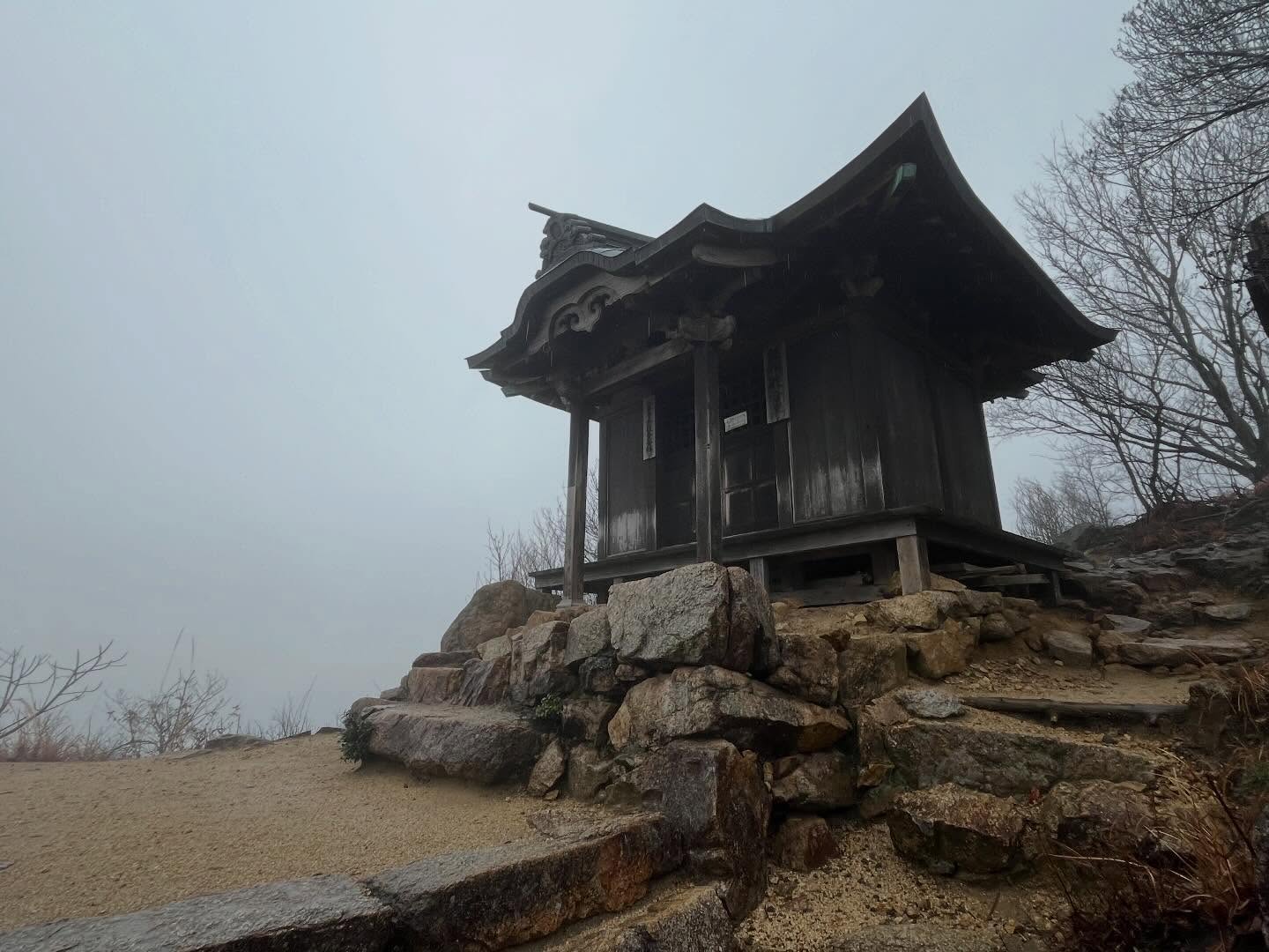
石段を登って、笠松観音堂にご挨拶。
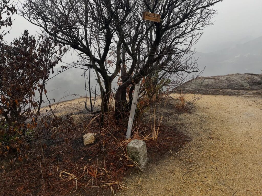
周辺の木々は焼けていますので、本当に奇跡的に無事だったことがわかります。
笠松観音堂からの眺望は残念ながら真っ白ですが、登ってこられて良かったです。
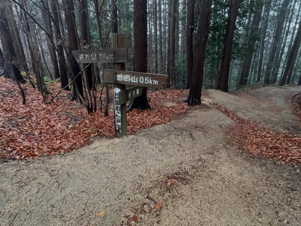
さらに進んで、世田山への稜線を歩きます。
こちらも焼けた木々の中を歩きます。
特にモヤのなかですので、白と黒のモノトーンがはっきりします。
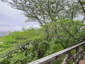
その中でも、新しい松葉が出てきているのが嬉しいですね。
笠松山東峰の三角点を経て、世田山との分岐点から下ります。
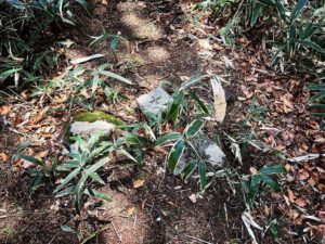
こちらの道は、整備されていないので登山道っぽいです。
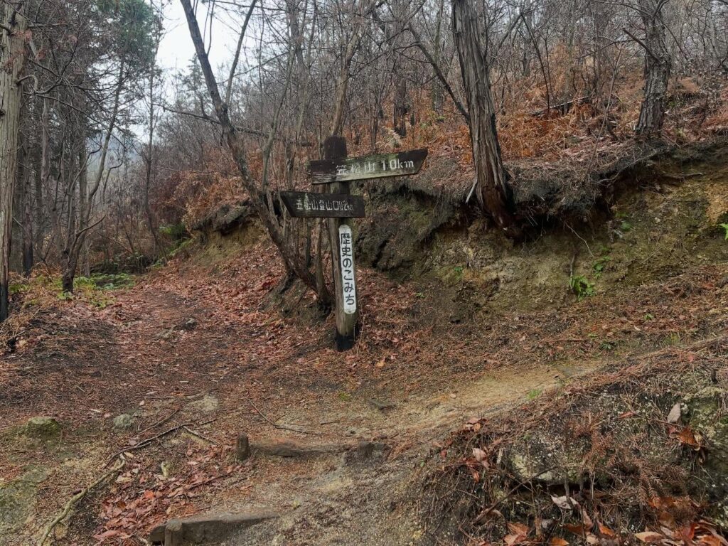
野々瀬・奥登山口に到着。
昭和35年建設の立派な登山口標識がありました。
設置から65年も登山者を見守っているのですね。
ちょっと感慨深かったです。
雨とモヤのため世田山は諦めましたが、笠松山をぐるっと歩けた良い時間でした。

現在は20基程度
愛されているお山ということがわかりますね

歴史のこみちという名前がつけられているそうです

奥に見えるのが笠松山


このような眺望が待っています
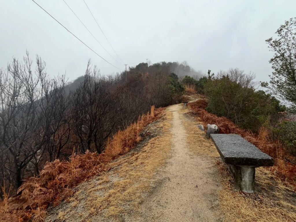
天気が良ければ、ベンチで景色を眺めながら小休止ですね
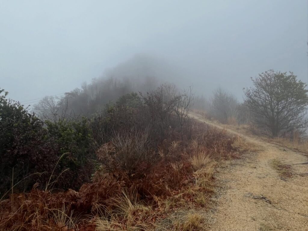
うっすら見えるのが笠松山山頂

奥には立派な東屋も


隣の木々は焼けていますので、本当に奇跡!

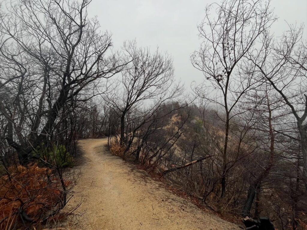
両端の木々は真っ黒です
この日は世田山を諦めて下山

昭和35年建設の立派な標識です
#笠松山
#かさまつやま
#標高357m
#笠松観音堂
#千手観音
#愛媛の小山登り
#小山登り
#愛媛県
#今治市
#西条市
#朝倉南
#山火事
#山林火災
Since I’m in Imabari for work, I really want to climb Kasamatsu Mountain.
From March 23rd to 31st, 2025, fires broke out on Kasamatsu Mountain and Setayama.
Kasamatsu Mountain also had a fire from August 24th to 26th, 2008, so this is the second time.
As someone who climbs mountains, I need to properly witness this devastation to help prevent such causes in the future.
That said… it’s raining.
Yesterday’s forecast said cloudy.
I’m climbing again on Sunday, so I don’t want to get my hiking boots wet…
After agonizing over it, I decided to climb wearing the rain gear and boots I had in the car, plus an umbrella.
At this point, I’m determined to climb no matter what!
The rubber boots have great slip-resistant soles, but they’re really heavy.
It makes you appreciate your regular hiking boots.
This time, I started from the Nonose/Mizudaishi trailhead in the Nonoze Kofun Group.
The path is well-maintained, mostly stairs.
From the lower part of the trailhead, the views along the way are full of scorched earth.
You really get a sense of how devastating the fire was.
There are several viewing spots along the way.
Though shrouded in white haze, you can faintly make out the view.
After about 40 minutes, we reached the summit plaza and took shelter from the rain at the rest area.
We climbed the stone steps to pay our respects at Kasamatsu Kannon Hall.
Seeing the surrounding trees charred, you realize how miraculously it survived.
The view from Kasamatsu Kannon Hall was unfortunately completely white, but it was still worth the climb.
We continued further, walking along the ridge line towards Setayama.
Here too, we walked through charred trees.
Especially in the haze, the monochrome of black and white became starkly clear.
Even so, it was heartening to see new pine needles emerging.
Passing the triangulation point on Kasamatsu Mountain’s East Peak, we descended from the fork leading to Setayama.
This path, being unmaintained, felt more like a proper mountain trail.
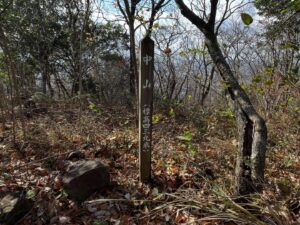
Arrived at the Nonose/Oku trailhead.
There was a splendid trailhead sign built in 1960.
It’s been watching over hikers for 65 years since its installation.
It felt a bit poignant.
Though we gave up on Mt. Setayama due to the rain and mist, it was a good time walking around Mt. Kasamatsu.
笠松山 野々瀬・水大師登山口(野々瀬下登山口)
笠松山 野々瀬・奥登山口(野々瀬上登山口)
笠松山のMAP
活動データ(YAMAP)
活動データはYAMAPからご覧ください↓