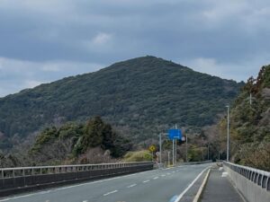
堂堂山 堂堂山公園とテレビ塔と展望台(愛媛県西宇和郡伊方町)標高403m
佐田岬半島スクーター登山の旅。
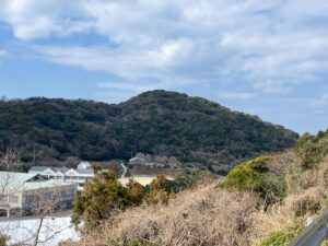
本日のラスト、8つ目の山は堂堂山。
堂堂山公園のある場所です。
大峰から堂堂山までは、道こそ悪いのですが、比較的近くになります。
のはずなのですが、これまたgoogle mapの案内が悪く、違う道へ…
スクーターのガソリンが残り少ないため、本当にドキドキです。
細道を通って、ようやく堂堂山公園に到着です。
帰り道でも思いましたが、ここ、軽自動車以外では行ってはダメですよね…
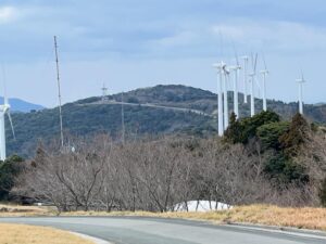
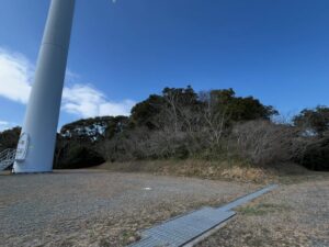
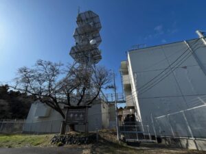
公園といっても、テレビアンテナ施設がメインです。
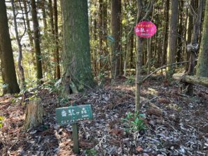
この前に堂堂山の案内看板が立っています。
三角点はなく、YAMAPの山頂ポイントはアンテナ施設の裏側の建物あたりです。
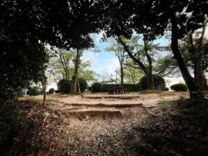
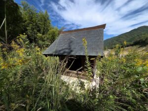
昔は藤棚などがあったようですが、今は基礎と柱だけ。
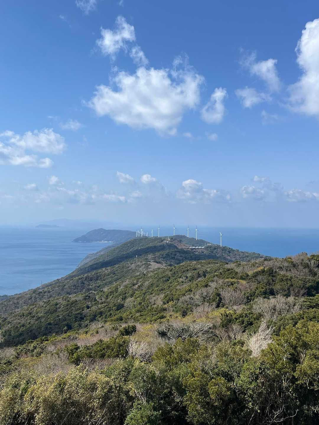
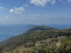
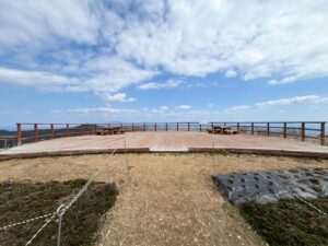
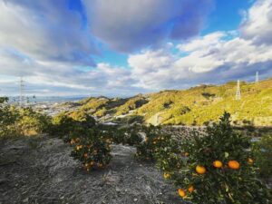
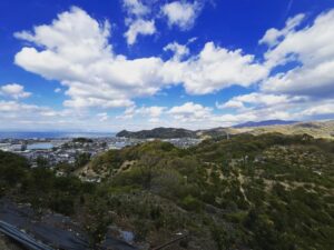
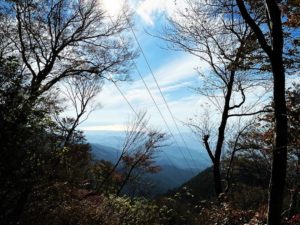
奥に進むと、展望台がありました。
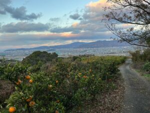
展望台からは西の佐田岬方面の眺望と風車の列を見ることができます。
昔は観光地だったのだろうなぁと思いつつ、その前に道を整備してほしいなぁと思う次第です。
帰り道、伊方町と八幡浜市の境あたりに向かって降りれるはずだったのですが、堂堂山に太陽ファームさんが工場を作られていて、アスファルトではなくコンクリの道となっていました。
チャレンジしてみましたが、アウェイ感が強く、工場の敷地内なのか公道なのかわからず、諦めて戻って伊方町役場の方向に続く道を下りました。
あのまま進んでも良かったのでしょうかね?
いずれにせよ、道が狭くて荒れすぎでしたので、堂堂山公園に行かれる際は、車の方は軽自動車のみの自己責任でお願いします。
ということで、佐田岬半島スクーター登山の旅は8つのピークハントをすることができました。
晴天でしたが、基本が10℃ちょっとで風が強いため、心底冷え切りました。
食べ物を買う場所が全くないので、伊方町の町のドラッグストアmacさんに寄られることをお奨めします!
道の駅で買った、よくわからないお菓子のおかげで、私は救われました(汗)

駐車場はこの堂堂山の看板前です


#堂堂山
#堂々山
#どどやま
#標高403m
#スクーター登山
#堂堂山展望台
#展望台
#愛媛の小山登り
#小山登り
#愛媛県
#西宇和郡
#伊方町
#河内
#えひめ森林浴八十八ヵ所
A Scooter Hiking Trip on the Sada Misaki Peninsula.
Today’s final stop, the eighth mountain, is Mt. Dodo.
This is where Dodo Mountain Park is located.
The road from Omine to Mt. Dodo is rough, but it’s actually relatively close.
Or so it should be, but once again, Google Maps gave me bad directions, and I ended up on the wrong road…
With very little gas left in the scooter, I was really nervous.
After navigating a narrow path, I finally arrived at Dodo-yama Park.
I thought the same thing on the way back, but really, this place shouldn’t be accessible to anything other than a kei car…
Although it’s called a park, the main feature here is a TV antenna facility.
There’s a signpost for Dodo-yama right in front of it.
There’s no triangulation point, and the summit marker on YAMAP is located near the building behind the antenna facility.
It seems there used to be a wisteria trellis here, but now only the foundation and pillars remain.
As I went further in, I found an observation deck.
From the observation deck, you can see the view toward Cape Sada to the west and a row of wind turbines.
I found myself thinking that this must have been a tourist spot in the past, but before that, I really wish they’d fix the roads.
On the way back, I was supposed to be able to head down toward the border between Ikata Town and Yawatahama City, but Taiyo Farm has built a factory on Mt. Dodo, and the road was concrete instead of asphalt.
I tried to go for it, but I felt very out of place—I couldn’t tell if I was on private factory grounds or a public road—so I gave up and turned back, heading down the road toward the Ikata Town Hall.
I wonder if I could have kept going?
In any case, the road was too narrow and in terrible condition, so if you’re planning to visit Dodo-yama Park by car, please note that only kei cars are allowed, and you do so at your own risk.
So, on this scooter mountain-climbing trip around the Sada Misaki Peninsula, I managed to conquer eight peaks.
It was sunny, but with temperatures hovering just above 10°C and strong winds, I was absolutely frozen to the bone.
There are absolutely no places to buy food, so I highly recommend stopping by the drugstore “mac” in Ikata Town!
I was saved by some mysterious snacks I bought at the roadside station.
堂堂山のMAP
堂堂山公園展望台のMAP
活動データ(YAMAP)
活動データはYAMAPからご覧ください↓