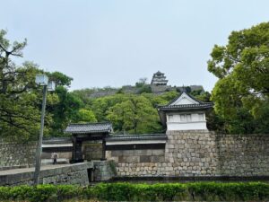
新城山 苦行を耐えた先に待っている超お薦めの眺望スポット(愛媛県松山市)標高161m
アテンド登山。
2つ目の山は、恵良山のお隣のお隣の山、新城山です。
前回登ったのは1月、そして今日は7月。
1月ですら、登山道が藪でしたので、今日はどうなることやら…
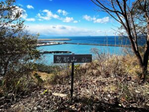
新城山はお薦めの山なのですが、登山口がマニアックすぎて、初めての方には難易度が高い山です。
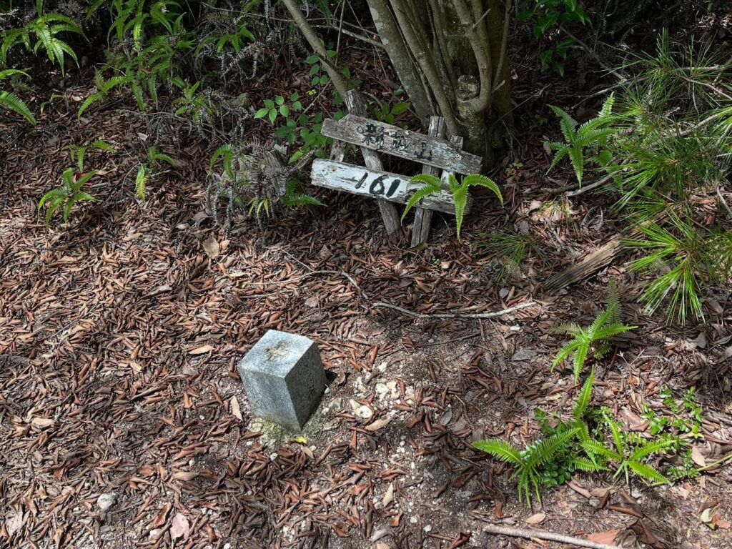
まずは入口に小さな案内があるのですが、草に隠れ、しかも傾いてしまっている状況。
この1年半の間に何があった??
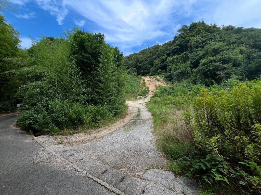
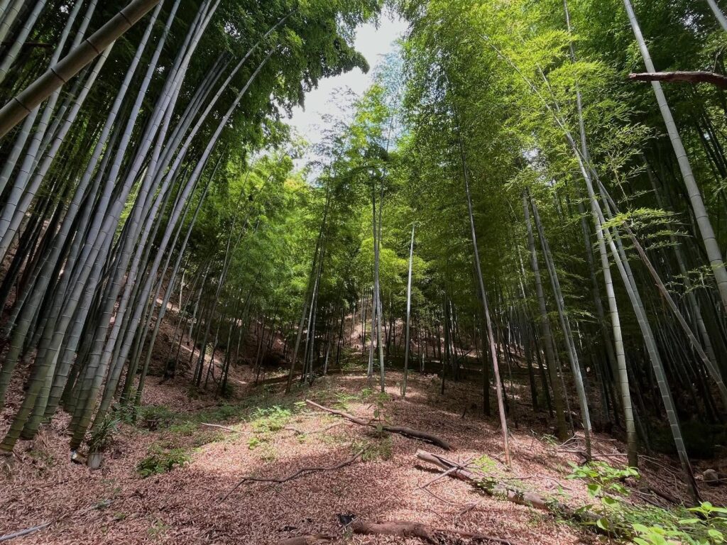
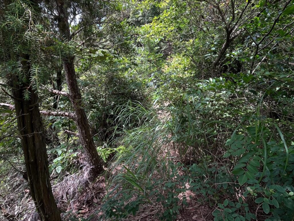
土砂採集場に入ると、左手に竹藪に入る道があります。
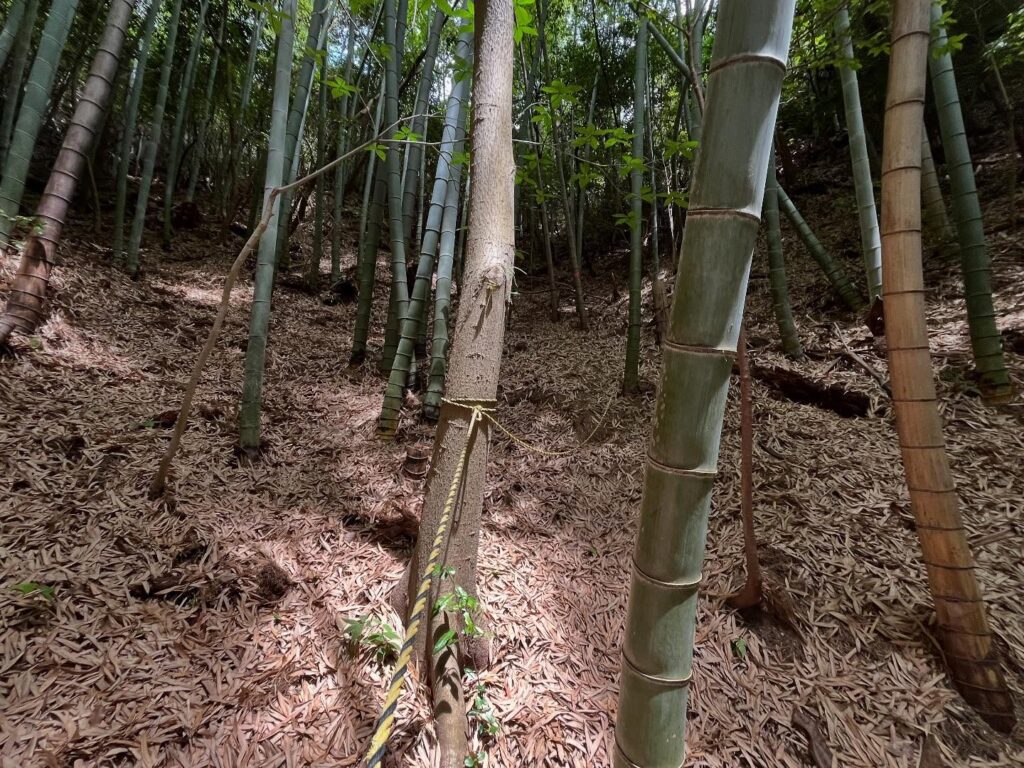
ここから入り、竹藪を奥に奥に進んでいくと、トラロープが見えてきます。
あとは、トラロープが尾根まで案内してくれます。
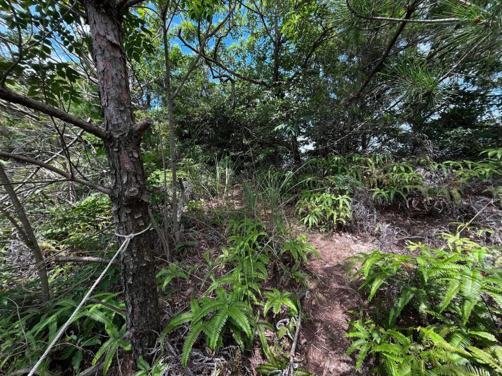
登り始めは笹の葉の落ち葉で、滑りまくるので要注意。
一気に傾斜を登っていきます。
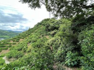
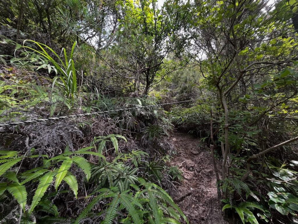
尾根に出ると、想像通り、なかなかの藪道のスタートです。
蜘蛛の巣も多く、ひたすら露払いをしながら道を作っていきます。
友人も「なんで、こんなところに…」と絶望していたはず(笑)
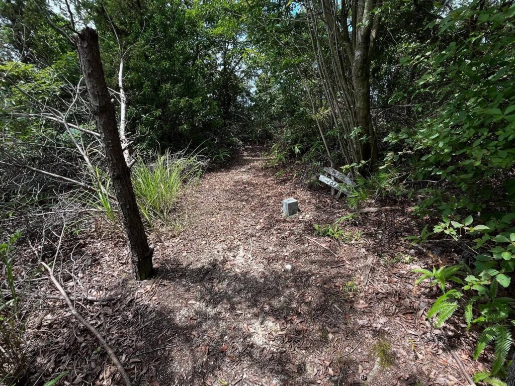
最後の登りを終えると新城山の三角点に到着。
ここがゴールだったら、本当に絶望かもしれません(笑)
さらに奥へ奥へと進んでいきます。
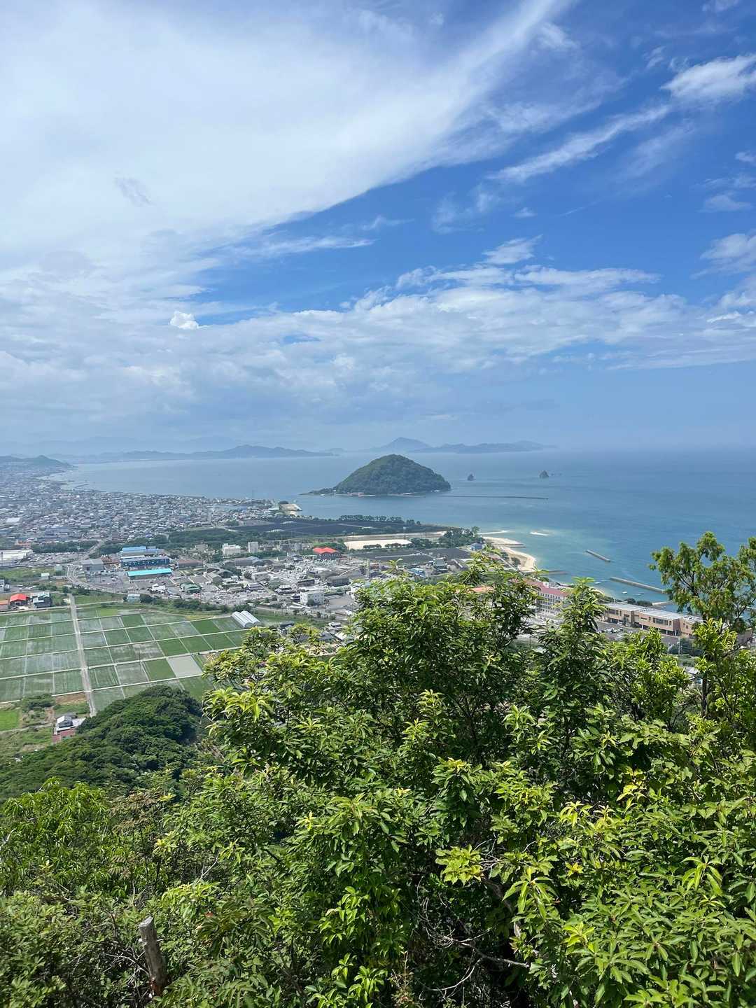
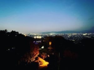
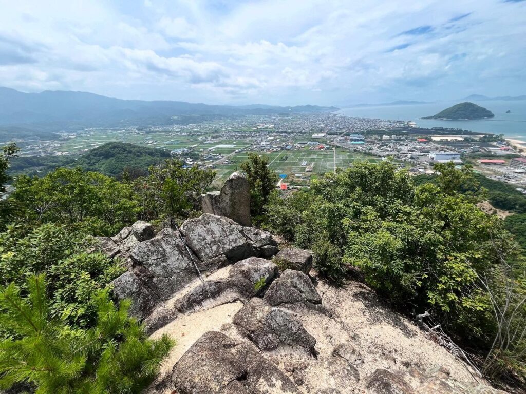
眺望がない道を黙々と進んでいった先に、一気に眺望が開けるのですよね!
最高の眺望の岩場が待っています。
先ほどまで登っていた恵良山。
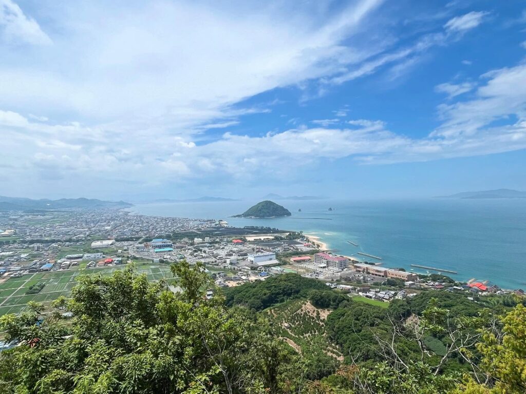
鹿島と瀬戸内海のパノラマ眺望。
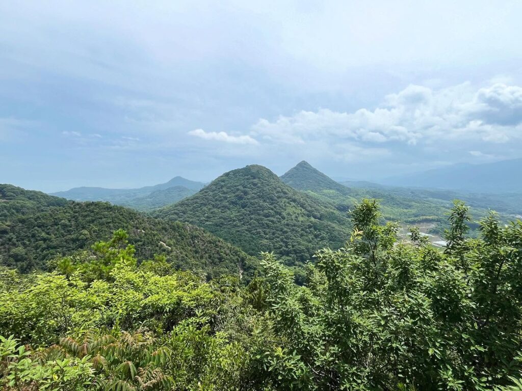
風も涼しく、ゆっくりと景色を楽しむことができました。
登って良かった!と言っていただき、アテンドしたかいがありました。
まぁ、この後、同じ藪道を降りるのですけどね(汗)
雲と青空が絶妙な眺望だったのですが、この1時間後には嵐に…
お天気にも恵まれたアテンド登山でした。
知らないと絶対にわかりません
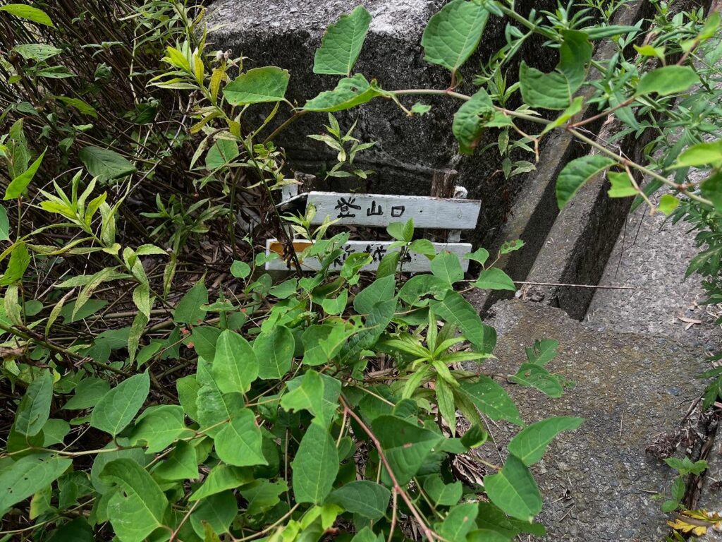
真っすぐになるよう撮影しましたが
かなり斜めになってしまっていました
ここも入り口を知らないと入れません
笹の葉で滑りますので注意
なかなかの傾斜です
濡れていると滑るので注意
左側に進んでいきます
蜘蛛の巣と棘に気を付けながら進みます
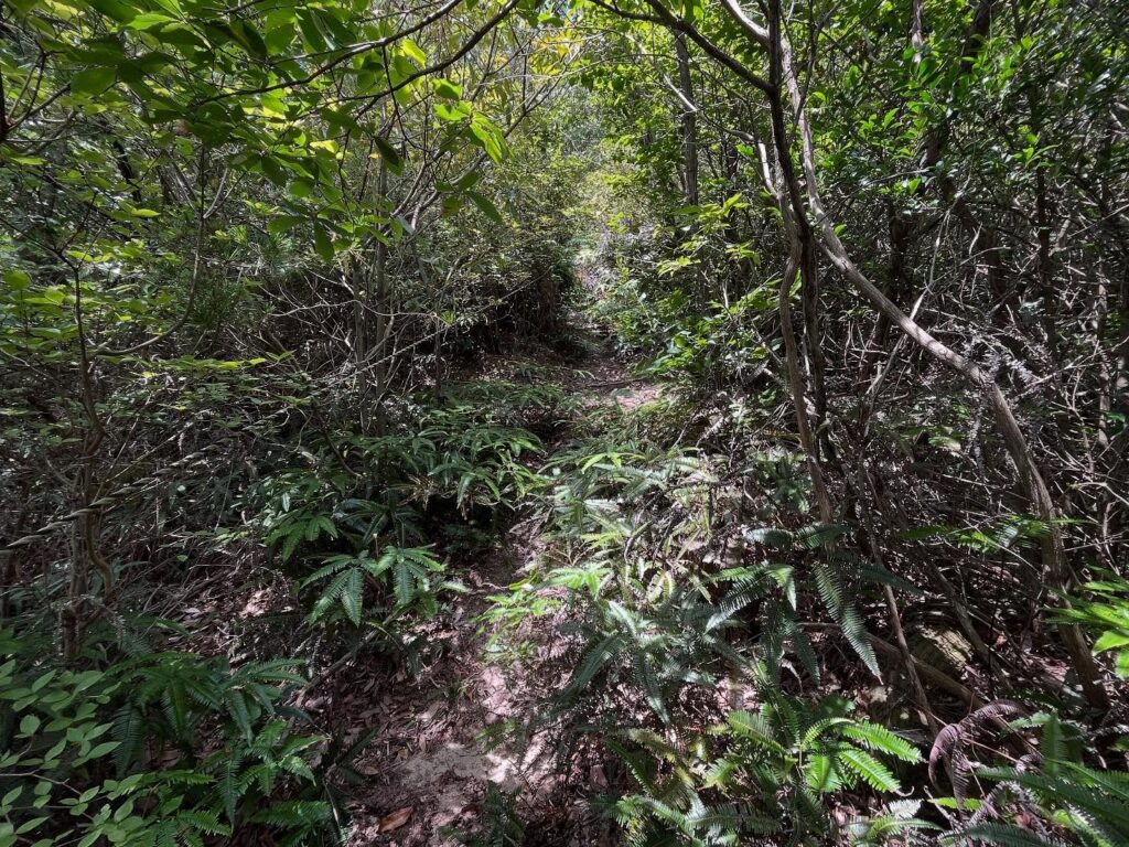
更に奥に進んでいきます
一気に眺望が広がります!
広がる眺望は新城山の方が素晴らしいです!
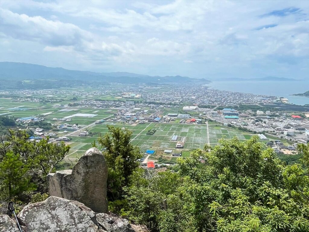
そして北条の街並みが広がります
ずっと居れますので、おやつは必須!
#新城山
#しんじょうやま
#標高161m
#愛媛の小山登り
#小山登り
#愛媛県
#松山市
#絶景スポット
#眺望スポット
#三角点
#アテンド登山
Attende mountain climbing.
The second mountain is Mt. Shinjo, a neighbor of Mt. Eroyu.
The last time we climbed this mountain was in January, and today is July.
Even in January, the trail was bush, so I was not sure how it would be today…
Mount Shinjo is a recommended mountain, but the trailhead is too maniacal and difficult for first-timers.
First of all, there is a small guide at the entrance, but it is hidden by grass and also tilted.
What has happened in the last year and a half?
After entering the sediment collection area, there is a path to the left that leads into a bamboo thicket.
Enter here and go deeper and deeper into the bamboo thicket, and you will see a tiger rope.
The tiger rope will lead you to the ridge.
Be careful at the beginning of the ascent as it is slippery due to fallen bamboo leaves.
You will climb up the incline in one go.
Once you reach the ridge, as you can imagine, it is the start of a very bush trail.
There were many cobwebs, and we had to make our way while clearing away the dew.
My friend must have been despairing, “How did we end up here?
After the final ascent, we arrived at the triangular point of Mt.Shinjo.
If this were the goal, we might really be in despair.
We continued further and further into the mountain.
After silently advancing along a path with no view, the view opens up all at once, doesn’t it?
A rocky area with the best view awaits you.
Mt. Eryou, which we had just climbed.
Panoramic view of Kashima Island and the Seto Inland Sea.
The wind was cool and we were able to relax and enjoy the view.
We were glad to have climbed the mountain! and it was worth attending to.
Well, we had to go down the same bush path afterwards.
The view was exquisite with clouds and blue sky, but an hour later, it turned stormy…
We were blessed with good weather for attending the climb.
新城山 岩場からの眺望(動画)
新城山の登山口
竹林の入り口
新城山のMAP
新城山 岩場のMAP
活動データ(YAMAP)
活動データはYAMAPからご覧ください↓