大久野島山頂展望台(ひょっこり展望台) パノラマ眺望の展望台・中部砲台跡・日本一高い送電鉄塔(広島県竹原市)標高90m
「地図から消された島」大久野島に行ってきました。
毒ガス工場があったため、機密保持のために一時期、地図から消されていたとのことです。
現在は「うさぎの島」として、野生のウサギがたくさん棲息する島となっています。
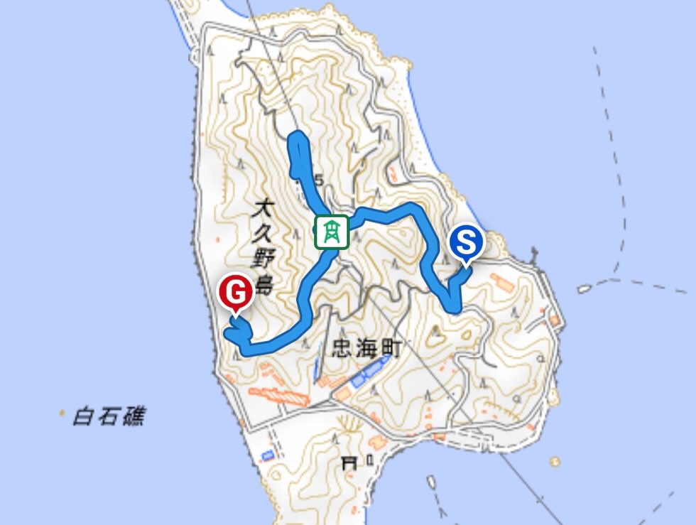
大三島の盛港からフェリーで15分、大久野島の第2桟橋に到着します。
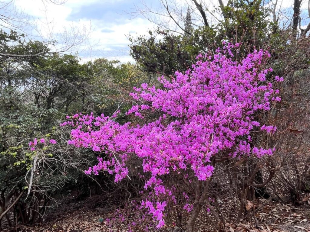
1週4kmほどの小さな島なので、寄ってくるウサギと戯れながら、まずはぐるりと歩いて一周。
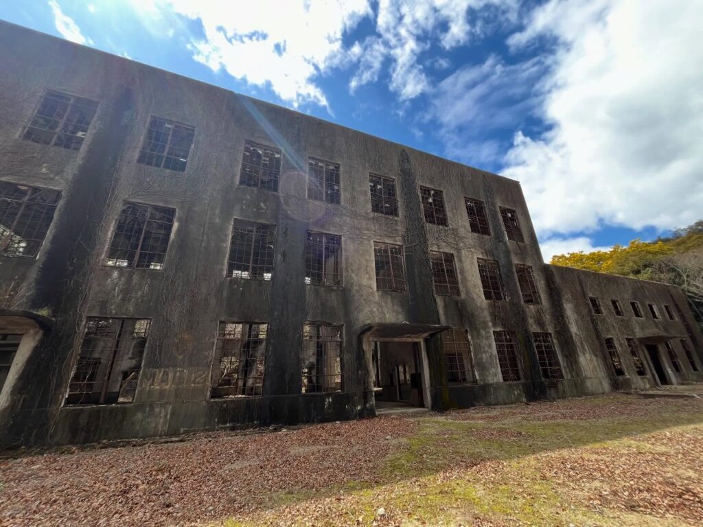
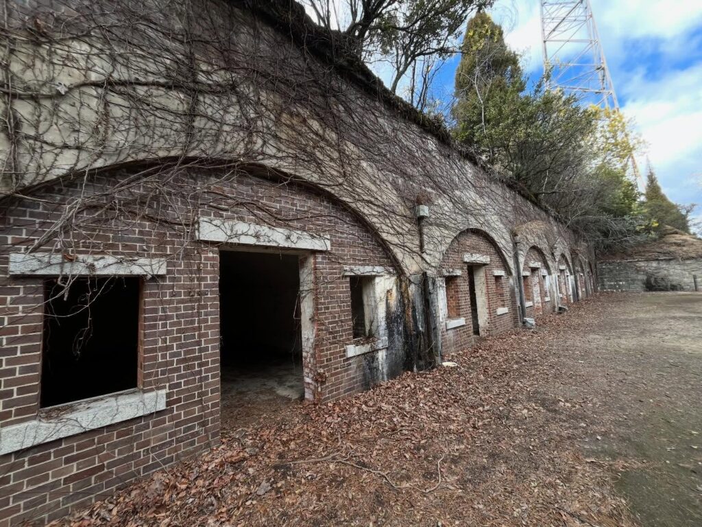
毒ガス資料館、毒ガス貯蔵庫跡、北部砲台跡、発電所跡など、日本の負の歴史を学びます。
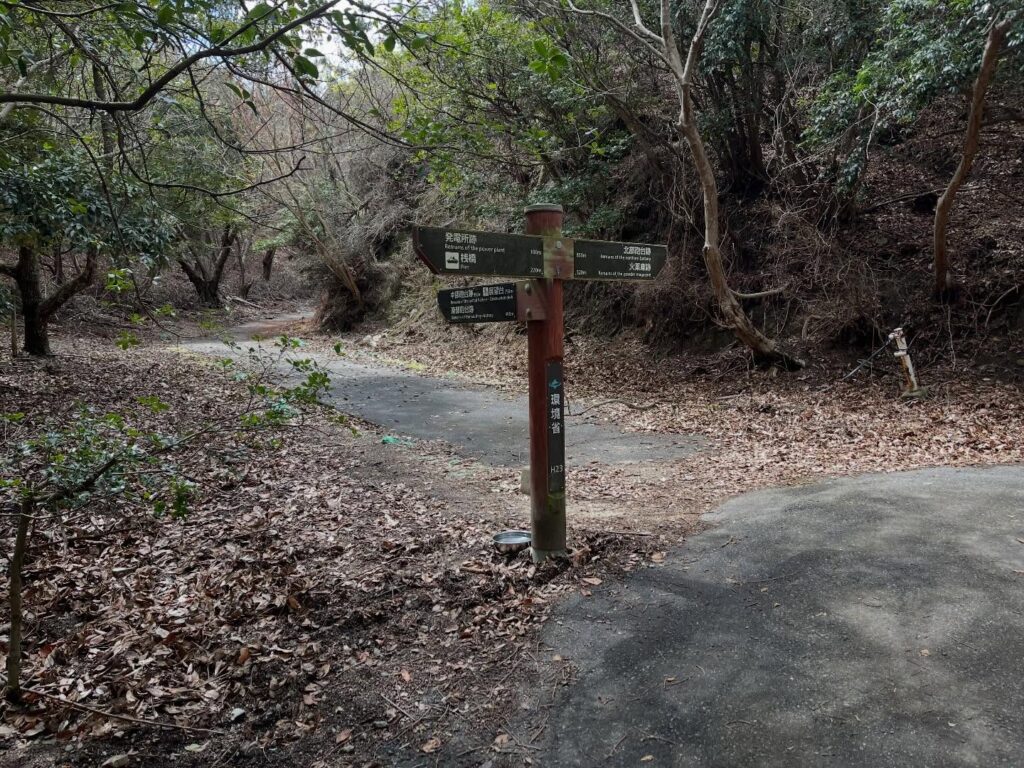
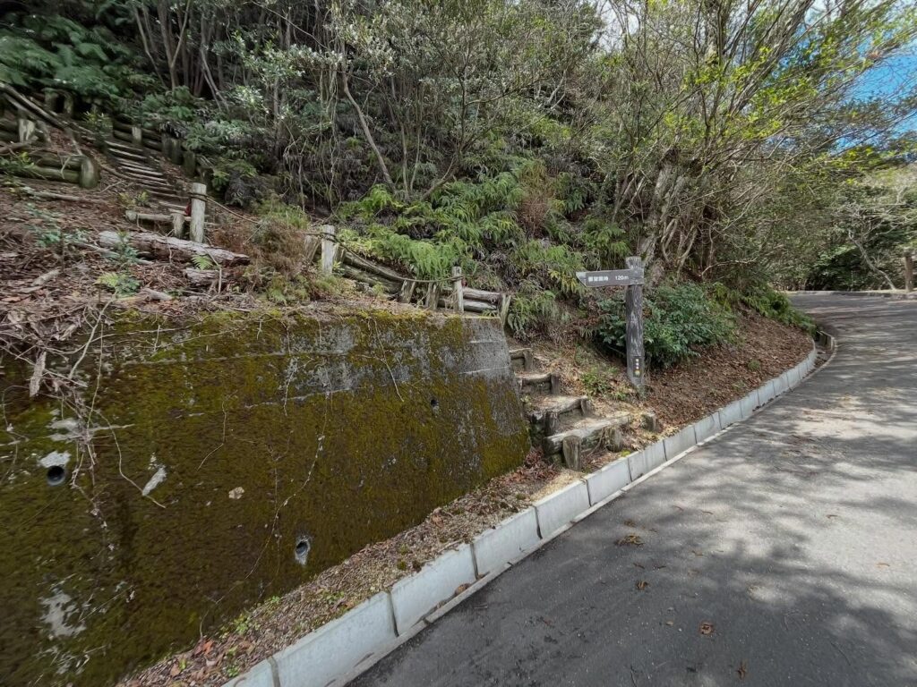
ぐるっと周ったところで、発電所跡の横道から展望台へと登ります。
(発電所跡の横道から登り、休暇村近くのグラウンドへと下りてきました。)
こちらの道は舗装された道で、楽々お散歩です。
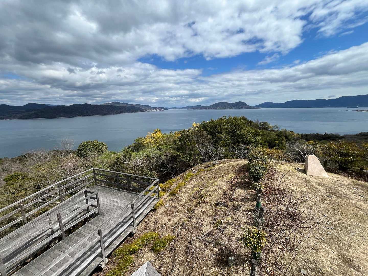
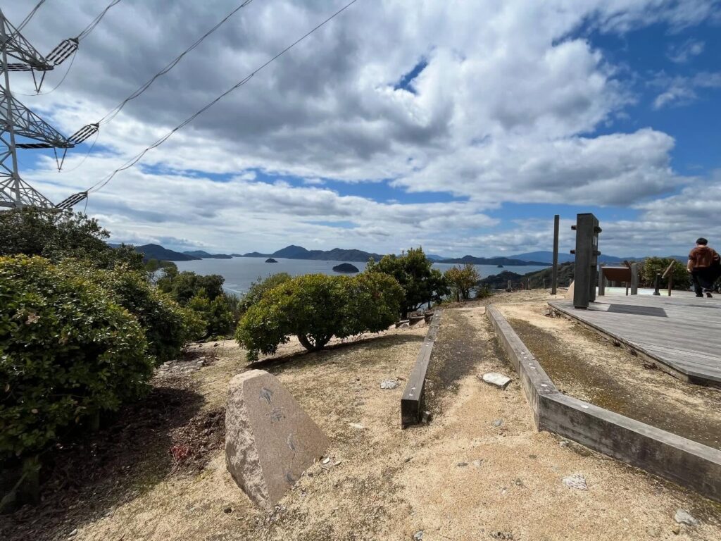
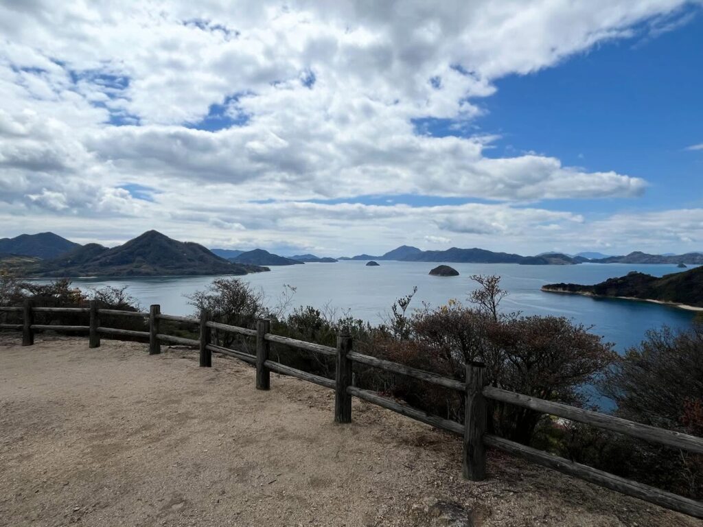
10分ほどで大久野島山頂展望台(ひょっこり展望台)に到着。
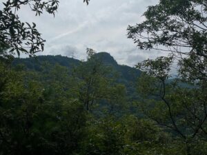
ぐるりと島からの眺望が見渡せます。
展望台には、日時を指定すると眺める星座がわかる「回転星座盤」や、島や橋をピンポイントで見れる「のぞき穴」などがあります。
標高100mと書かれているものが多いのですが、YAMAPでは標高90mぐらいでした。
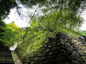
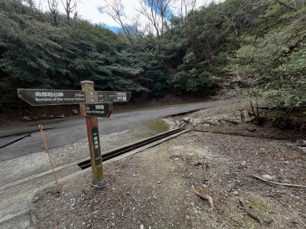
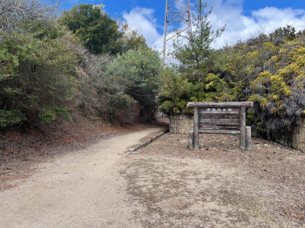
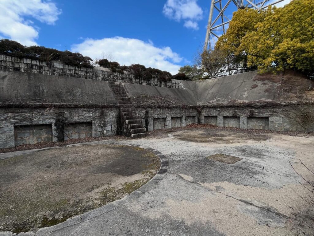
展望台から少し北側に進むと、中部砲台跡があります。
天空の城ラピュタのような世界観を堪能できます。
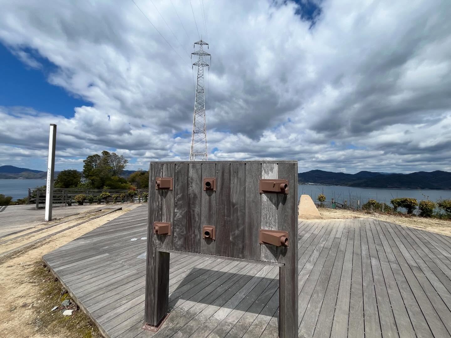
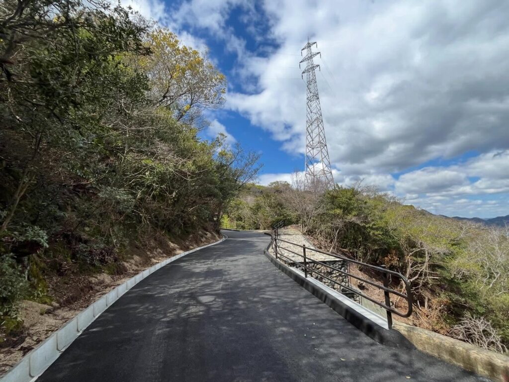
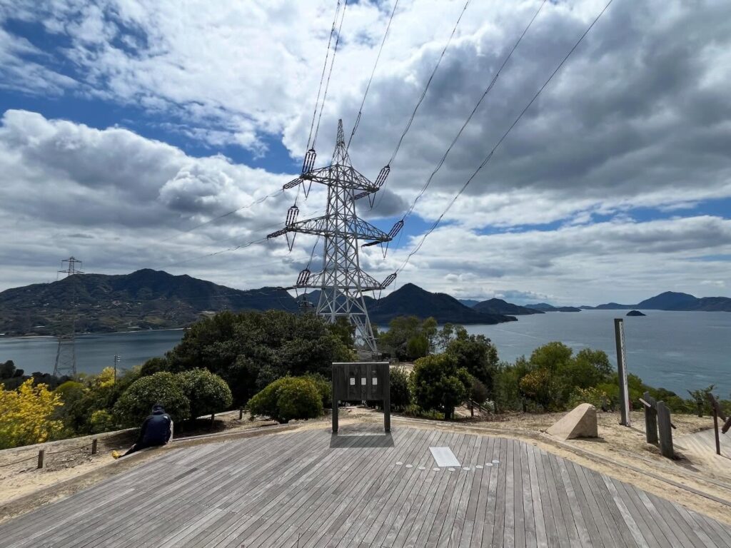
砲台跡の上部に登ると、展望広場があり、さらに大きな送電鉄塔の下まで歩けます。
この送電鉄塔は、本州と大三島を結ぶ送電線で、高さはなんと226m。
日本一高い送電鉄塔とのことです。
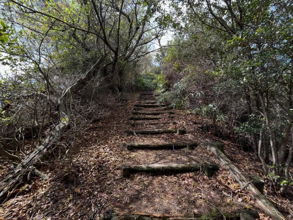
山頂を楽しんだら、帰りは休暇村近くのグラウンドに向かって下りていきます。
こちらの道はなかなか大変でした。
段差が高い階段、雨で崩れてしまった道、滑りやすい地面。
スーツ姿で登ってきている人がいましたが、かなりしんどそうでした。
下りでよかった(笑)
ただし、こちらの道の方が美しい眺望を楽しめます!
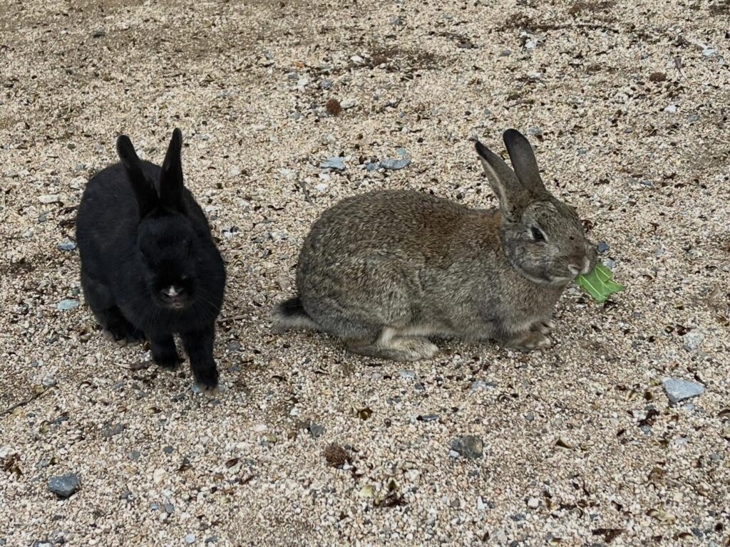
みんな30cmほどの距離まで走って寄ってきて、餌をくれるのかどうか伺っています
2018年7月6日~8日の大雨で土砂崩れが起こったそうです
3年半も通行止めだったそうですが、2022年4月1日に復旧しました
「ひょっこり」の名前の由来は
・突然眺望がひょっこり現れるから
・そばにある小島がひょっこりひょうたん島のモデルになったから
とか書かれている方がおられますが、詳細は不明です
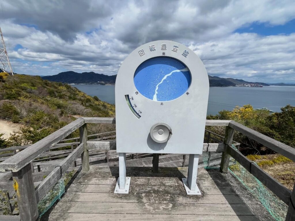
好みの日時の夜空の星座が表示されます

多々羅大橋、大三島などがピンポイントで覗けます
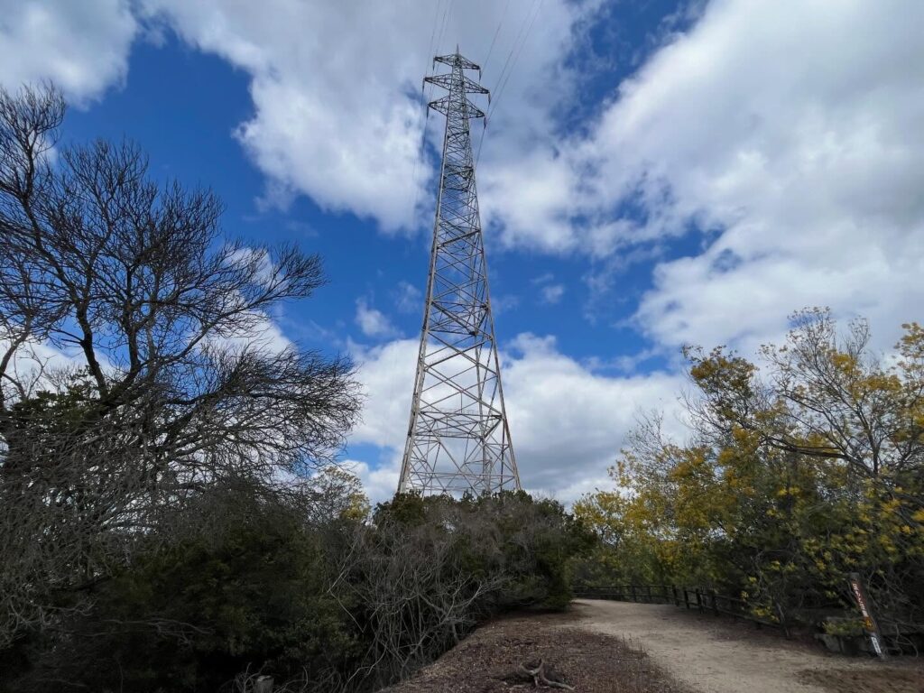
島の高さが100m程度に対して、鉄塔の高さはなんと2倍強の226m
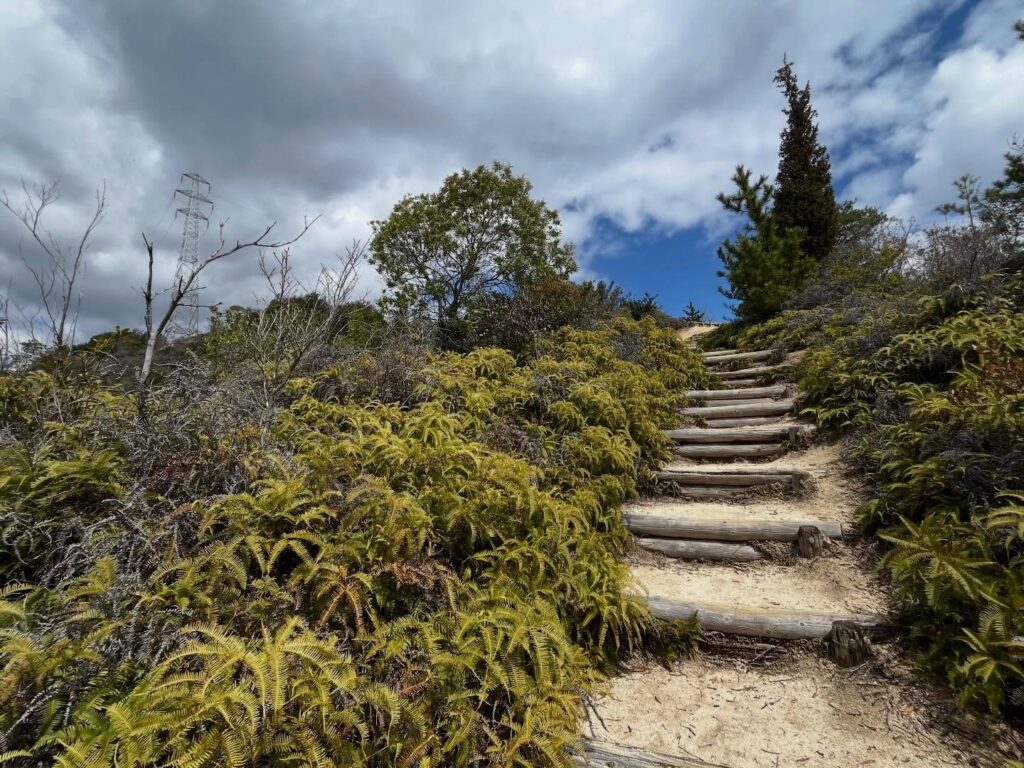
段差の高い階段、雨で溝になった道、滑りやすい土壌
土が流れている場所も多く、豪雨の影響が残っています

きれいな道で登る場合は、南側からの登り口から登りましょう
#大久野島
#おおくのしま
#ひょっこり展望台
#大久野島山頂展望台
#標高100m
#標高90m
#毒ガス資料館
#回転星座盤
#中部砲台跡
#芸予要塞
#愛媛の小山登り
#小山登り
#広島県
#竹原市
#忠海町
#展望台
#地図から消された島
#うさぎの島
I visited Ookunoshima, the “Island Erased from Maps.”
Apparently, because there used to be a poison gas factory there, the island was temporarily removed from maps to maintain secrecy.
Today, it is known as “Rabbit Island” and is home to a large population of wild rabbits.
It’s a 15-minute ferry ride from Sakari Port on Omishima to the No. 2 Pier on Ookunoshima.
Since it’s a small island with a circumference of about 4 km, I started by walking all the way around while playing with the rabbits that came up to me.
I learned about Japan’s dark history at the Poison Gas Museum, the former poison gas storage facility, the ruins of the northern battery, and the former power plant.
After completing the loop, take the side path next to the power plant ruins and climb up to the observation deck.
(I climbed up from the side path next to the power plant ruins and descended to the field near the vacation village.)
This path is paved, making for an easy stroll.
After about 10 minutes, we arrived at the Ookunoshima Summit Observation Deck (Hyokkori Observation Deck).
You can take in a panoramic view of the island.
The observation deck features a “rotating star chart” that shows which constellations are visible at a specific time and date, as well as a “peephole” that allows you to see the island and the bridge in detail.
Many sources list the elevation as 100 meters, but according to YAMAP, it was around 90 meters.
If you head a little north from the observation deck, you’ll find the ruins of the Chubu Battery.
You can really soak in the atmosphere, reminiscent of the world of Castle in the Sky.
If you climb to the top of the battery ruins, there’s an observation plaza, and you can walk all the way down to the base of a massive power transmission tower.
This transmission tower is part of the power line connecting Honshu and Omishima, and it stands a staggering 226 meters tall.
Apparently, it’s the tallest transmission tower in Japan.
After enjoying the summit, I headed back down toward the sports field near the resort village.
This path was quite challenging.
There were stairs with steep steps, a path that had eroded from the rain, and slippery ground.
I saw someone climbing up in a suit, and they looked like they were really struggling.
I’m glad I was going down.
However, this path offers even more beautiful views!
大久野島山頂展望台(ひょっこり展望台) の登り口(発電所跡横)
⇒ 大久野島山頂展望台(ひょっこり展望台) の登り口(発電所跡横)はこちら
大久野島山頂展望台(ひょっこり展望台) の登り口(休暇村横のグラウンド)
⇒ 大久野島山頂展望台(ひょっこり展望台) の登り口(休暇村横のグラウンド)
大久野島山頂展望台(ひょっこり展望台) のMAP
活動データ(YAMAP)
活動データはYAMAPからご覧ください↓