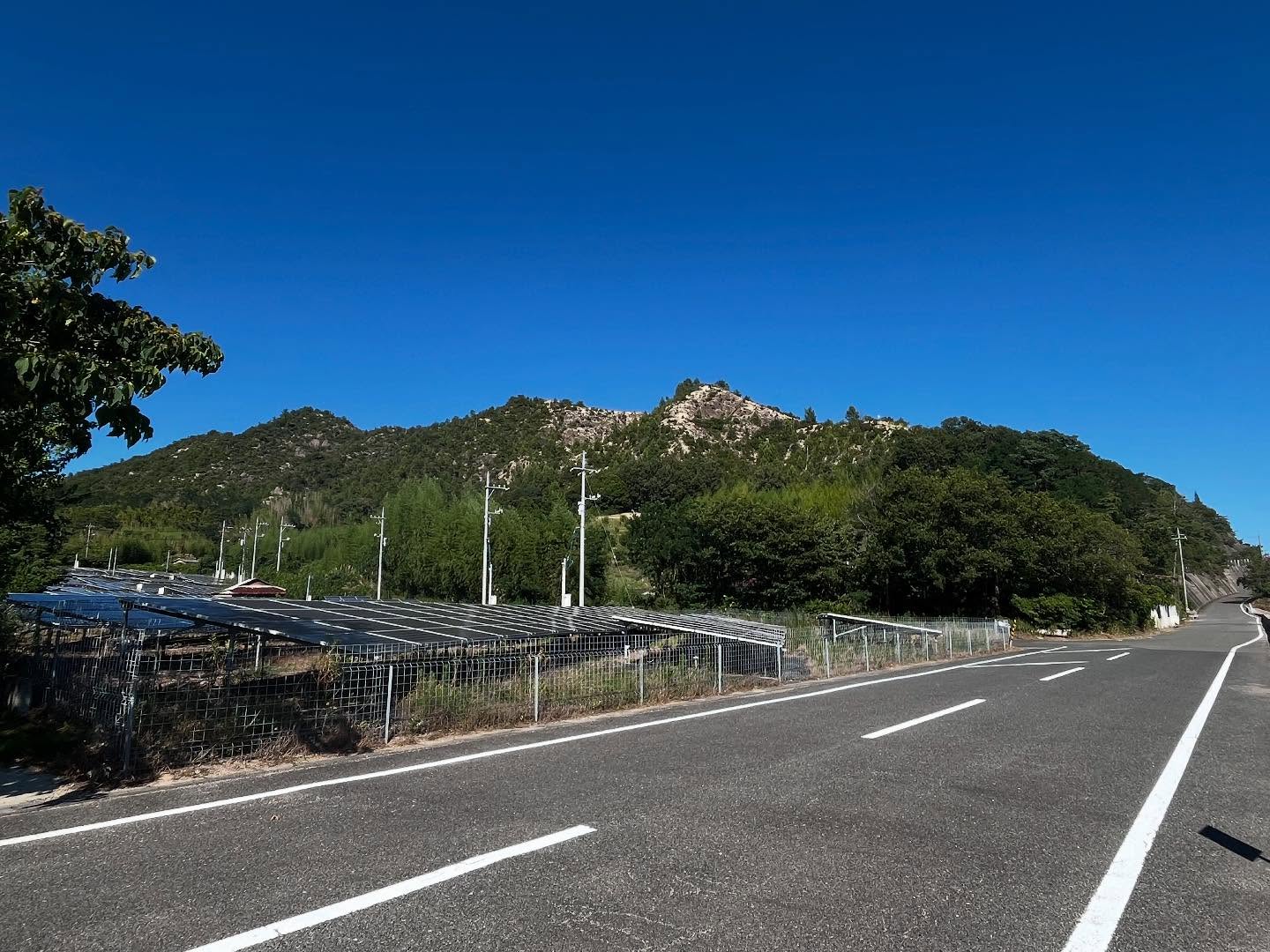
鉢巻山 キレットを楽しめる生名島のザレ場低山(愛媛県越智郡上島町)標高141m
三港汽船に乗って、生口島から岩城島へ。
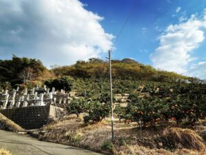
岩城橋を渡って生名島に入るところで右手に見えるザレ山が鉢巻山です。
前回は、登山口を見つけることができずに断念。
今回はリベンジ登山です。
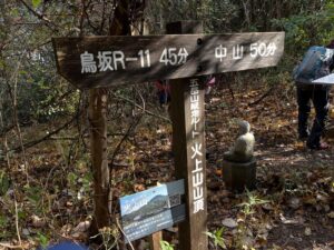
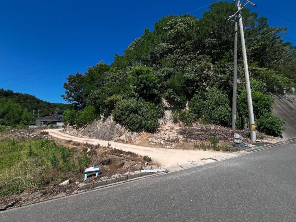
YAMAPの足跡から登山口を探します。
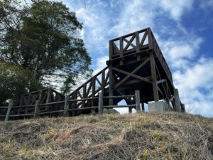
登り口らしきところがないぞ・・・ん?・・・まさかこれ??
という場所に「梯子」がかかっておりました。
梯子の上は草藪で、その上はザレ場です。
落ちたら・・・ケガしますよね?
思い切って梯子を登り、滑りまくるザレ場を慎重に登っていきます。
フェンス越しに登るのがお勧めです。
ズボンと靴はコセンダングサだらけになるので要注意。
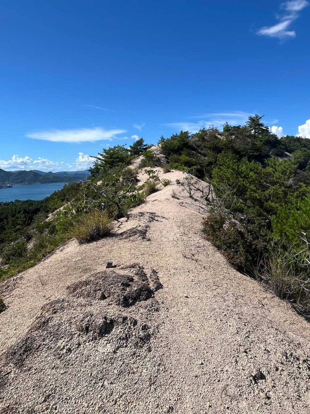
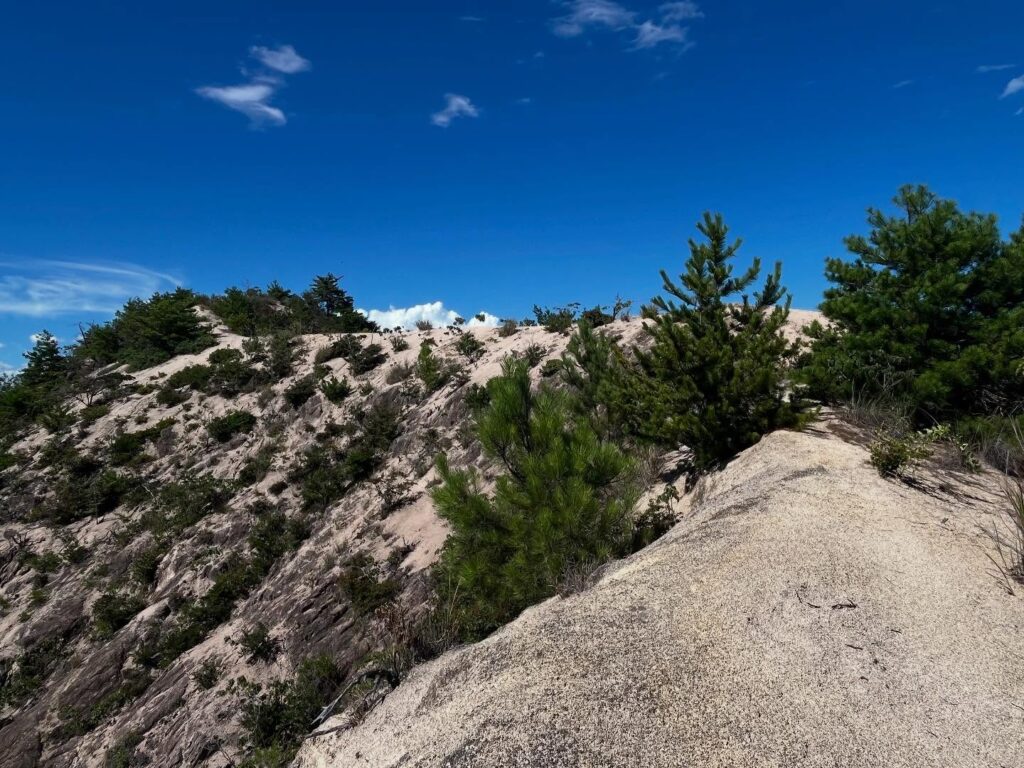
それから、木々の横の踏み跡を通り抜けると、ザレ場がスタートです。
登山道はありませんので、このザレ場を丁寧に登っていきます。
とにかく滑りまくるので、一歩一歩慎重にです。
困ったのが暑さと直射日光。
休憩は入れたものの、先の牡蠣山登山でフラフラになっている身に堪えます。
影場が全くありませんので、本当にきつい。
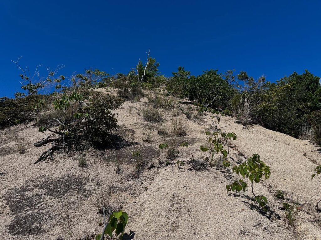
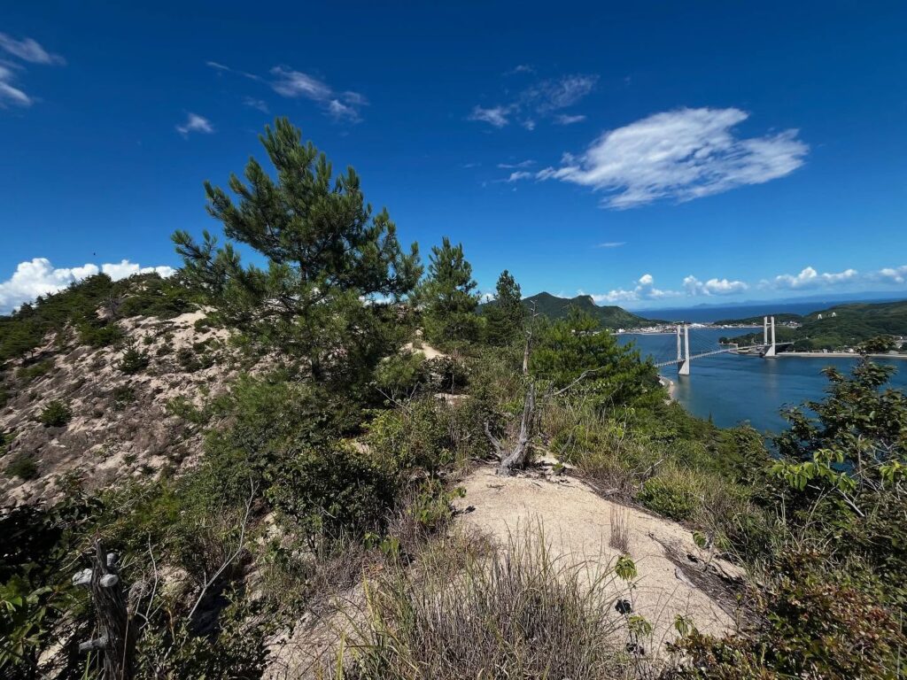
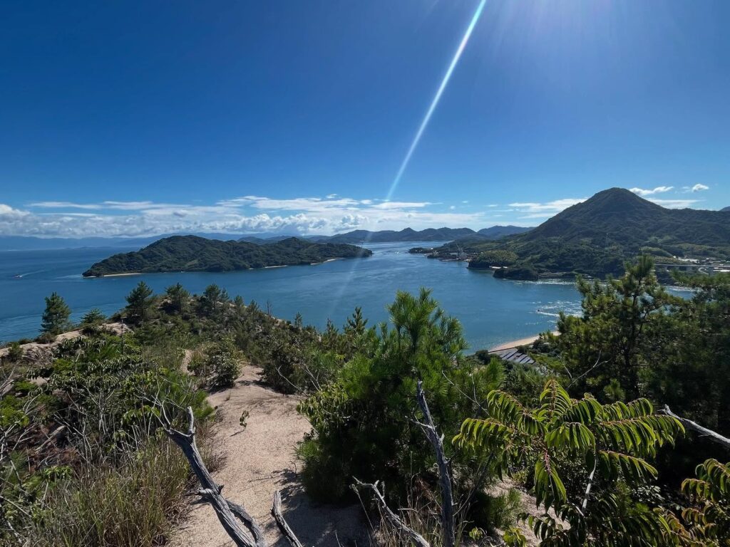
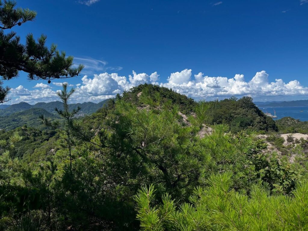
ようやくピークまで登ると、念願のキレットが現れます。
両側の傾斜が思った以上に緩やかで安心しましたが、それでも気を抜くと滑り落ちるリスクがあります。
フラフラの足でゆっくりとキレットを渡ります。
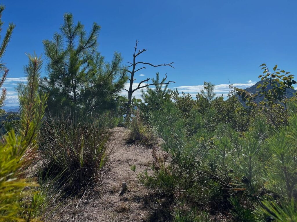
更に進んだところにピークが。
ようやく着いた!と思いきや、もう一つ先のピークが山頂でした。
ここで、熱中症状態でダウン。
超低木のほとんどない木陰に頭を入れて、しばらく横になり休憩。
20~30分もダウンしておりました。
さて、山頂まではキレットを通って約150mほど。
体力と相談して、悩みまくった末に、このピークを山頂として撤退することに。
本当に残念。
帰路はキレットをゆっくり通った後、ザレ場の下りです。
ふらふらですので、遠くを見ずに、一歩一歩の繰り返しで降りていきました。
最後の難所は、梯子への取りつき。
ザレ場の砂の白煙をあげながら、草木を掴み、なんとか梯子へ。
無事に下山することができました。

山頂は一番左のピーク
奥には民家がありますのでご迷惑にならないようにしましょう
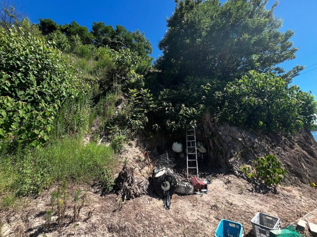
YAMAPの足跡から辿り着いた結論は、まさかのこの梯子!
梯子の上はすぐにザレ場なので転落に要注意!
下はザレ場で傾斜がきついです
掴める草はあまりありません
行きも帰りも、ここでコセンダングサだらけになります
木々の下に踏み跡の道があります

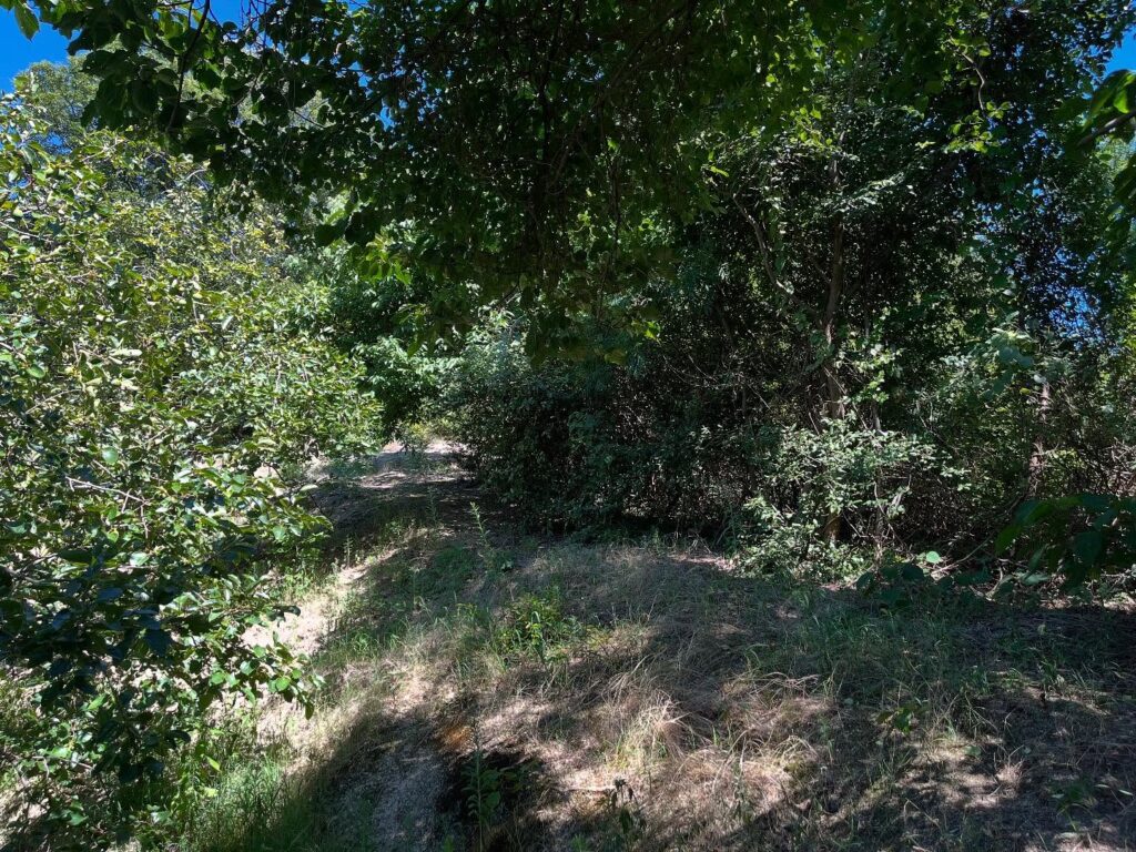
この辺りからザレ場をどんどん登っていきます
かなり滑りますので気をつけましょう

スダジイ・ヤシャブシ・ウバメガシ・エノキ・ヤマモモ・コナラ
いろいろな木が植えられていますね
それでも足元が滑るのでゆっくりしか登れません
春秋が良いですね!
木々が低く影がありませんが眺望は素晴らしいです

思ったよりなだらかでした
それでも気をつけないと転がると大変です
しかし影がありません…
暑さのためここでダウンしてしまいました
さて、どうしよう…
体調を考えて諦めることに
このピークを私の山頂とします!
#鉢巻山
#はちまきやま
#標高141m
#キレット
#愛媛の小山登り
#小山登り
#愛媛県
#越智郡
#上島町
#ザレ山
#ザレ場
Take the Sanmin Ferry from Ikuchijima to Iwakijima.
As you cross the Iwakibashi Bridge and enter Ikinajima, you will see Mount Zare on your right, which is Mount Hachimaki.
Last time, I gave up because I couldn’t find the trailhead.
This time, I’m back for revenge.
I searched for the trailhead using YAMAP’s footprints.
There doesn’t seem to be a trailhead… Hmm? … Could this be it?
There was a ladder at that spot.
Above the ladder was a grassy area, and above that was a scree field.
If you fall… you’ll get hurt, right?
I decided to climb the ladder and carefully made my way up the slippery scree field.
It’s recommended to climb over the fence.
Be careful, as your pants and shoes will get covered in thistles.
Then, after passing through the trail beside the trees, the scree slope begins.
There is no hiking trail, so carefully climb the scree slope.
It’s extremely slippery, so take each step carefully.
The heat and direct sunlight were a problem.
Even though I took breaks, it was tough on my body, which was already exhausted from the previous climb up Oyster Mountain.
There is no shade at all, so it is really tough.
Finally, when you reach the peak, the long-awaited Kiretto appears.
The slopes on both sides are gentler than expected, which is reassuring, but there is still a risk of slipping if you let your guard down.
I slowly crossed the Kiretto with my wobbly legs.
Further ahead is the peak.
I thought I had finally arrived, but the summit was actually one peak further ahead.
Here, I collapsed from heatstroke.
I lay down in the shade of a nearly treeless area and rested for a while.
I was down for about 20–30 minutes.
The summit is about 150 meters away via the ridge.
After consulting with my physical condition and deliberating extensively, I decided to retreat, treating this peak as the summit.
It was truly disappointing.
On the way back, I slowly crossed the ridge and descended the scree slope.
Feeling dizzy, I focused on taking one step at a time without looking too far ahead.
The final challenge was reaching the ladder.
I climbed up the scree slope, kicking up white dust, grabbing onto plants, and managed to reach the ladder.
I safely made it back down.
鉢巻山の登山口
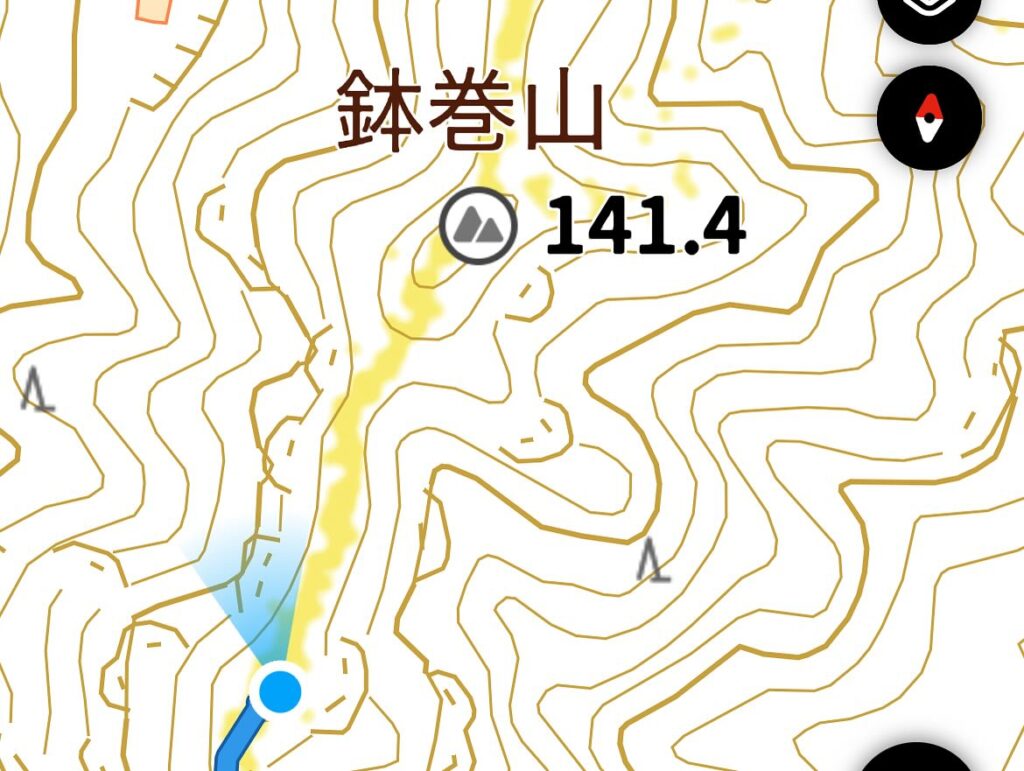
鉢巻山のMAP
活動データ(YAMAP)
活動データはYAMAPからご覧ください↓