花之江河 屋久島縦走 淀川登山口→花之江河(鹿児島県熊毛郡屋久島町)標高1640m
愛媛から10時間半かけて、屋久島に行ってきました!
屋久島といえば、世界遺産、屋久杉というイメージが多いですが、やはり「洋上のアルプス」ですよね!
九州No.1からNo.8までの山が、なんと屋久島にあります。
九州最高峰の宮之浦岳を目指して縦走します。
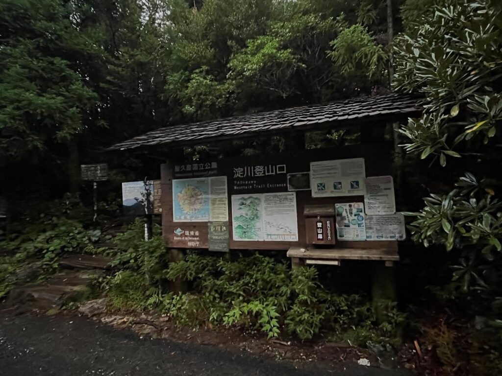
今回は淀川登山口からスタート。
この時点で、標高1360mです。
雨が心配されていたのですが、なんと快晴に!
気持ちよくスタートです。
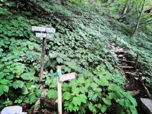
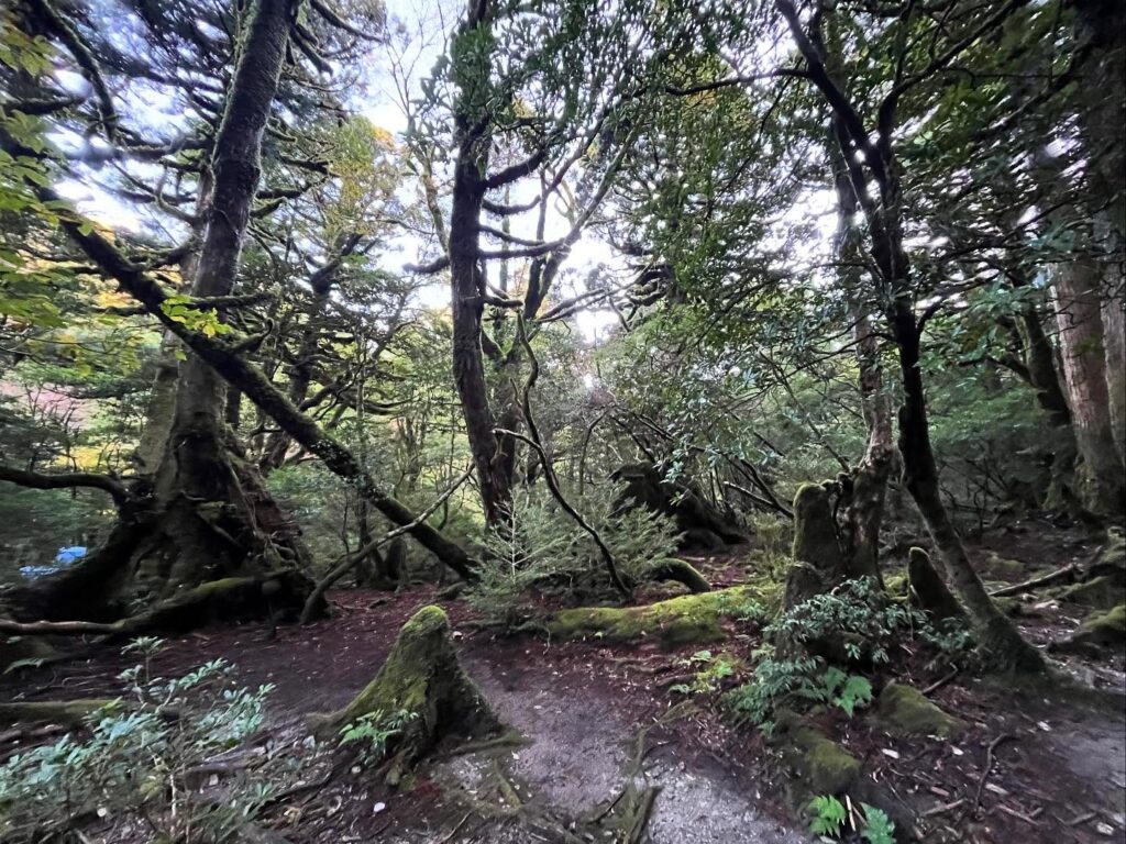
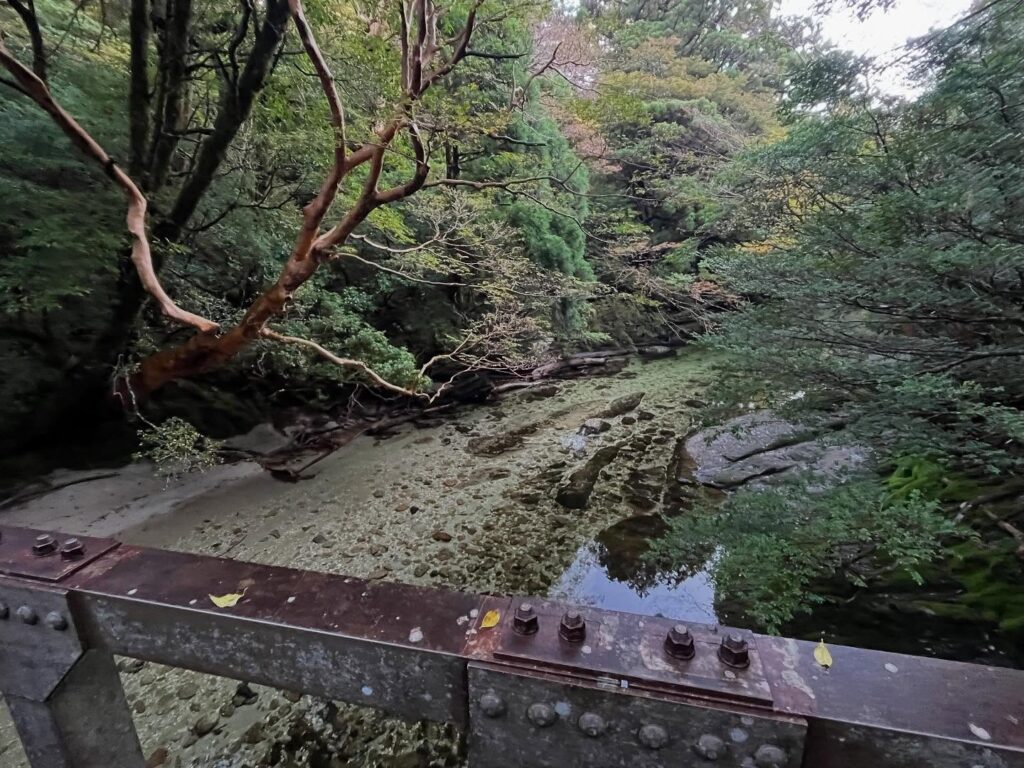
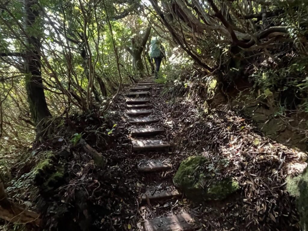
屋久島の登山道は、木道、木の根、花崗岩の3種類といえます。
島の気候から湿っているのですが、花崗岩が滑りにくくありがたいです。
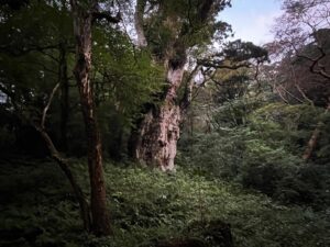
この辺りも大きな杉と苔が美しく、気持ちよく歩けます。
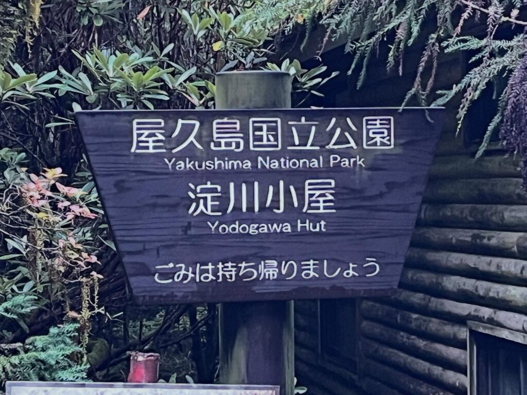
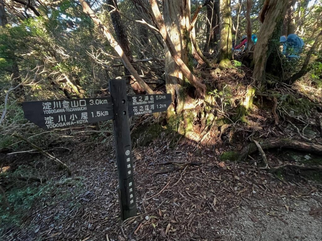
登山口から1.5kmで淀川小屋に到着。
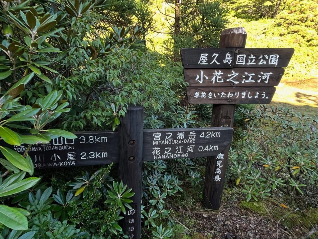
宮之浦岳まで6.5km、まだまだ先が長いです。
森の中をどんどん登っていきます。
0.5km毎に標識を設置してくれているので、精神的にはとても楽です。
登山口から3.8kmで、風景ががらりと変わります。
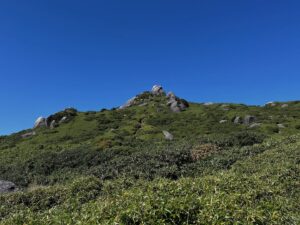
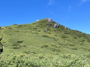
標高1630m、小花之江河に到着。
なんと、こんなところに湿原が広がっているのですよね。驚きです。
この湿原は、2600~2800年前にできなものだとか。
湿原の中を木道が通っており、まるで尾瀬のようです。
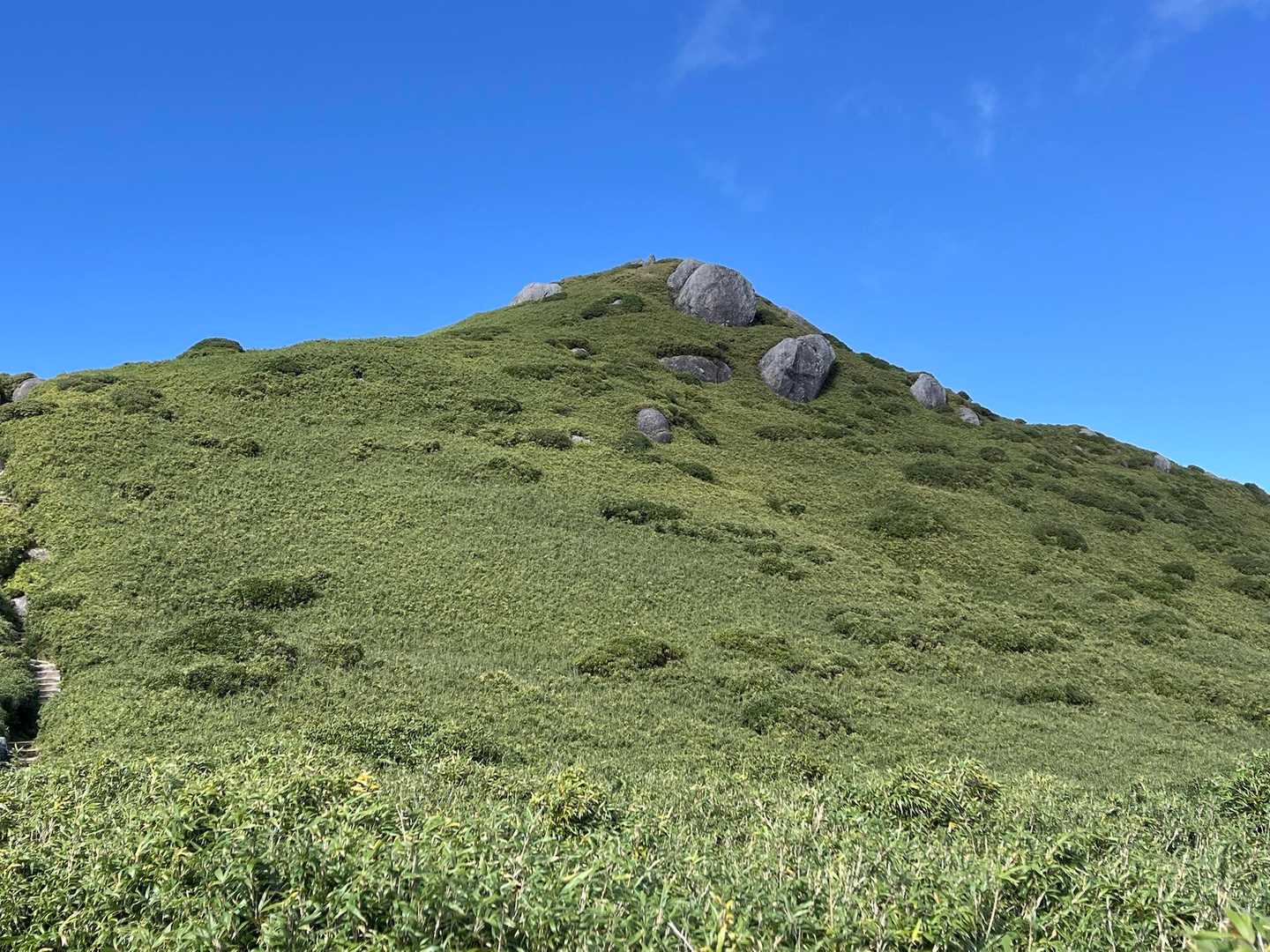
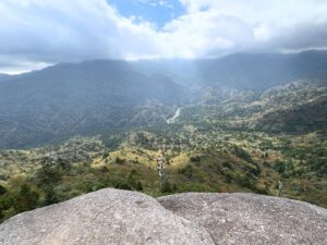
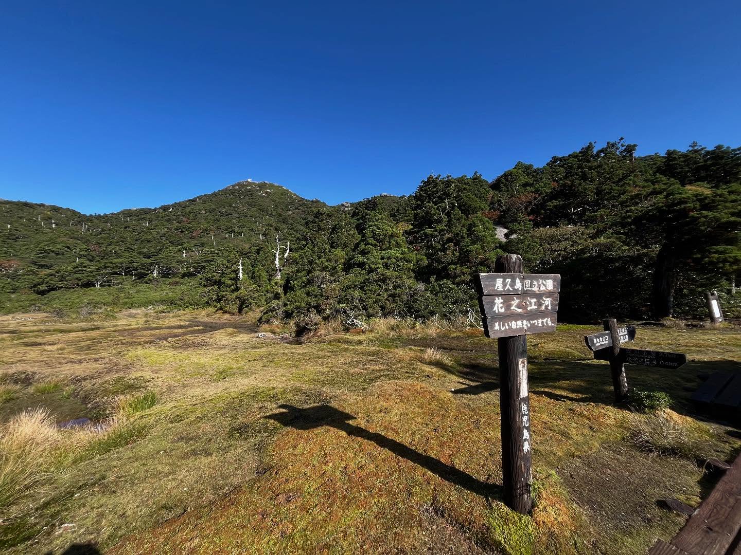
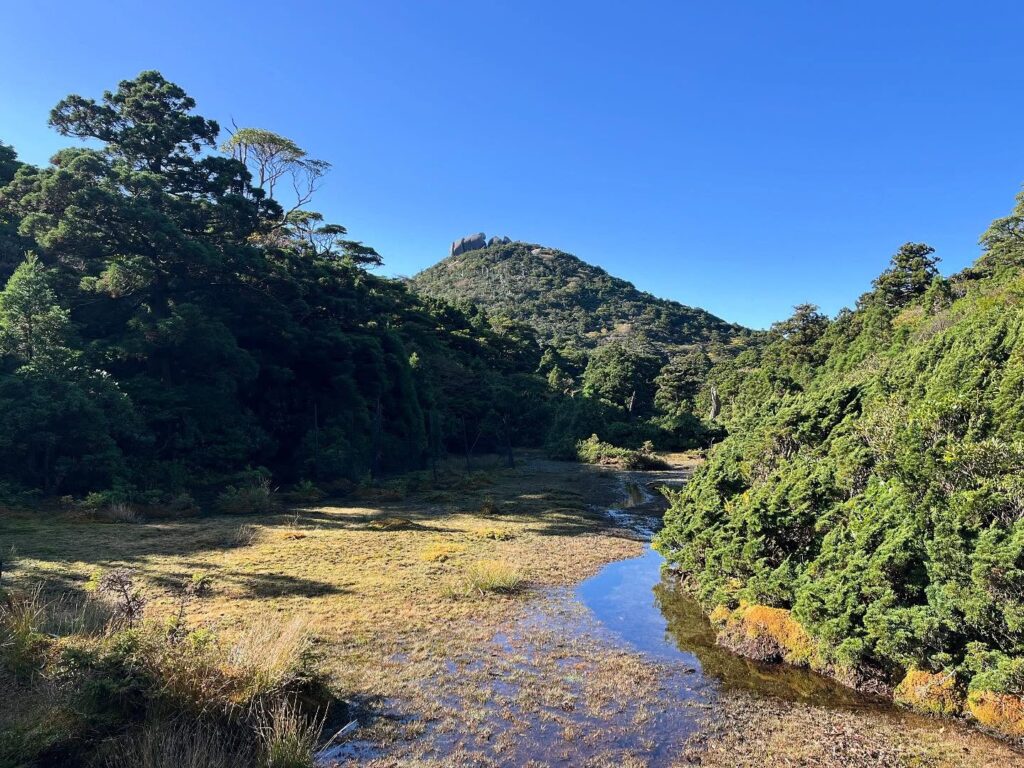
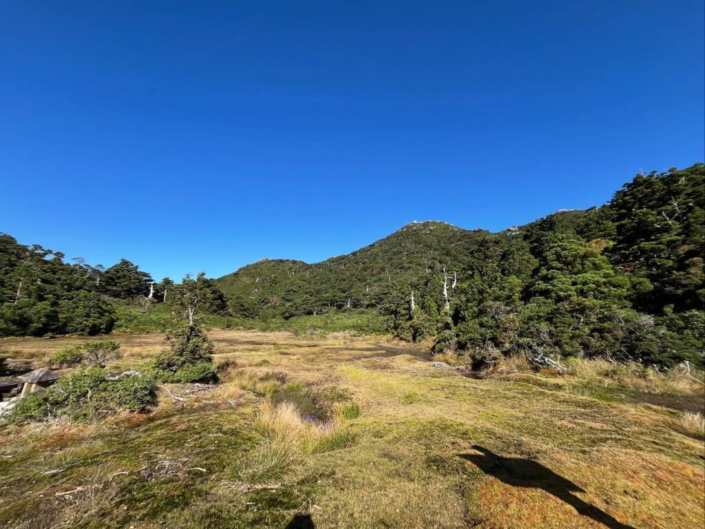
さらに少し進むと、標高1640m、花之江河に到着です。
こちらはさらに広い湿原が広がっています。
日本最南端の湿原!
奥には、標高1831mの黒味岳を眺めることができます。
屋久島の標高No.1からNo.3の山を「三岳」と言いますが、屋久島の三岳酒造さんが作る焼酎「三岳」は、宮之浦岳、永田岳に、No.6の黒味岳の三岳となっています。
美しい湿原と、黒味岳を眺めながら、しばし休憩です。
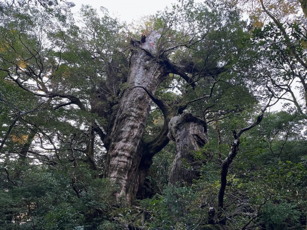
こういう木があちこちにあるのが屋久島の魅力
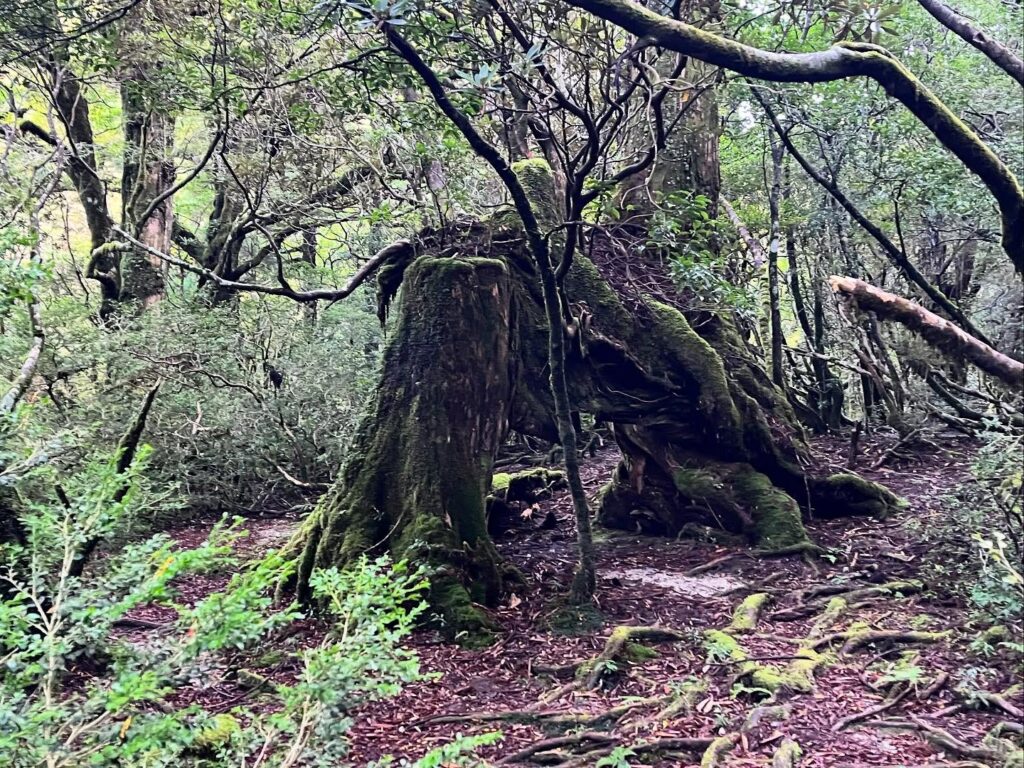
伐採、台風、雷などが原因とのこと
小休止してすぐに出発
雨が多く土が流れ、ほとんど砂になっているためだとか
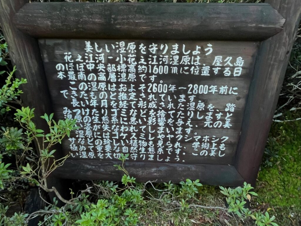
標高約1600mにある日本最南の高層湿原
2600年から2800年前にできたものと推定されています
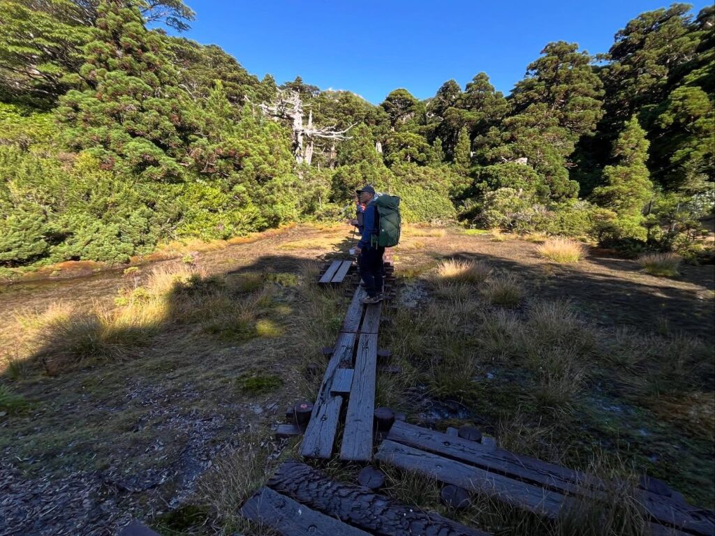
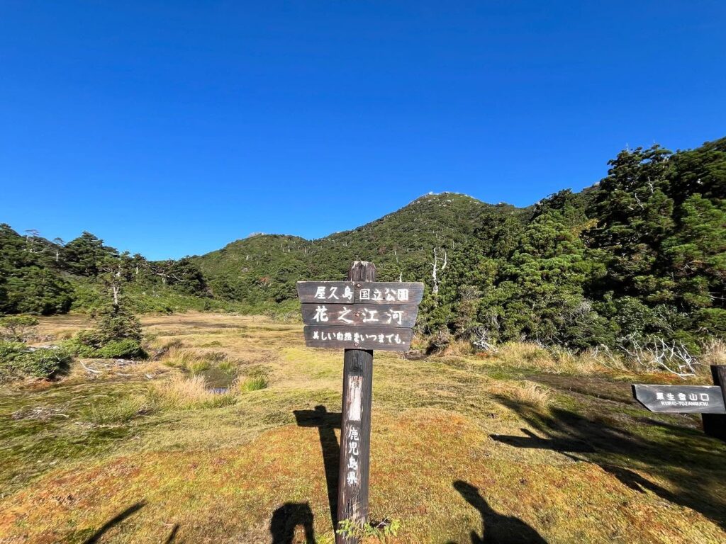
こちらの湿原の規模がすごい!
今回は巻いていきますので登れません

#屋久島
#淀川登山口
#淀川小屋
#花之江河
#はなのえご
#標高1640m
#小花之江河
#こはなのえご
#標高1630m
#花之江河湿原
#黒味岳
#くろみだけ
#奥岳
#三岳
#愛媛の小山登り
#小山登り
#鹿児島県
#熊毛郡
#屋久島町
#世界遺産
#洋上のアルプス
After a 10.5-hour journey from Ehime, I made it to Yakushima!
When you think of Yakushima, images of the World Heritage Yakusugi cedars come to mind, but it’s truly the “Alps of the Sea”!
Kyushu’s highest mountains, from No. 1 to No. 8, are all found on Yakushima.
I set out on a traverse aiming for Miyanoura-dake, Kyushu’s highest peak.
This time, we started from the Yodogawa trailhead.
At this point, we were already at an elevation of 1360m.
We were worried about rain, but it turned out to be a clear, sunny day!
A pleasant start.
Yakushima’s hiking trails can be categorized into three types: boardwalks, tree roots, and granite.
Due to the island’s climate, it’s often damp, but the granite is surprisingly non-slip, which is a blessing.
This area is also beautiful with large cedars and moss, making for a pleasant walk.
After 1.5km from the trailhead, we reached the Yodogawa Hut.
Still 6.5km to Mt. Miyanoura—a long way to go.
We steadily climbed deeper into the forest.
Markers every 0.5km made the mental journey much easier.
At 3.8km from the trailhead, the scenery changed dramatically.
We arrived at Kohana-no-Ego at 1630m elevation.
Imagine—a wetland spreads out here! It’s astonishing.
This marsh is said to have formed 2600 to 2800 years ago.
A boardwalk runs through the marsh, making it feel just like Oze.
A little further on, at an elevation of 1640m, we reach Hananoego.
Here, an even wider marsh spreads out.
Japan’s southernmost marsh!
In the distance, you can see Mt. Kuromi at 1831m.
Yakushima’s three highest mountains are called the “Mitake” (Three Peaks). The shochu “Mitake” made by Yakushima’s Mitake Shuzo features three peaks: Miyanouradake, Nagatadake, and the sixth-highest, Kuromidake.
We took a short break, enjoying the beautiful marsh and the view of Kuromidake.
宮之浦岳の登山口(淀川登山口)
小花之江河のMAP
花之江河のMAP
活動データ(YAMAP)
活動データはYAMAPからご覧ください↓