【登れず】三ヶ森 棘の藪で前半戦で撤退(愛媛県西条市)標高1377m
【登れず】
午後から時間ができた。
さて、どこに登りに行こう?
ということで、急遽思い付きで、丹原町の三ヶ森へ行ってきました。
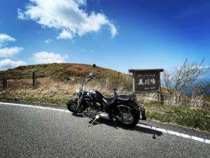
YAMAPで登山口だけ調べて、スクーターでGOです。
というものの、下調べを全くせずに行ったのが、悪かったのですよね…
google MAPでは1時間ちょっとで登山口に着くはずだったのですが
林道がとにかく悪路で長い。
舗装と砂利道の繰り返しです。
これは、車では無理だろうなぁ。
結局、1時間半以上かかって、ようやく登山口に。
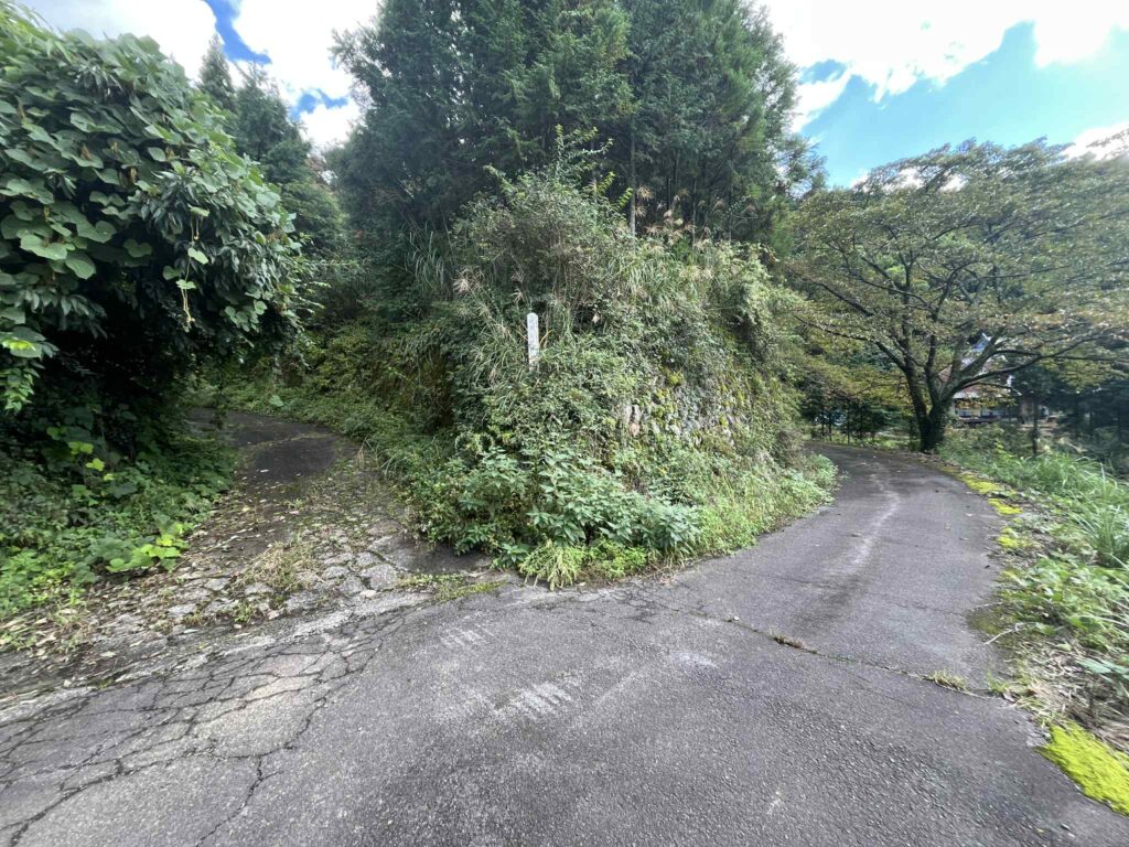
林道の途中にいきなりありました。
誰ですか?YAMAPに駐車場マーク入れた人(汗)
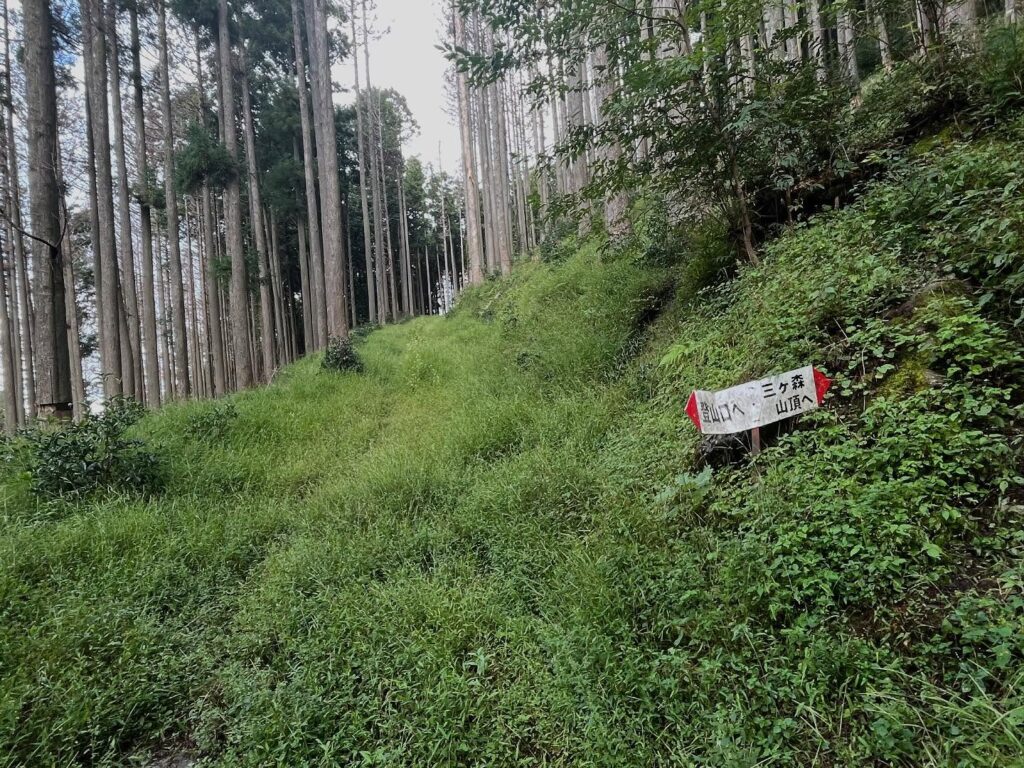
さて、登山口から登っていきます。
まずは、わかりやすい標識とテープに従って登っていきます。
昨日の雨のせいか、足元が粘土質で滑ります。
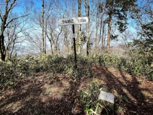
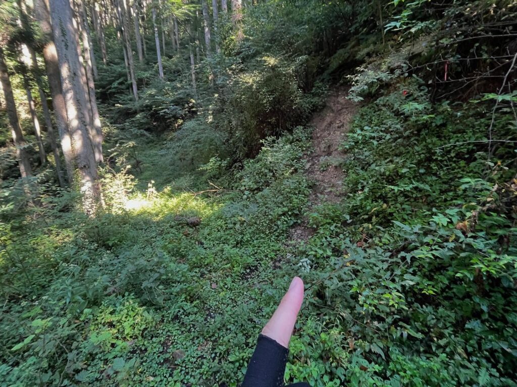
しばらく進むと、YAMAPからルート外れの警告音。
MAPとにらめっっこしながら、いろいろ探すのですが、道が見つかりません。
ここかな?と何度かチャレンジして、最終的にかなり戻った場所から登るのが正しい道でした。
さらにしばらく進むと、再び、YAMAPからルート外れの警告音。優秀ですね。
しばらく戻りましたが、こちらも道が見つかりません。
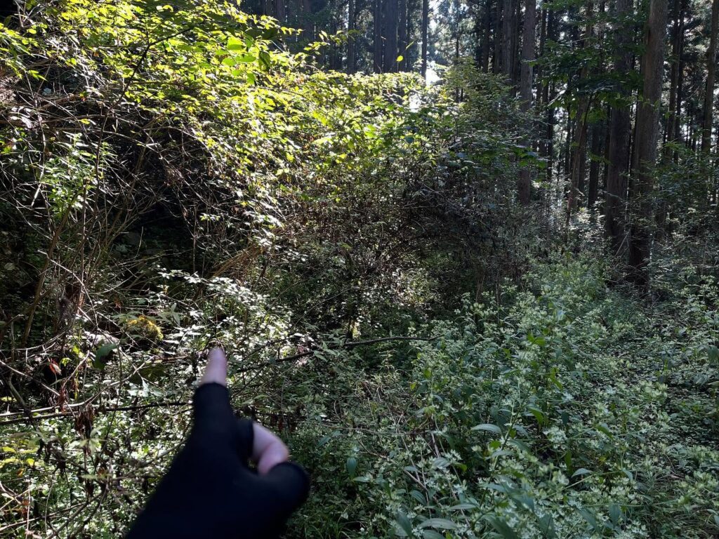
よくよく見てみると、左手の藪の中に、なんとなく○が見えます。
もしかして、ここを潜るの?と進んでいくと正解っぽいです。
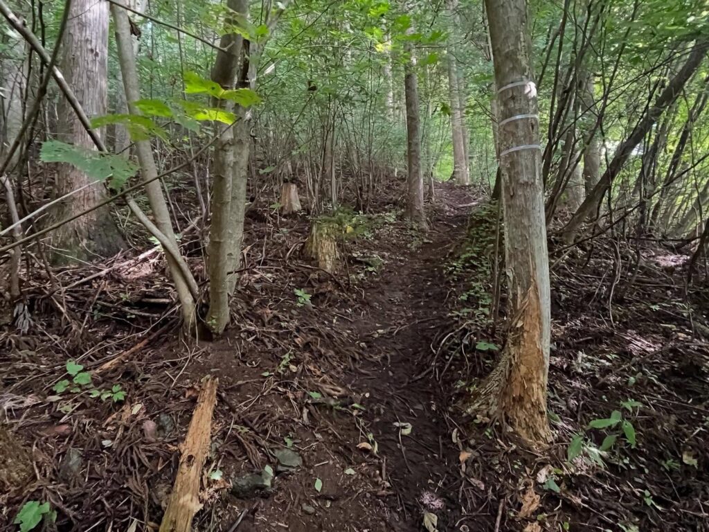
ここから先が棘の道です。
道は確かにあるのですが、棘の藪が邪魔してきます。
全ての枝がトゲトゲです(泣)
これをくぐれば、あそこまで頑張れば、と少しずつ進んでいきましたが
「囲まれてしまった・・・」
ということで、棘の中で、しばしシンキングタイム。
行くも地獄、引くも地獄。
これは時期が悪いということで、諦めて引きの地獄を選択し、棘の道を戻ってきました。
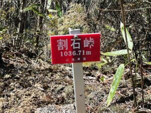
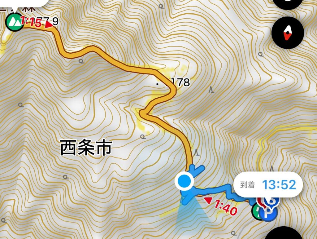
帰ってから調べると、かなりの急登のお山とのこと。
次回は、かなり準備と気合いが必要だなと思いました。
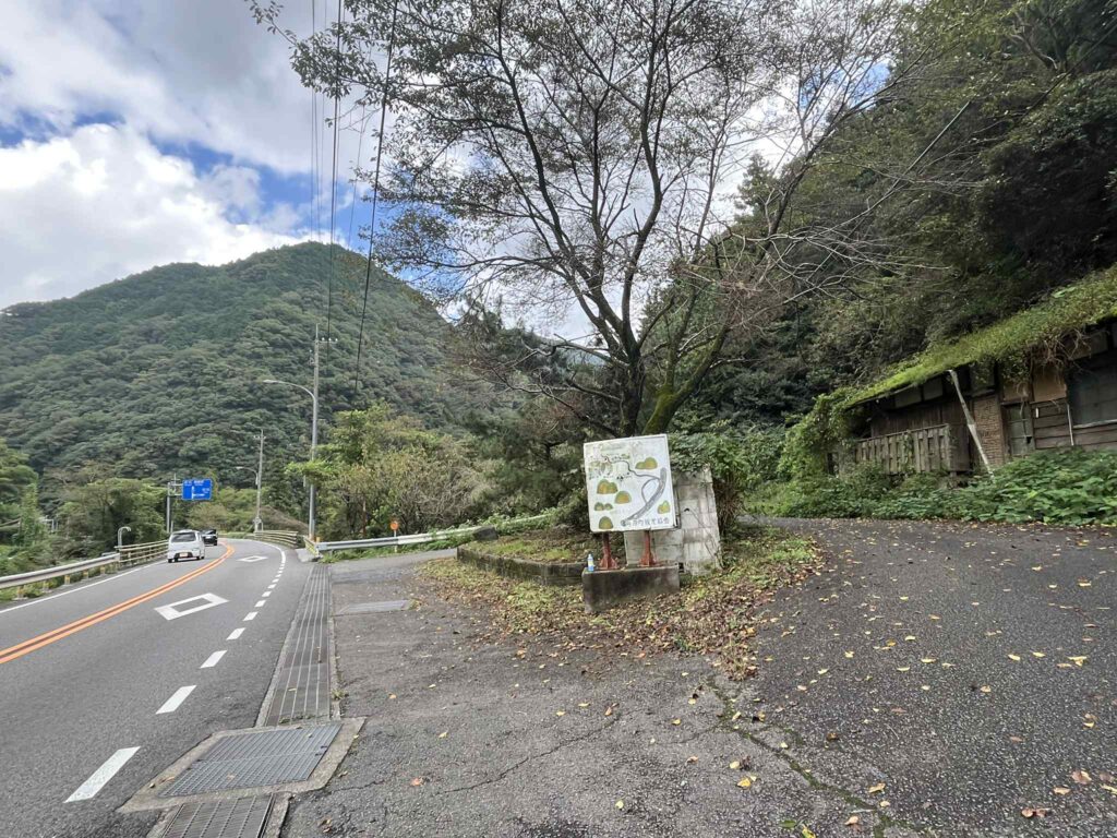
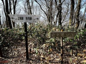
ここから曲がると少しショートカットですが
青い看板の落合橋の所から曲がると道が広いです
この場所でUターンするように山に入っていきます
左手の細道に入っていきます

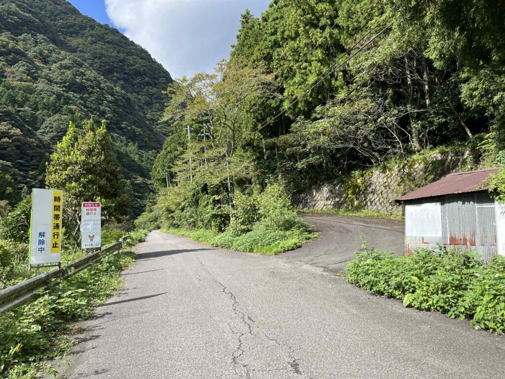
登山口まで想像以上に遠い!

ここが登山口
YAMAPに駐車場と書かれていますが
ちょっと道が広いだけ

皆さんが試されたであろう斜面への踏み跡がたくさんありますが
正解はかなり手前のここ
再びYAMAP警告が!
登山道が探しても見当たりません
正解は藪の中の輪っかになっているところ
ここを潜るのか…
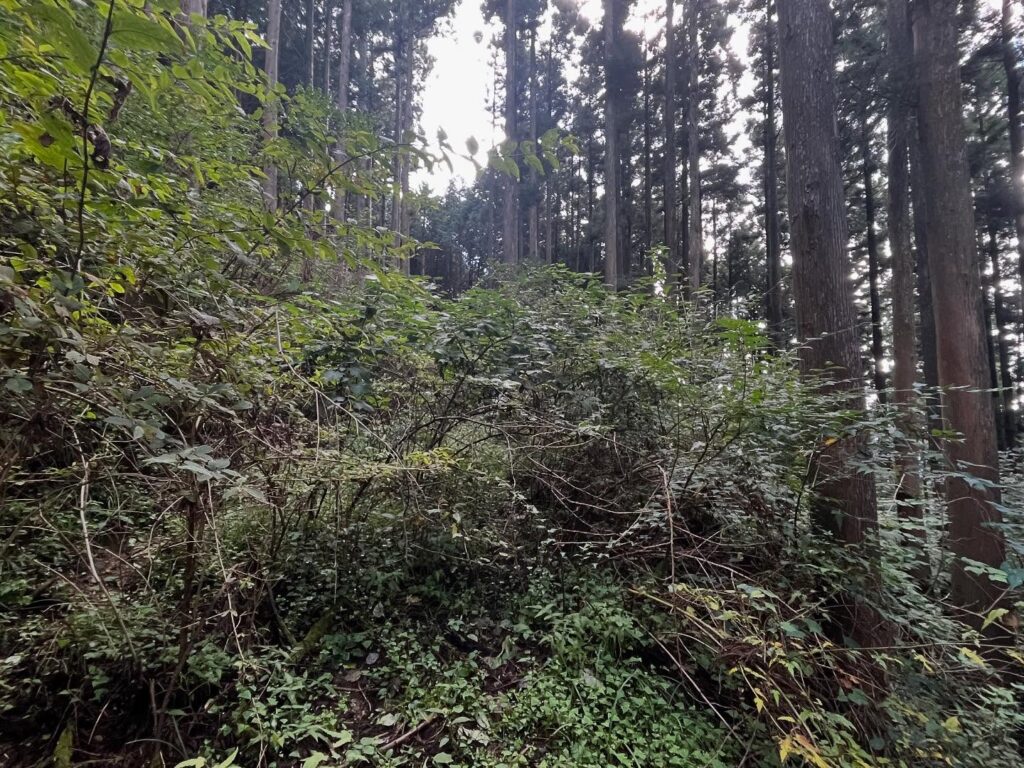
登っても登ってもこんな感じで茨の林です
気をつけないと服が破れます
まだまだ前半戦でした
見ての通り、等高線が密で急傾斜ですね
#三ヶ森
#みつがもり
#標高1377m
#愛媛の小山登り
#小山登り
#愛媛県
#西条市
#丹原町
#シャクナゲ
#登れず
I had some free time in the afternoon.
So, where should I go hiking?
On a sudden whim, I decided to head to Mitsugamori in Tanbara Town.
I just checked the trailhead on YAMAP and took off on my scooter.
But going without any prior research was a mistake…
Google Maps said it should take just over an hour to reach the trailhead,
but the forest road was incredibly rough and long.
It alternated between paved and gravel sections.
This would be impossible by car, I thought.
In the end, it took over an hour and a half to finally reach the trailhead.
It appeared suddenly in the middle of the forest road.
Who put that parking lot marker on YAMAP?
Anyway, I started climbing from the trailhead.
First, I followed the clear signs and tape markers up the path.
Probably because of yesterday’s rain, the footing was clayey and slippery.
After a while, YAMAP sounded an off-route warning.
I stared at the map, searching around, but couldn’t find the path.
“Is this it?” I tried a few times, but the correct route turned out to be climbing from a spot quite a ways back.
After walking a bit further, YAMAP sounded another off-route warning. Impressive.
We retraced our steps again, but still couldn’t find the path.
Looking closely, I spotted a faint circle in the thicket on the left.
“Maybe we crawl through here?” I thought, and it seemed like the right move.
From here on, it was a thorny path.
The trail was definitely there, but the thorny thicket made it difficult.
Every single branch was covered in thorns.
I kept thinking, “If I just get through this, if I push on just a bit more…” and made slow progress.
“I’m surrounded…”
So, I took a moment to think, stuck in the thorns.
Go forward, hell. Turn back, hell.
Deciding the timing was just bad, I gave up and chose the hell of retreat, backtracking through the thorny path.
After getting back, I looked it up and found out it’s a mountain with some seriously steep climbs.
Next time, I’ll need a lot more preparation and determination.