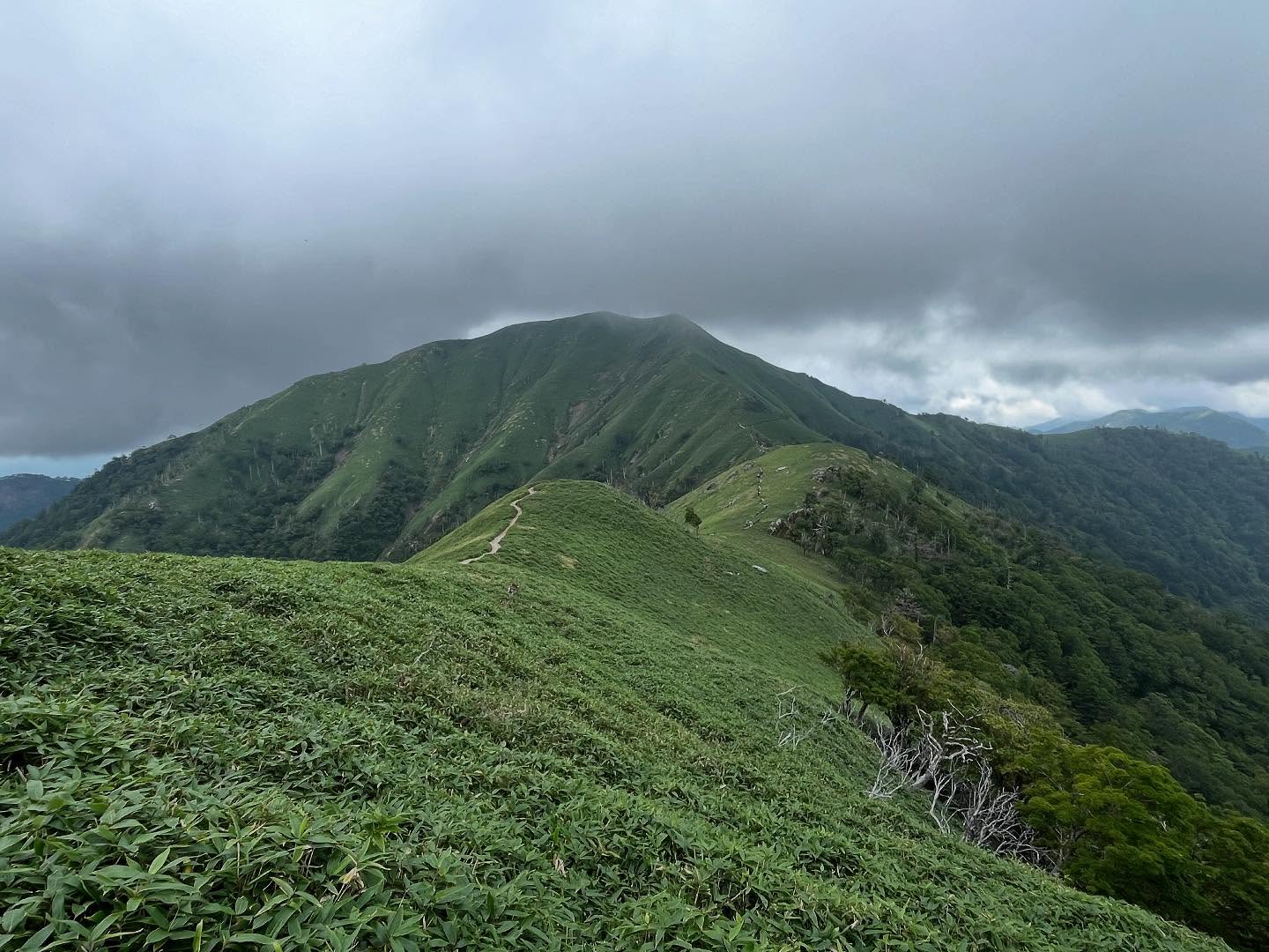
次郎岌 剣山からの稜線が美しい兄弟山(徳島県三好市、美馬市、那賀郡那賀町)
次郎岌・・・岌って何なのでしょう?と調べてみました。
【岌】たかいさま、山が高いさま
剣山は別名が太郎岌。
次郎岌とは、太郎・次郎の兄弟峰なのですよね。
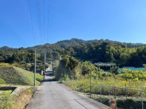
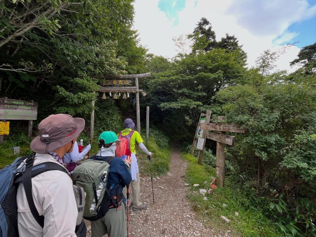
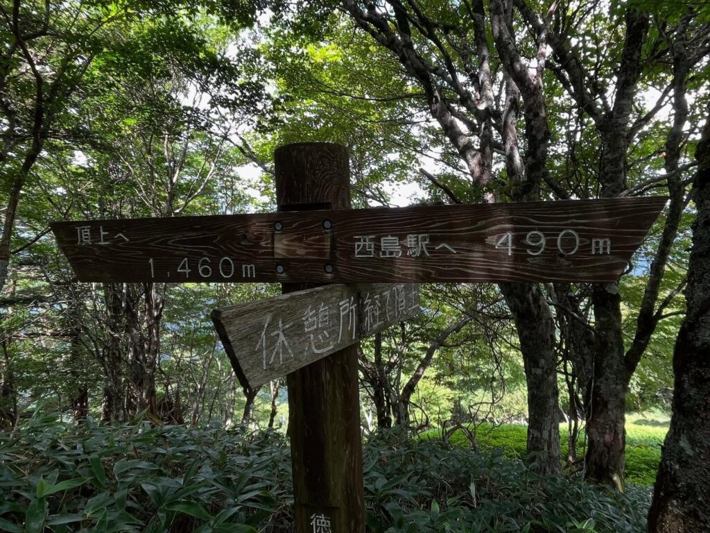
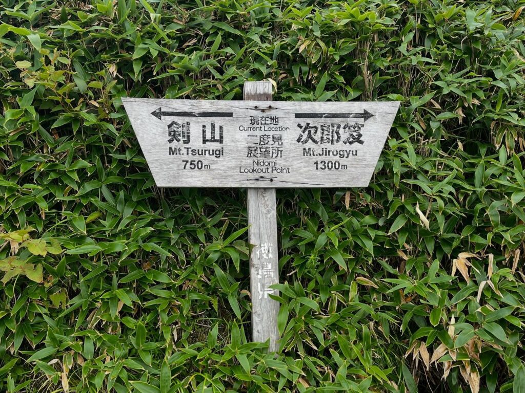
リフト西島駅から次郎岌を目指します。
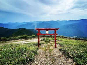
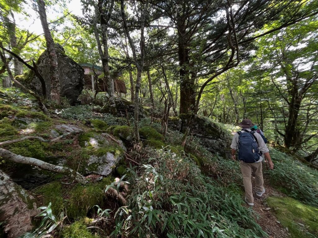
鳥居をくぐると剣山への道。
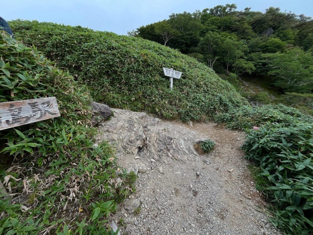
鳥居の右手のトラバース道(遊歩道コース)へ進みます。
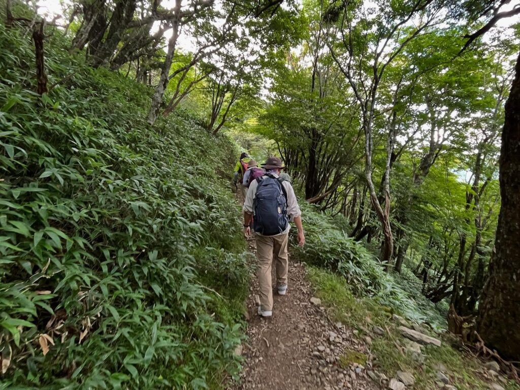
笹の間の平坦な道を歩いていきます。
しばらく歩くと登りへ。
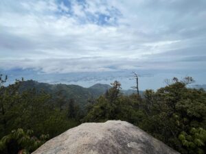
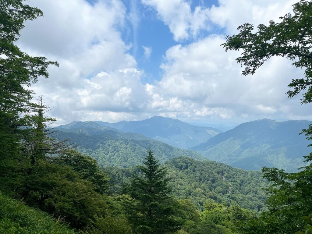
気持ちの良い道をどんどん登っていくと視界が開けます。
雲は上がってきていますが、三嶺までの稜線が見えました!
(来月はあの三嶺に行く予定です)
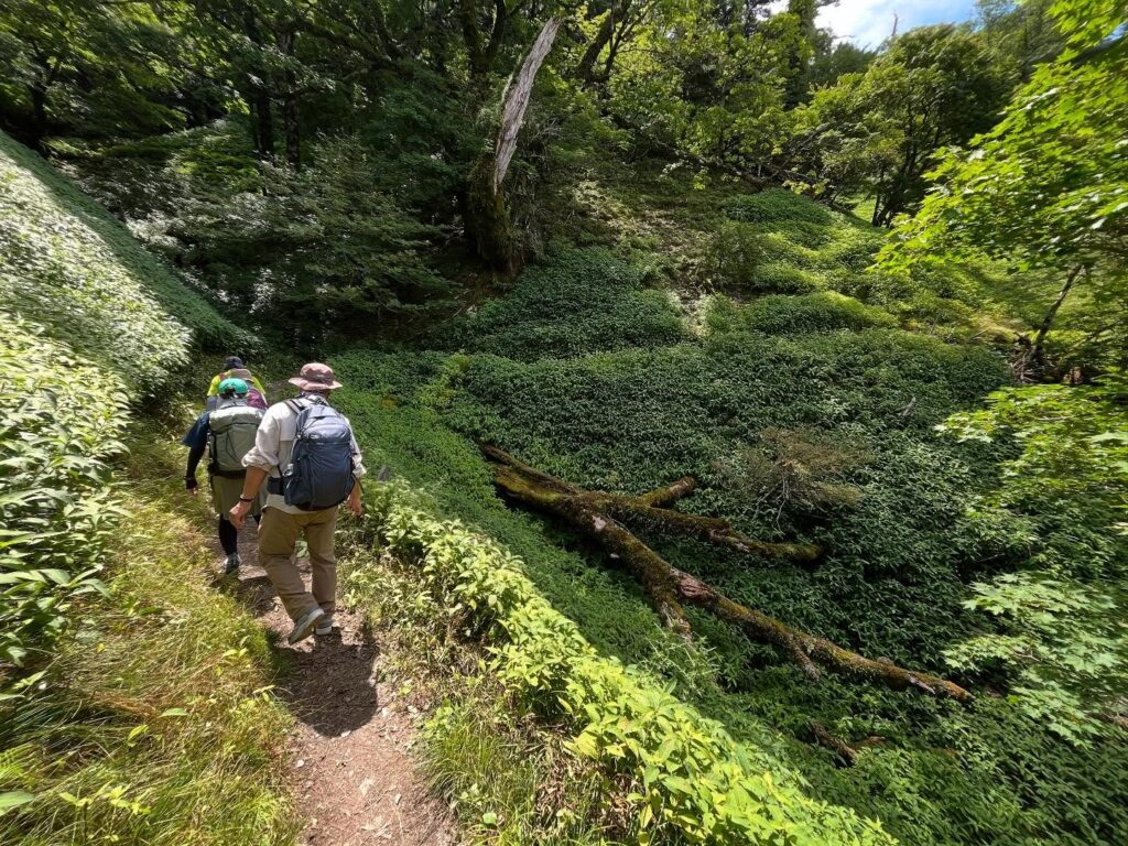
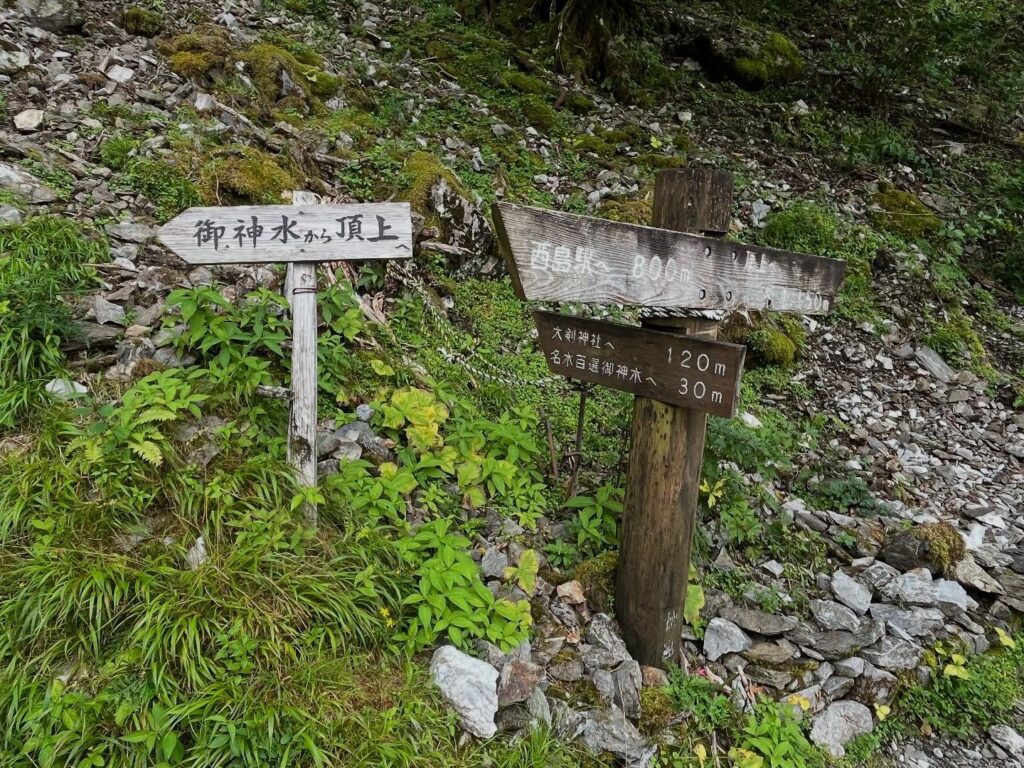
名水百選御神水へ30mの標識がありますが、残念ながら今回はスルー。
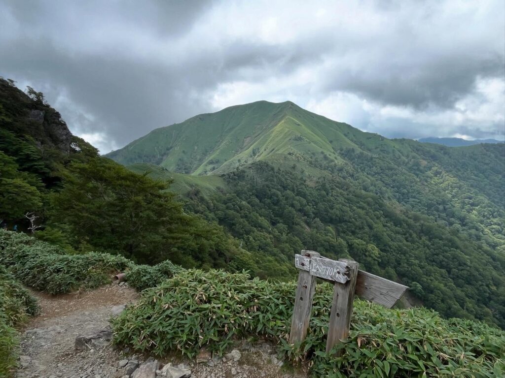
更に進んでいくと、二度見展望所へ。
次郎岌山頂がきれいに見えます。
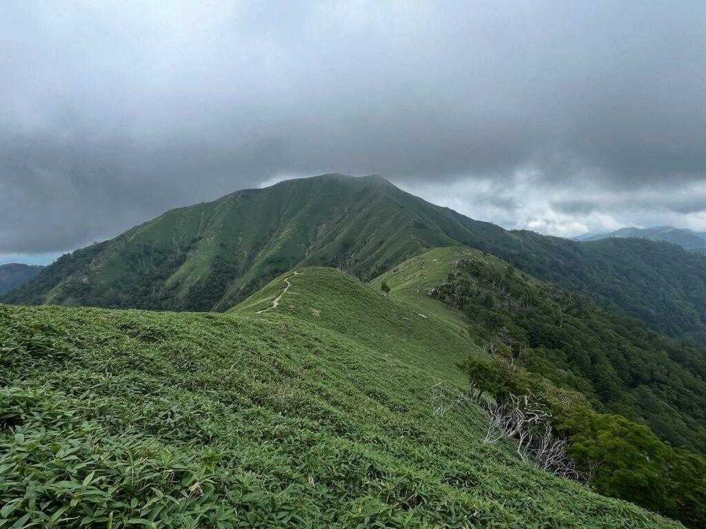
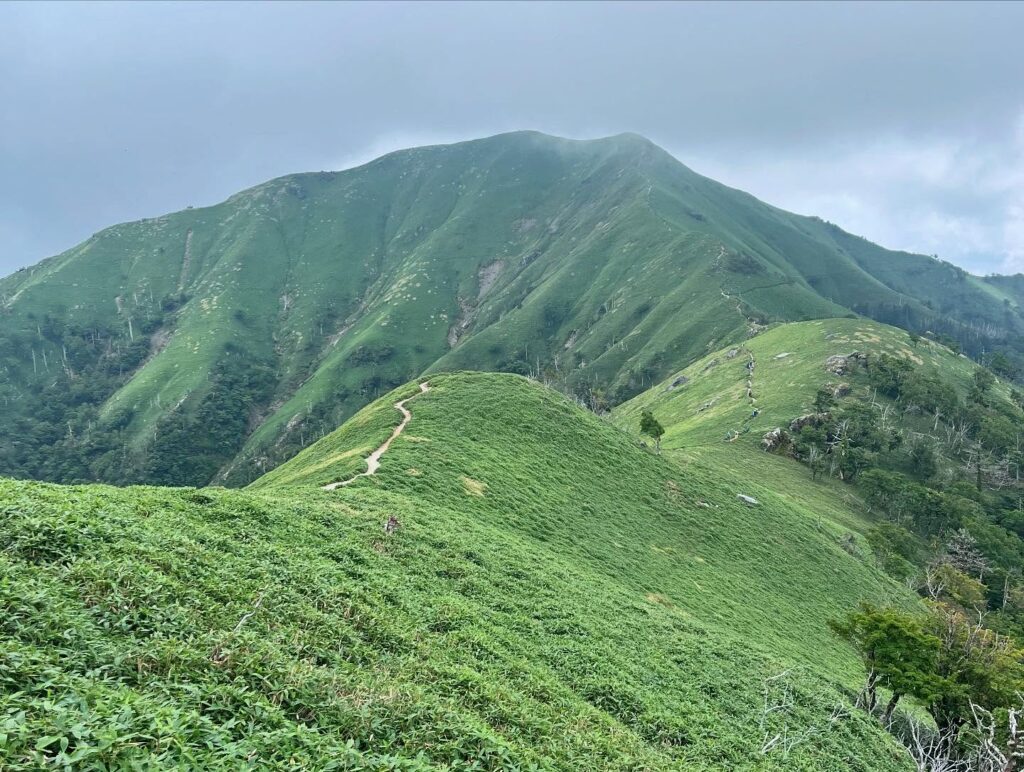
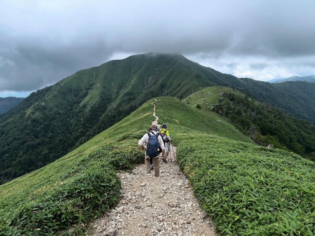
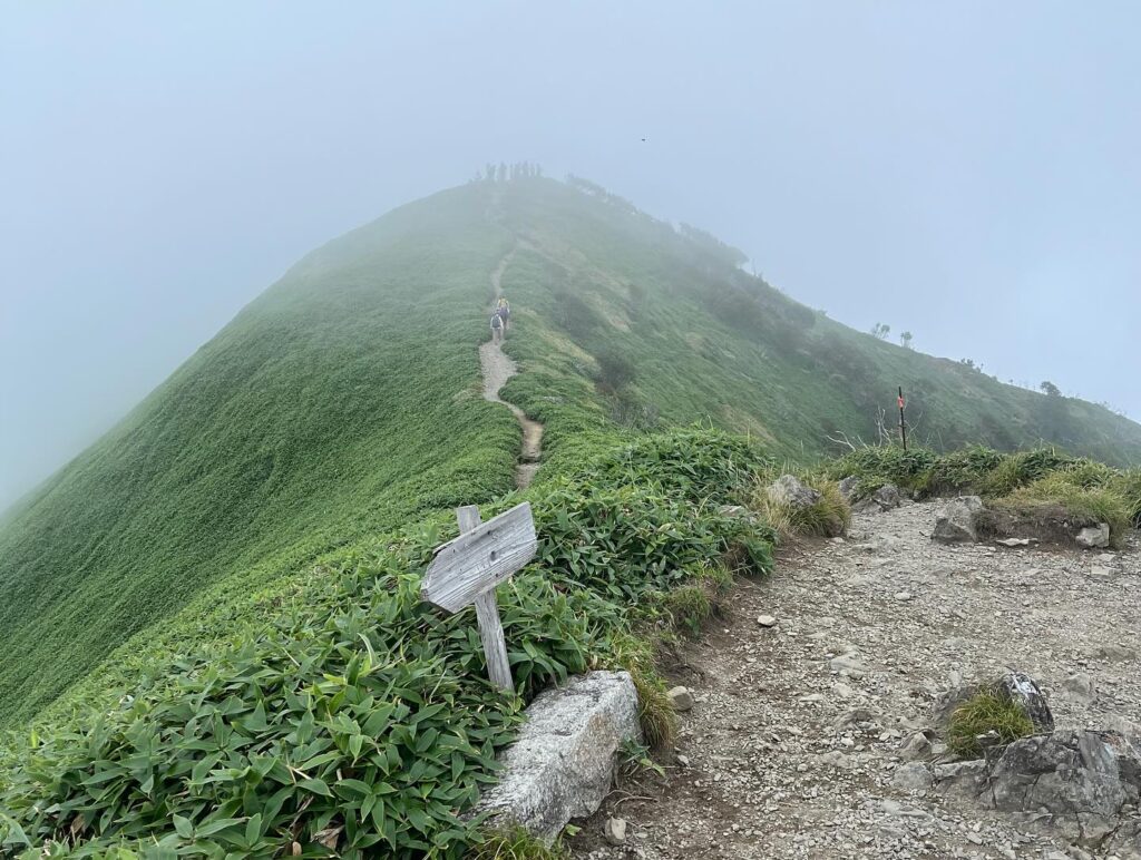
そして剣山と次郎岌の稜線へ!
先ほどより雲が上がってきましたが、美しき笹の稜線を見ることができました。
本当にこれが見たかった!良かった!
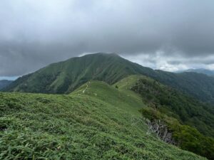
ここから美しき稜線を歩いていきます。
楽しい時間ですね。
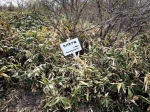
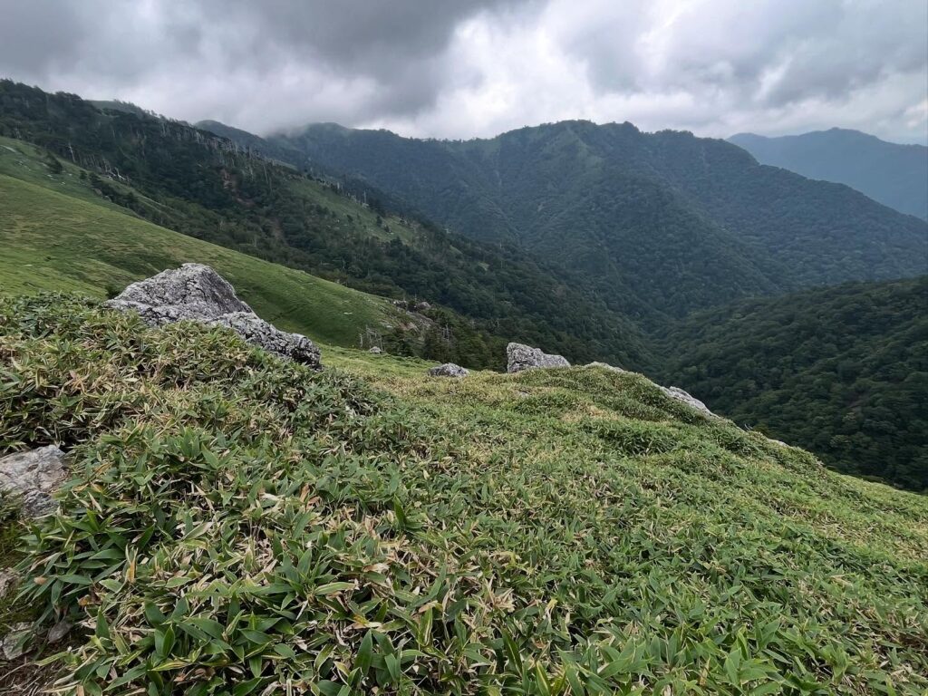
笹原の間に、所々、石灰岩のような岩が出て、カルストのような感じの場所もあります。
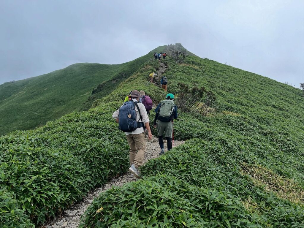
気持ちの良い稜線を歩いて、次郎岌への登りに入ります。
なかなかの急坂です。
振り返ると、剣山山頂に雲がかかってきました。
次郎岌山頂にも雲が増えてきています。急がねば!
笹路のように見えた道も、登りは岩山です。
細い道ですので、下りの方とすれちがいながら、道を譲りながら登っていきます。
山頂まであと少し!
一気に雲がかかってガスの中になってきまいした。
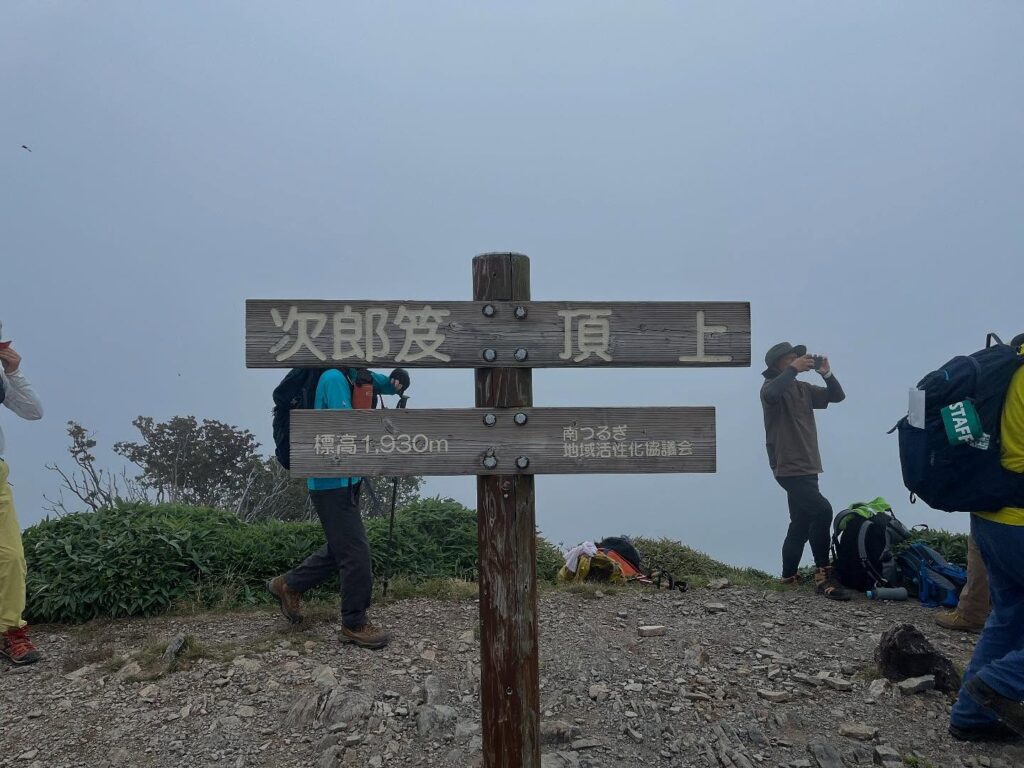
山頂に到着!
ガスの中で眺望はなくなってしまいましたが、憧れの次郎岌山頂へ。
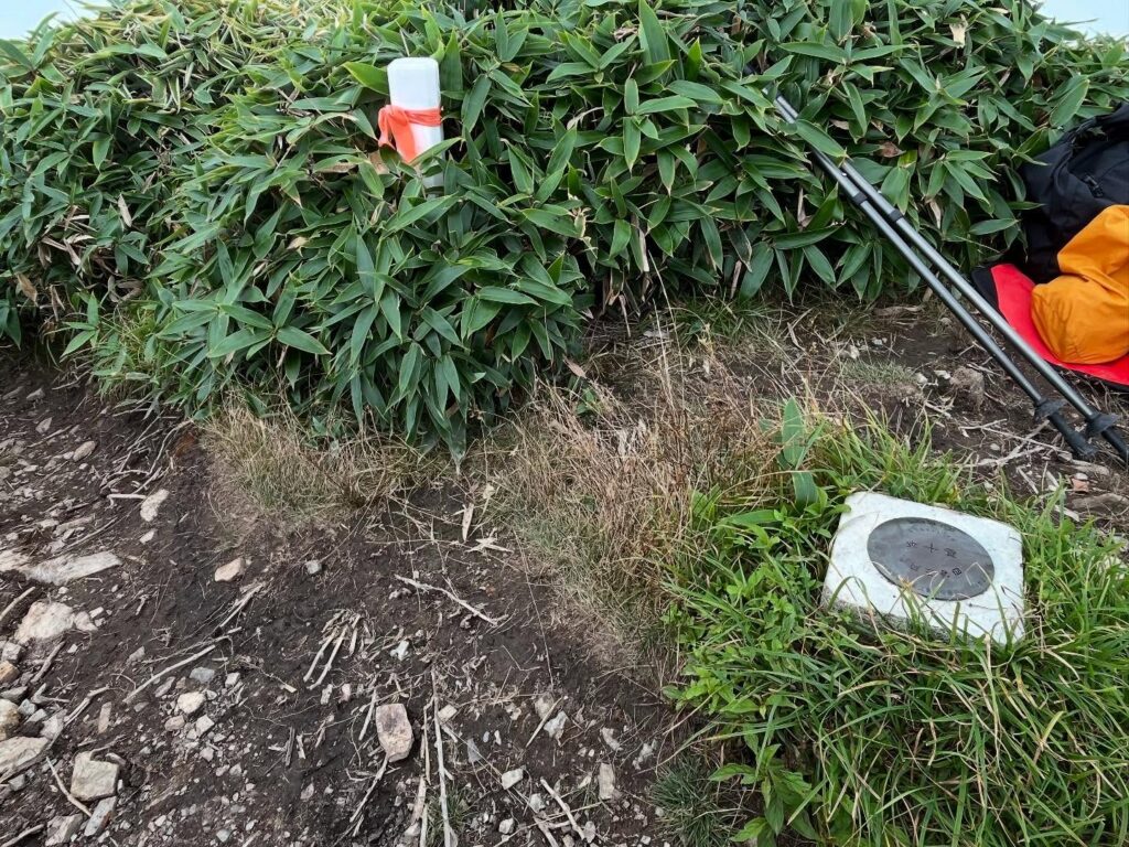
山頂標識よりさらに奥に三角点がありました。
ゆっくりしたいところですが、雨が降り出しそうなので、再び稜線を歩いて、剣山山頂へ向かいます。
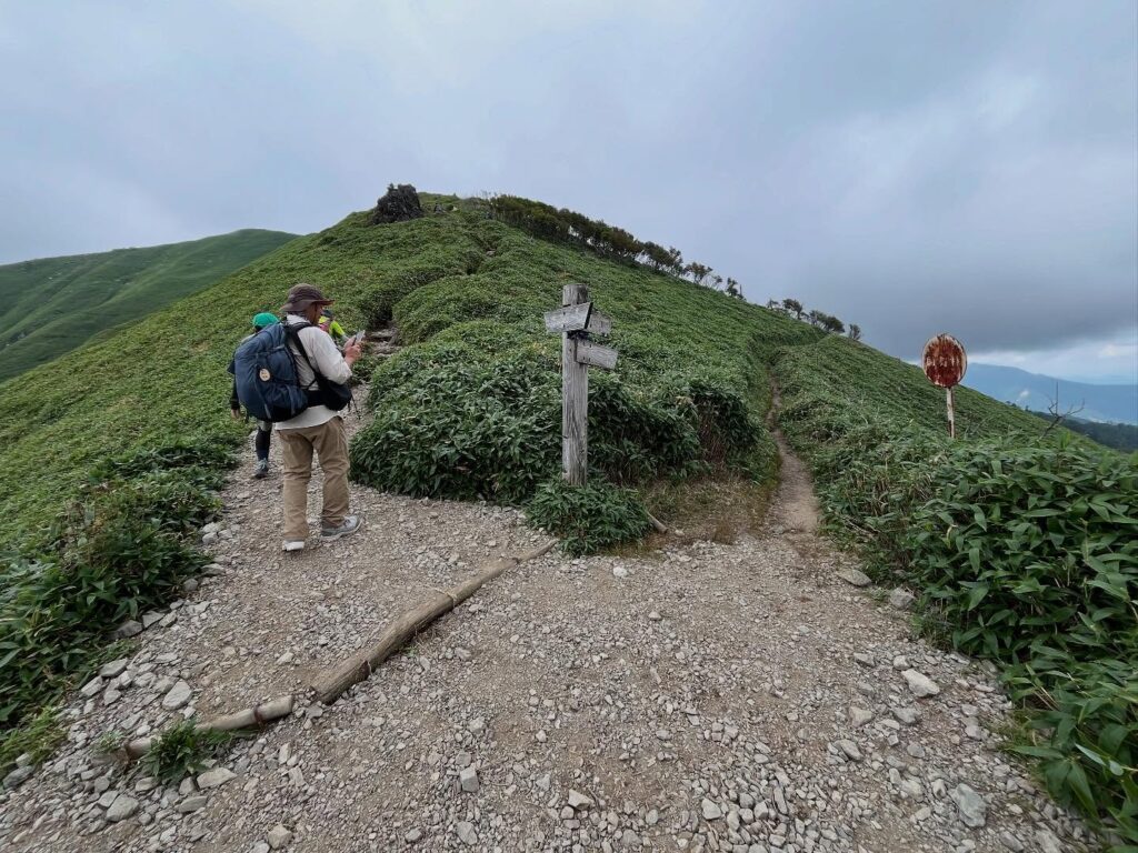
次郎岌へは左側のトラバース道を進みます

きれいですね!
(わずか30m)
剣山から次郎岌までの稜線
本当にきれいですね!
本当に楽しい!
ここに来てようやく風が出てきました
まっすぐ登っていきます
思ったより岩場、ガレ場です
ガスにすっかり覆われてしまいました
残念ながら眺望は隠れてしまいましたが
ようやく登ることができました
三角点は少し奥にあります
#次郎岌
#じろうぎゅう
#標高1930m
#太郎岌
#剣山
#剣山観光登山リフト
#西島駅
#にしじまえき
#標高1750m
#稜線
#愛媛の小山登り
#小山登り
#徳島県
#三好市
#美馬市
#那賀郡
#那賀町
#日本百名山
#四国百名山
#松山ハイキングクラブ
#MHC
Jiro-Gyu… What does “Gyu” mean? I looked it up.
【Gyu】High, like a high mountain.
Mt. Tsurugi is also known as Taro-Gyu.
Jiro-Gyu is the brother peak of Taro-Gyu.
From the Nishijima lift station, we headed for Jiro-Gyu.
Passing through the torii gate, we entered the path to Mt. Tsurugi.
We proceed along the traverse path (walking course) to the right of the torii gate.
We walk along the flat path through the bamboo grove.
After walking for a while, we begin to climb.
As we continue climbing along the pleasant path, the view opens up.
The clouds are rising, but we can see the ridge line all the way to Sanrei!
(We plan to visit Sanrei next month.)
There is a sign indicating that it is 30 meters to the “Meisui Hyakusen” sacred water, but unfortunately, we skip it this time.
Continuing on, we arrive at the Nidome Viewpoint.
The summit of Jiro-dake is clearly visible.
And then we reach the ridge line of Mt. Tsurugi and Jiro-Gyu!
The clouds have risen since earlier, but we were able to see the beautiful bamboo ridge line.
This is exactly what I wanted to see! I’m so glad!
From here, we walk along the beautiful ridge line.
What a fun time!
Among the bamboo grass, there are places where limestone-like rocks appear, giving it a karst-like feel.
Walking along the pleasant ridge, we begin the climb to Jiro-Gyu.
It’s quite a steep slope.
Looking back, clouds have begun to cover the summit of Mount Tsurugi.
Clouds are also increasing over the summit of Jiro-Gyu. We must hurry!
The path that looked like a bamboo grass trail is actually a rocky mountain on the way up.
The path is narrow, so we pass by people coming down the mountain and take turns going up.
We’re almost at the summit!
Clouds suddenly cover the mountain, and we are enveloped in fog.
We arrive at the summit!
The view is obscured by fog, but we have reached the summit of Jiro-Gyu, which we had longed to see.
There is a triangulation point further back than the summit sign.
We would like to relax here, but it looks like it is going to rain, so we walk along the ridge again and head for the summit of Mt. Tsurugi.
見ノ越登山口(劔神社)のMAP
次郎岌のMAP
活動データ(YAMAP)
活動データはYAMAPからご覧ください↓