剣山 次郎岌→剣山 雨とガスと雷の稜線縦断(徳島県三好市、美馬市、那賀郡那賀町)
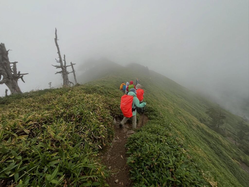
ガスガスの次郎岌を早めに出発し、剣山へ向かいます。
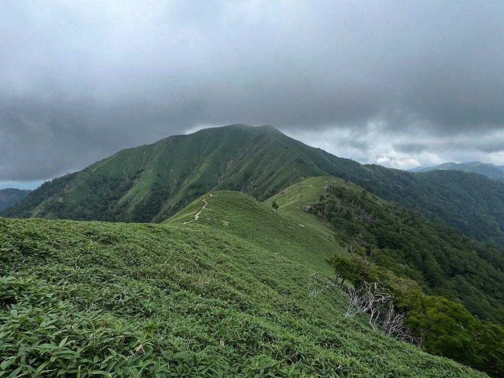
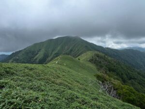
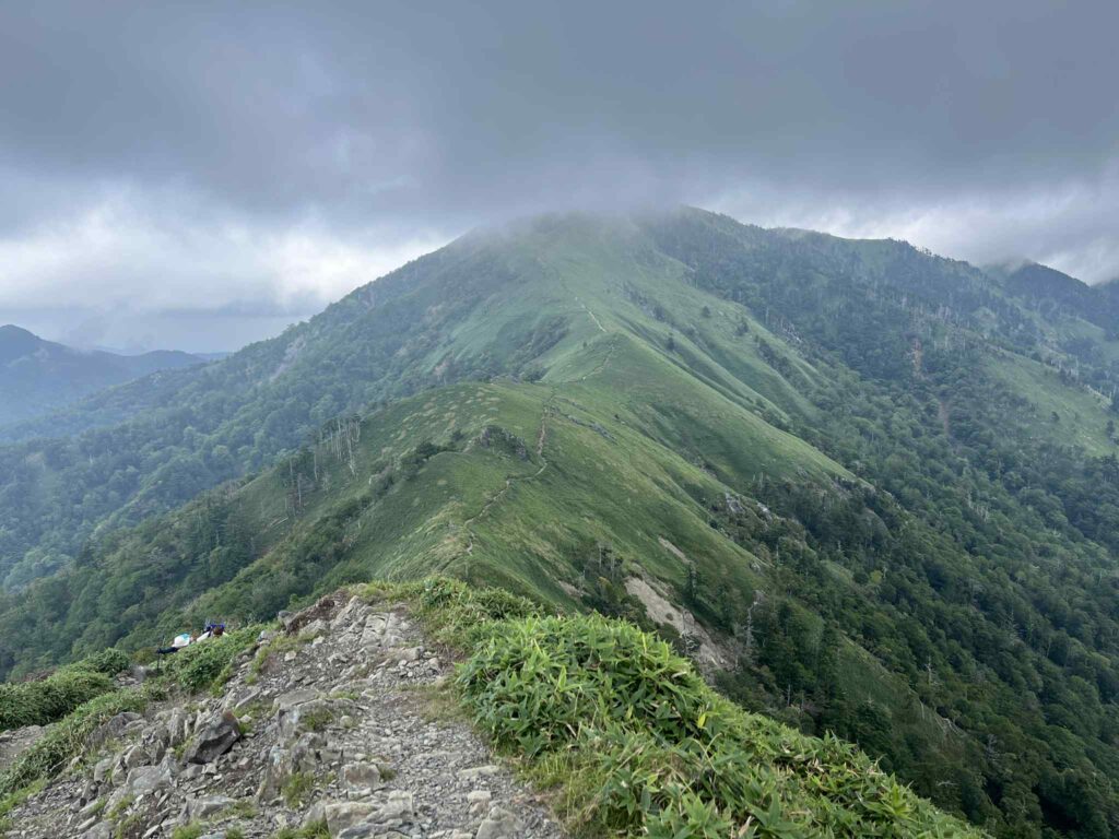
剣山までの美しき稜線は雲の中。
往路でしっかりと稜線を眺めていて良かったです。
(剣山側の写真をあまり撮影していなかったのが残念)
次郎岌から下っていくと、大粒の雨がボトボトっと振り出しました。
慌てて岩場の陰を見つけて、雨具を着用します。
雨が大粒すぎて、上着を着た時点でズボンは濡れまくりです。
雨具の取り出しから着用までの早さは、鍛えておかないとダメですね(汗)
雨具を着用して、ザックカバーをかけたら、気をあらためて出発です!
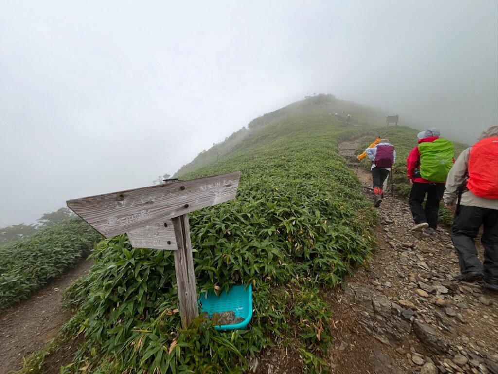
真っ白なガスの中を進んでいきます。
途中、下の方に一匹の鹿を見つけることができました。
稜線を歩いていると、遠くでゴロゴロと雷の音が。
なんといっても、四国No.2の高さの稜線を歩いています。
ドキドキしながら進んでいきます。
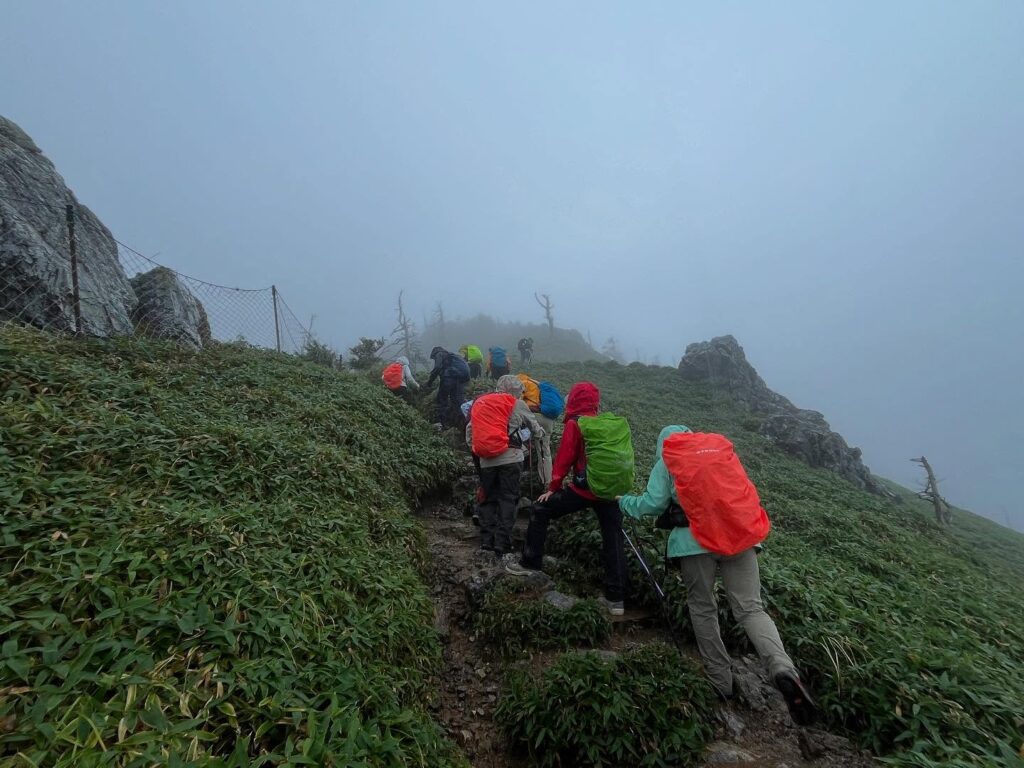
剣山への登りに入ります。
雨で登山道が小さな川のようになっています。
水を避けながら、滑らないように、一歩一歩登っていきます。
雷の音も、近くなったように感じてドキドキが続きます。
晴天でしたら、美しい景色を眺めながら楽しく登れますが、今日はガスのため距離感が掴みにくい状況。
メンバーの皆さんと黙々と登っていきます。
木の階段が見えたら、もうすぐ山頂。
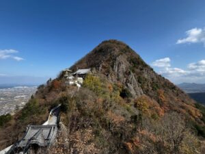
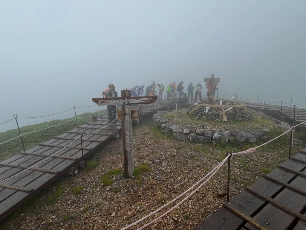
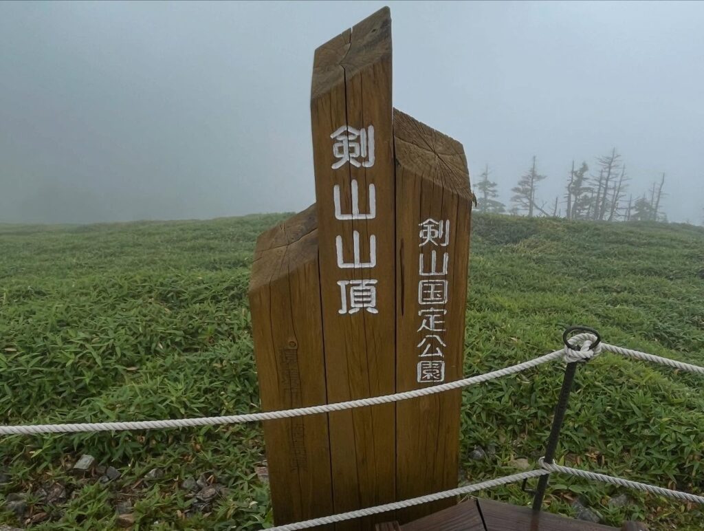
ガスガスの山頂に到着しました。
山頂は風が強く、気温は17℃あるのですが、かなり寒い状況。
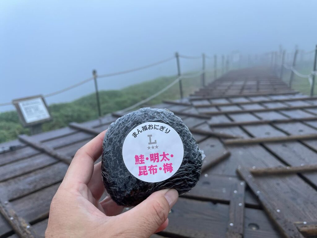
雨が止んだので、この隙に、山頂でお昼ごはんタイムです。
暑さ対策はしっかりしてきたのですが、寒さ対策は雨具程度。
あったかいカップラーメンが食べたい心境でした。
お昼ごはんを食べた後は、MHCの皆さんで記念撮影。
まっしろな中での撮影でしたが、皆さんと登れて楽しい時間でした。
往路で美しい稜線が見れて、本当に良かったです。
下りは最短の尾根道コースでリフト西島駅まで。
晴れていたら、ここからリフトで降りても良いかなと思ったのですが、雨が強くなっていたので断念。
(MHCからも許可が出ていました)
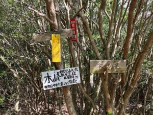
そこから、見ノ越登山口まで降りていきました。
木々があるので、あまり濡れずに降りることができたので正解だったようです。
雨になってしまいましたが、雨天登山の良い経験となりました。
パッキングも、もっといろいろ考えねば!と、たくさん勉強させていただきました。
ガスが上がっていますが
この時点ではまだ雨は降っていません
次郎岌から下っている途中で大粒の雨が…
慌てて雨具とザックカバーを
往路でじっくりと堪能できたので良し!
山頂は雲に隠れてしまっていますが良い景色!
剣山への登りが始まります

山頂までもう少し
今回もガスガスでした(2回目)
雨が止んでくれたのがありがたいですね
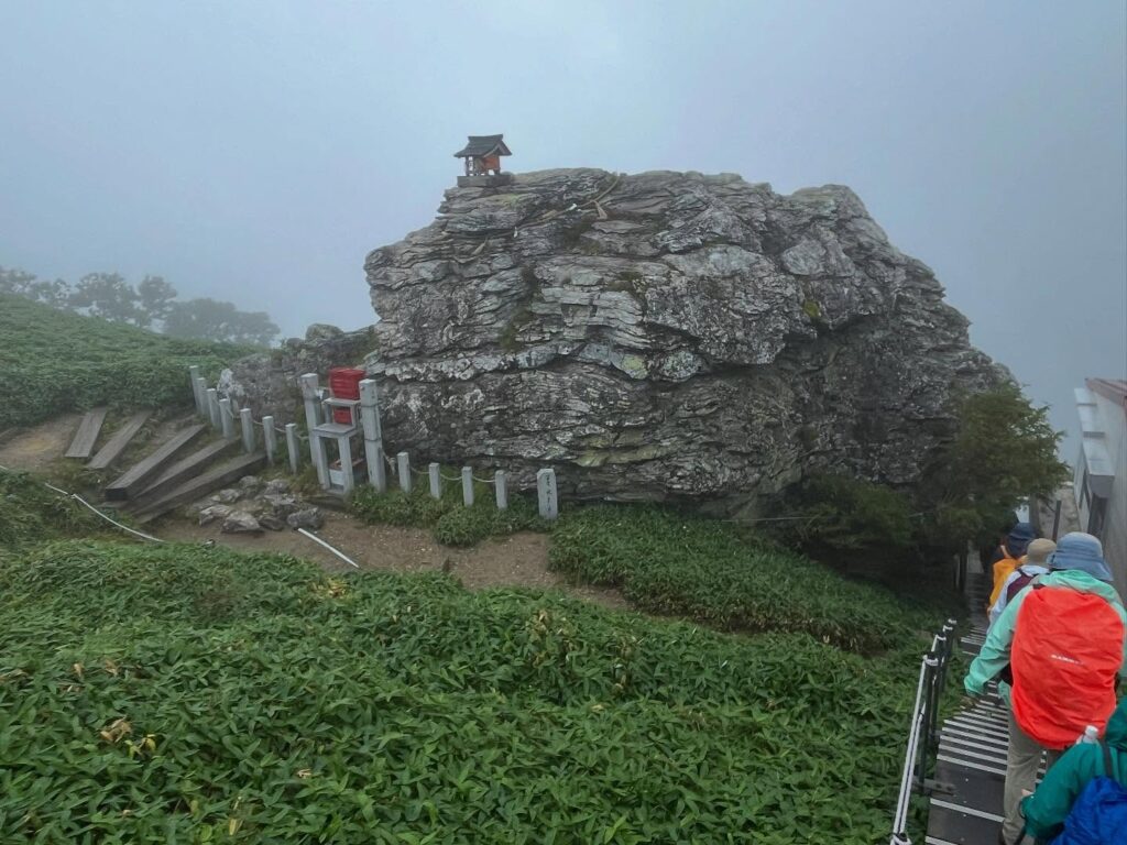
安徳天皇の宝剣を納めたという巨大な磐座(いわくら)
https://www.tsurugisan.jp/
次回は一の森にも行きたいですね
#剣山
#つるぎさん
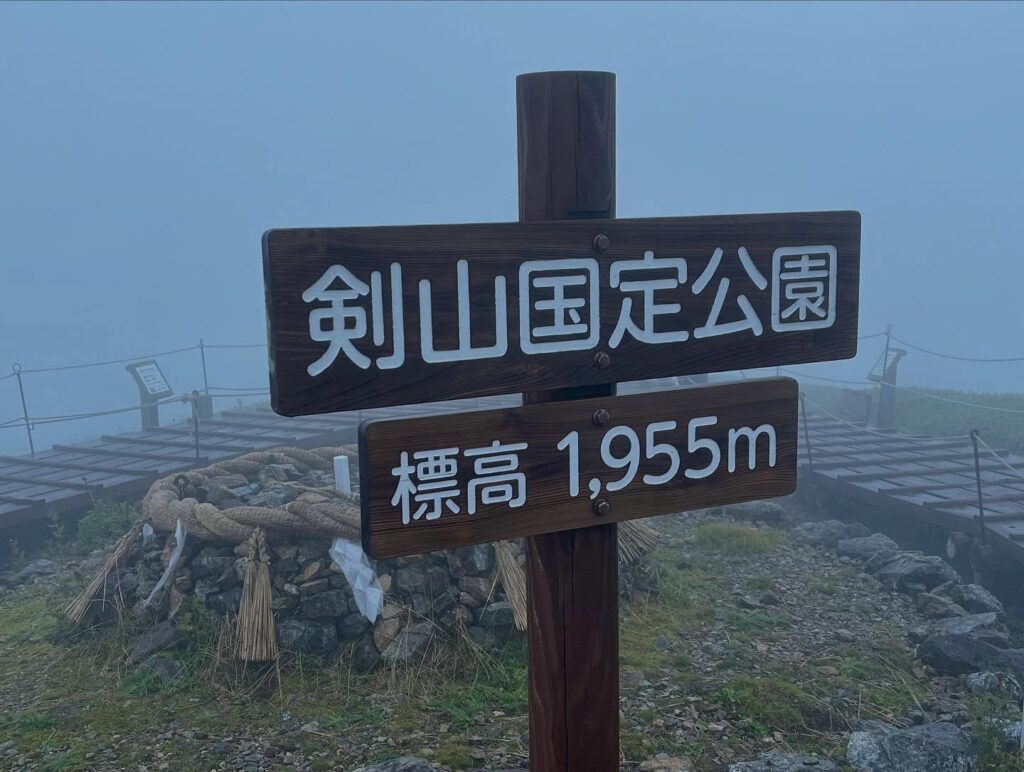
#標高1955m
#太郎岌
#次郎岌
#見ノ越登山口
#剣山観光登山リフト
#見ノ越駅
#みのこしえき
#標高1420m
#西島駅
#にしじまえき
#標高1750m
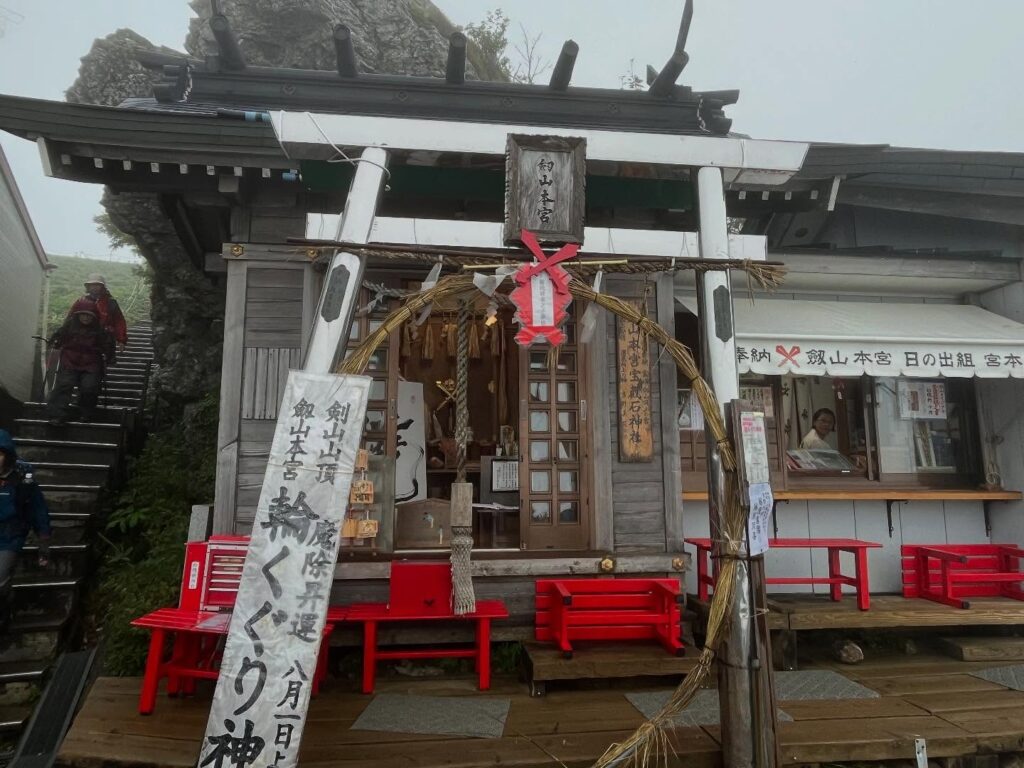
#劔山本宮劔神社
#愛媛の小山登り
#小山登り
#徳島県
#三好市
#美馬市
#那賀郡
#那賀町
#日本百名山
#四国百名山
#松山ハイキングクラブ
#MHC
We left Jiro-Gyu early and headed for Mt. Tsurugi.
The beautiful ridgeline to Mt. Tsurugi was hidden in the clouds.
I’m glad I took the time to look at the ridgeline on the way there.
(It’s a shame I didn’t take many photos of Mt. Tsurugi.)
As we descended from Jiro-Gyu, large raindrops began to fall.
We hurriedly found shelter under some rocks and put on our rain gear.
The rain was so heavy that by the time I put on my jacket, my pants were already soaked.
You really need to practice putting on your rain gear quickly (sweat).
After putting on my rain gear and backpack cover, I set off again with renewed determination!
I made my way through the thick fog.
Along the way, I spotted a deer below.
As I walked along the ridge, I heard the rumble of thunder in the distance.
After all, I was walking along the second-highest ridge in Shikoku.
I continued on with a racing heart.
I began the ascent to Mount Tsurugi.
The trail was like a small river due to the rain.
I carefully avoided the water and climbed step by step to avoid slipping.
The sound of thunder seemed to grow closer, keeping my heart racing.
On a clear day, you can enjoy the beautiful scenery while climbing, but today, due to the fog, it was difficult to judge distances.
We continued climbing silently with the other members.
When we saw the wooden stairs, we knew the summit was near.
We arrived at the foggy summit.
The wind was strong at the summit, and although the temperature was 17°C, it felt quite cold.
The rain had stopped, so we took the opportunity to have lunch at the summit.
I had prepared well for the heat, but my cold-weather gear was limited to rain gear.
I was in the mood for a warm cup of ramen.
After lunch, we took a commemorative photo with the MHC members.
It was a white-out, but it was a fun time climbing with everyone.
It was truly wonderful to see the beautiful ridgeline on the way up.
We took the shortest ridge trail down to the Lift Nishijima Station.
If it had been sunny, I might have considered taking the lift down from here, but the rain was getting heavier, so I decided against it.
(Permission was also granted by MHC.)
From there, we descended to the Minogoe Trailhead.
Since there were trees, we were able to descend without getting too wet, so it seems like the right choice.
Although it rained, it was a good experience for rainy-day hiking.
I learned a lot about packing and realized I need to think more carefully about it in the future.
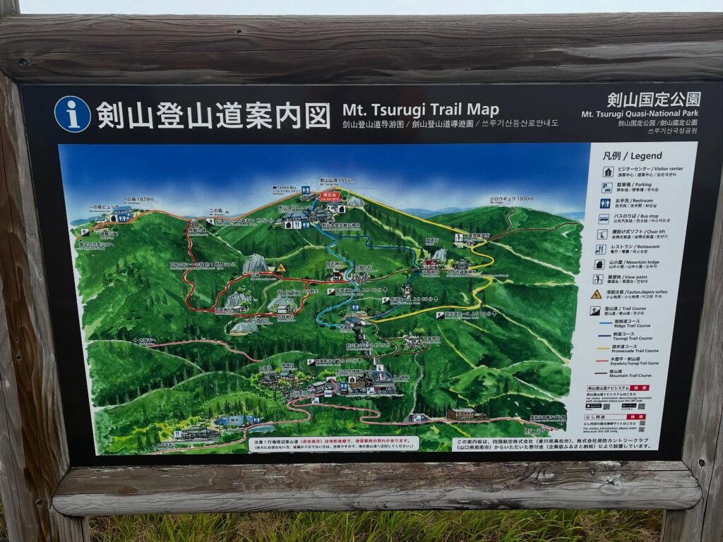
見ノ越登山口(劔神社)のMAP
次郎岌のMAP
剣山のMAP
活動データ(YAMAP)
活動データはYAMAPからご覧ください↓