大黒山 峠と麓から登れるパノラマ眺望が楽しめる山(愛媛県西条市)標高322m(大黒 標高392.6m)
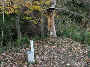
竜門山の登山口から、数十メートルほど道路を登って少し降りると、山肌にピンクテープが見えます。
ここが大黒山への峠の登山口です。
麓の大明神池上の登山口もありますが、こちらは中級者向けです。
峠からの方が安全に登れます。
ということで、私は峠の登山口から登ります。
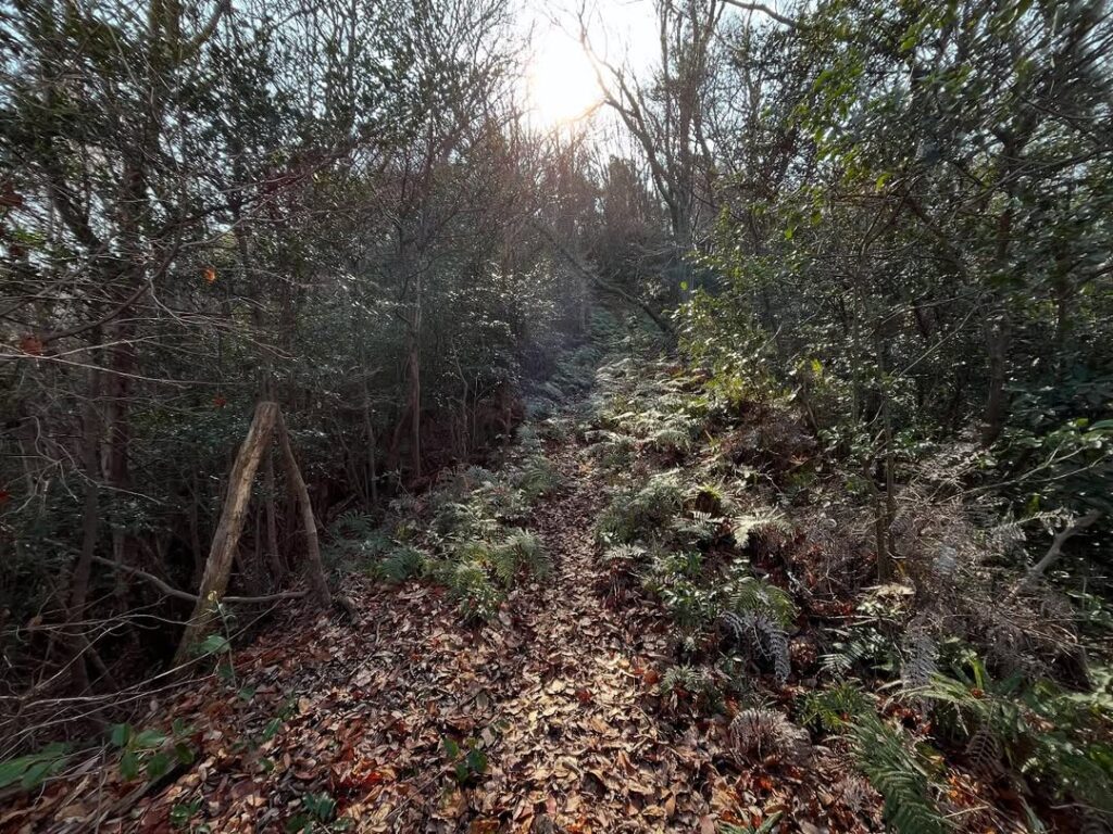
ここから登れるの?
という場所からスタートしますが、ロープを張ってくれているので、進むべき方向はわかりやすいです。
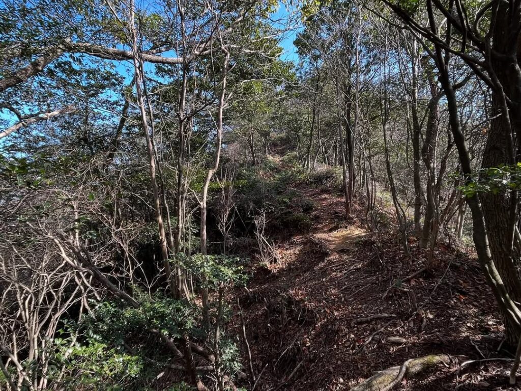
尾根まではとにかく急登!
所々にロープを張ってくれています。
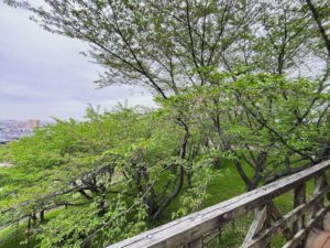
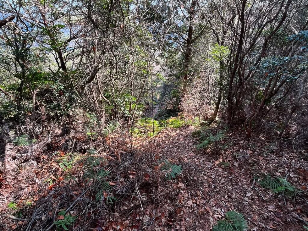
かなりのシダ道を想定していたのですが、初春の季節は登りやすい道でした。
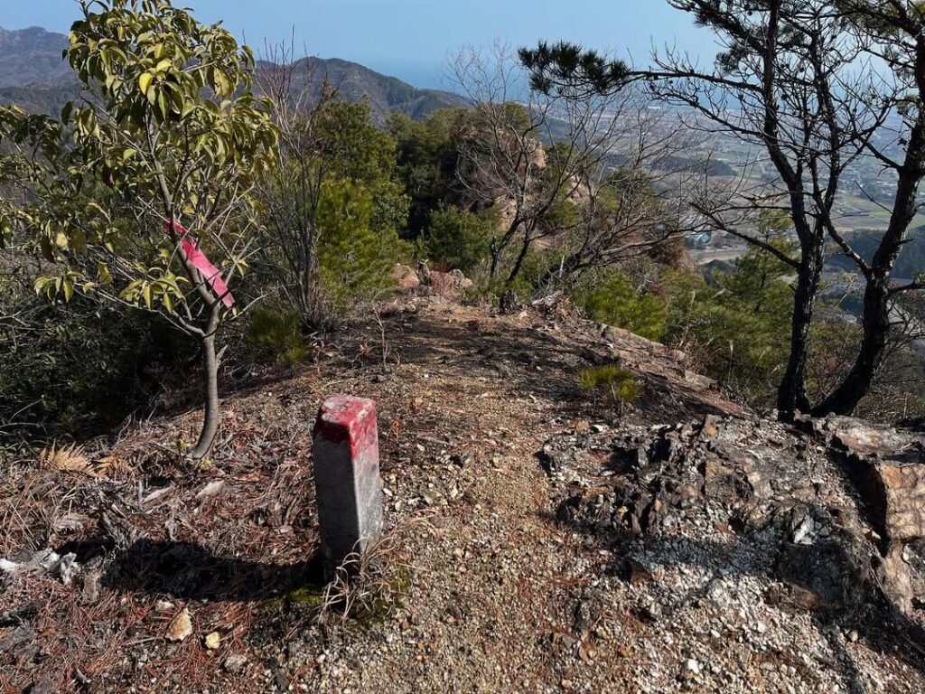
尾根に登ると分岐点。
西側に少し進むと、三角点 大黒があります。
こちらの標高は392.6m。
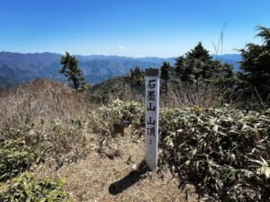
そして、東側に進むと大黒山山頂 標高322mとなっています。
なんと、山頂の標高の方が70mも低い!というお山。
ここから尾根歩きが始まりますが、ここから90mほどを一気に下り、20mぼど登ると東のピークである大黒山に到着します。
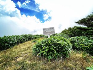
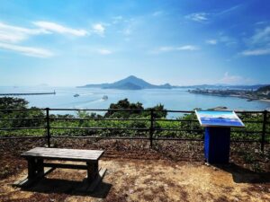
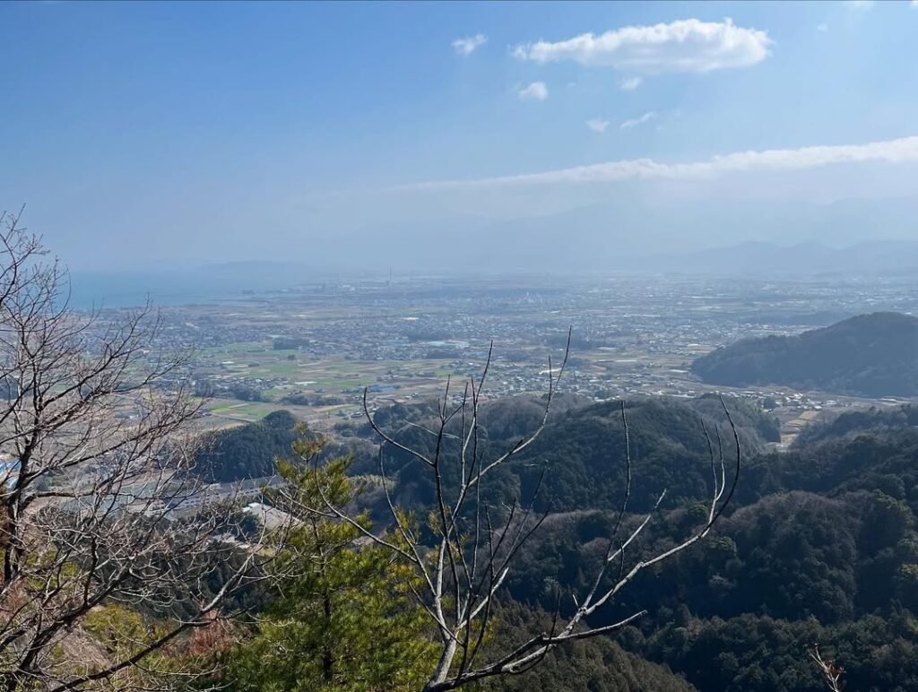
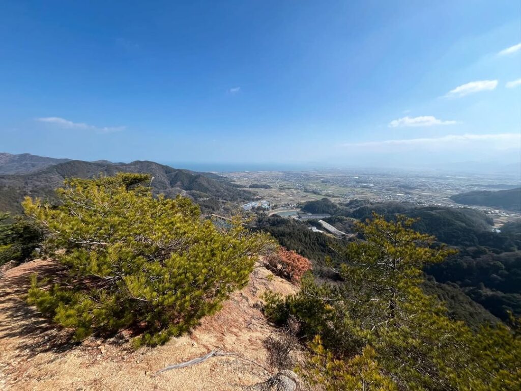
大黒山山頂からの眺望は最高!
パノラマの眺望を楽しむことができます。
先ほどまでいた竜門山もきれいに眺めることができます。
昔は三角点の場所が山頂だったと思いますが、東ピークの方が眺望が良いので移されたのでしょうか?
ちょっと複雑な気持ちですが、最高の眺望です!
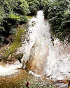
この大黒山山頂からさらに東に進むと、岩肌のピークに到着します。
ここが大黒山名物のロープ場です。
大明神池上の登山口から登ると、垂直の岩肌の壁をロープで登ることになります。
上から覗き込みたかったのですが、万一があったらいけないので諦めました(汗)
大黒山は平成8年7月に山火事があったそうで、何名かの登山ブログを読むと、大明神池上の登山口からの登山道は、まだ崩れやすい岩肌が残っている感じだのようです。
初心者は峠の登山口から登ることをお薦めします!

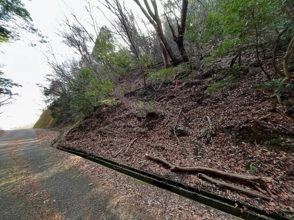
ここが登山口!

春先だから歩きやすいですが、夏場はかき分けるのが大変そう

(写真では傾斜がわかりにくいですね)


上から覗くのは勇気が要りますね
#大黒山
#だいこくやま
#標高322m
#大黒
#だいこく
#標高393m
#愛媛の小山登り
#小山登り
#愛媛県
#西条市
#黒谷
#三角点
#大黒山ロープ場
#大黒山城
#大黒山城跡
#炭谷山
From the trailhead of Mt. Ryumon, a few dozen meters up the road and a short distance down, you will see pink tape on the mountainside.
This is the trailhead for the pass to Mt.Daikoku.
There is also a trailhead above the Daimyojin Pond at the foot of the mountain, but this trailhead is for intermediate climbers.
It is safer to climb from the pass.
Therefore, I will climb from the trailhead of the pass.
Is it possible to climb from here?
But the ropes are set up so that it is easy to know which direction to go.
It is a steep climb up to the ridge!
The ropes are placed in various places.
I had expected a very steep fern trail, but it was easy to climb in the early spring season.
Climbing up to the ridge, we came to a fork.
A little further to the west is Triangle Point Daikoku.
The elevation here is 392.6 meters,
and to the east is the summit of Daikokuyama, elevation 322 meters.
The summit elevation is 70 meters lower than the summit! This is a mountain called “Daikokuyama.
From here, a ridge walk begins. From here, descend 90 meters at a stretch and climb 20 meters to reach the eastern peak, Mt.Daikoku.
The view from the top of Mt.Daikoku!
You can enjoy a panoramic view.
You can also see Mt. Ryumon, where you were just now.
I think the triangular point used to be the summit, but was it moved to the east peak because it has a better view?
I have mixed feelings about this, but it is the best view!
Further east from the summit of Mt. Daikoku, you will reach a rocky peak.
This is Daikokuyama’s famous rope station.
Climbing from the trailhead above the Daimyojin Pond, you will have to rope up the vertical rock face.
I wanted to look down from the top, but I gave up in case there was an emergency.
Daikoku had a forest fire in July 1996, and from reading some people’s climbing blogs, it seems that the trail from the trailhead above Daimyojin Pond still has some crumbling rock surfaces.
Beginners are recommended to climb from the trailhead at the mountain pass!
大黒山ロープ場からのパノラマ眺望(動画)
大黒山の登山口(峠)
三角点 大黒(大黒山城跡)のMAP
大黒山のMAP
大黒山ロープ場のMAP