石墨山 石墨分岐→石墨山(愛媛県上浮穴郡久万高原町)標高1455.99m
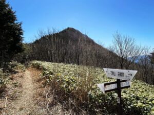
石墨分岐からの眺望を堪能したら、石墨山へ向かいます。
石墨分岐は標高約1365m、石墨山山頂までの標高差は約90m。
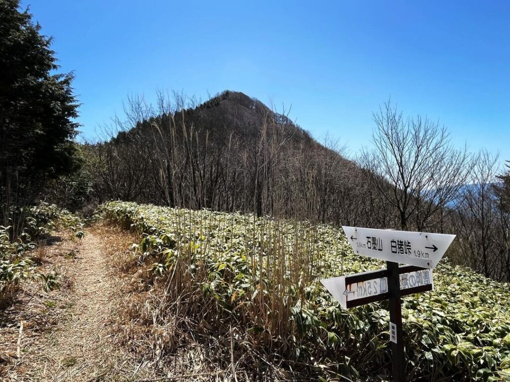
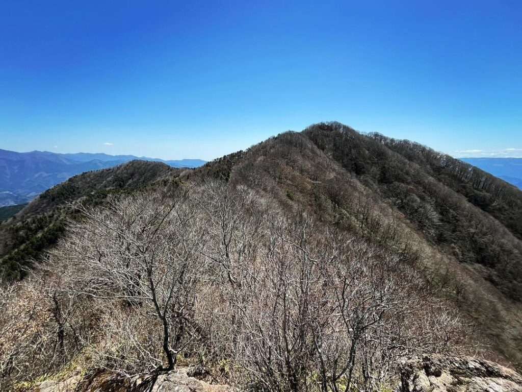
ここからは尾根道、アップダウンは少なめです。
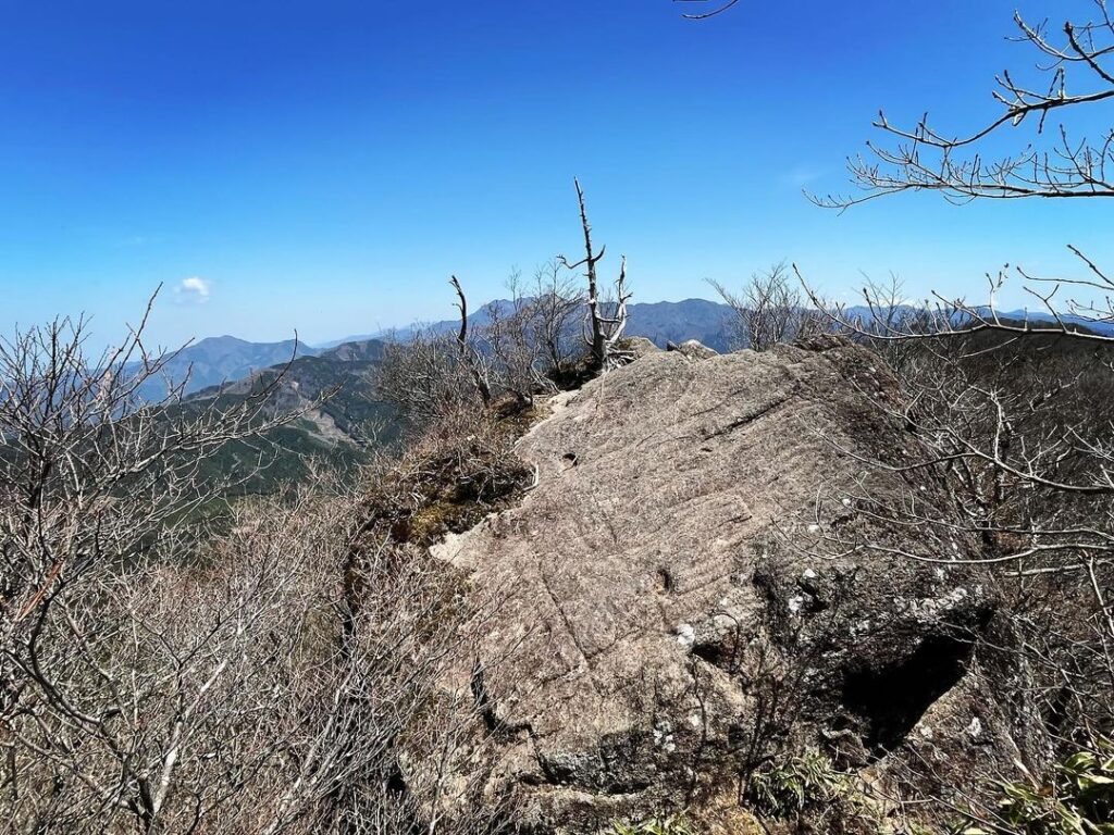
少し歩くと岩場に。
岩の上からの眺望も素晴らしいですね。
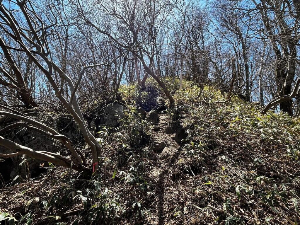
岩の隙間と、岩の奥が登山道に繋がっています。
岩の奥の方が安全かもしれません。
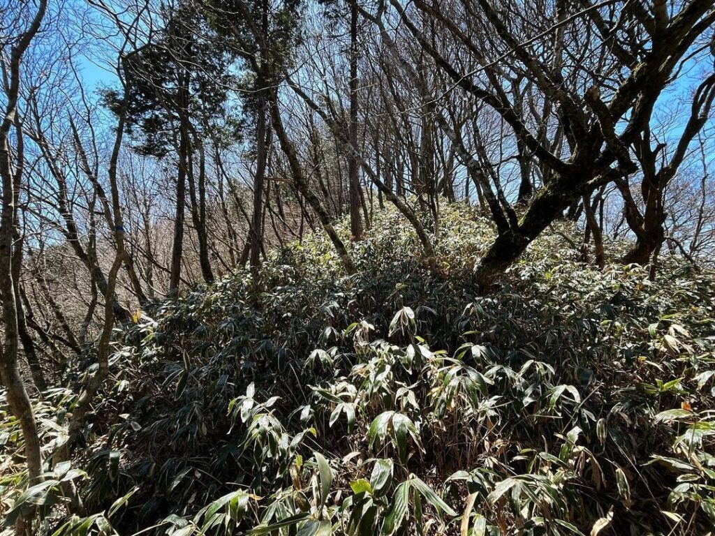
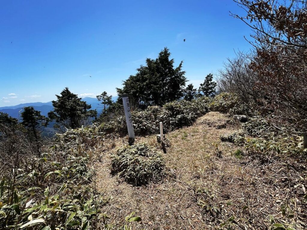
後は尾根の笹道を進んでいくだけ。
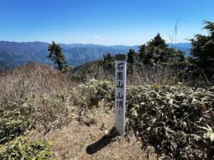
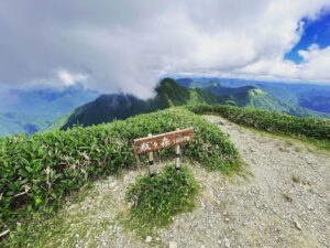
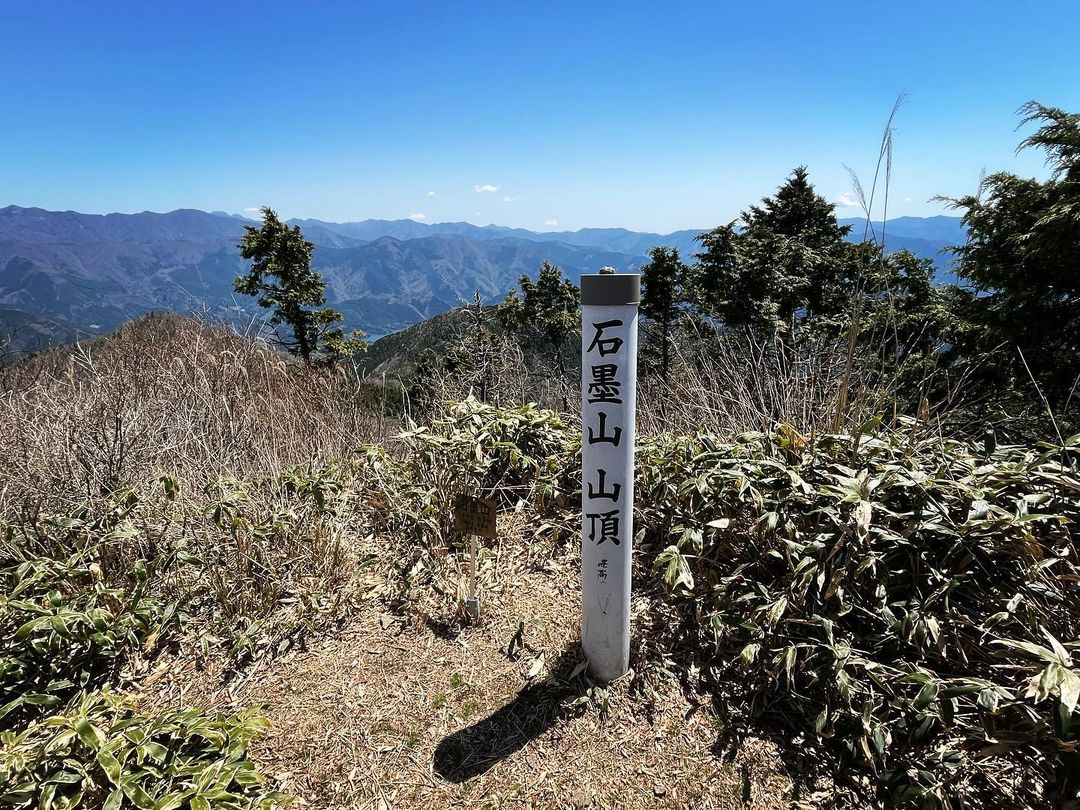
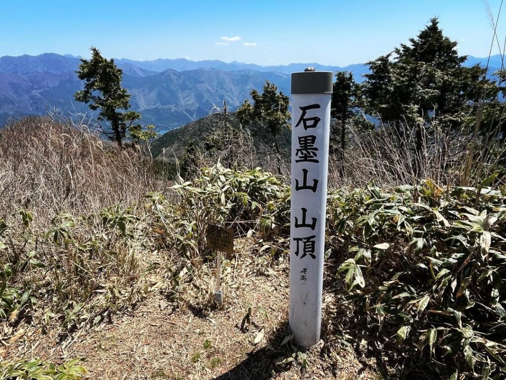
最後の小ピークを登りきると、石墨山の山頂です!
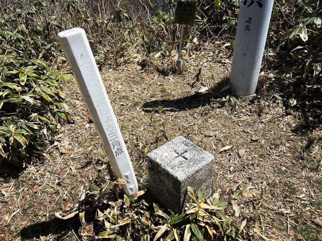
山頂の標識と三角点、そして素晴らしい景色が迎えてくれます。
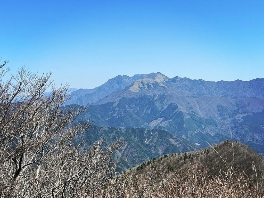
木々のためパノラマ眺望ではなく、片側眺望となりますが、なんといっても石鎚山を眺められるパワースポット。
動画では大きさが伝わりにくいのですが、石鎚連峰を一望することができます。
なかなかにお見事!
この景色を見ながら、おむすびを頂きました。
美味しかったですね。
岩場の隙間、岩場の奥と登山道が続きます
#石墨山
#いしずみさん
#標高1456m
#石墨分岐
#愛媛の小山登り
#小山登り
#愛媛県
#上浮穴郡
#久万高原町
#東温アルプス
#皿ヶ峰連峰
#石鎚山
#愛媛の山
#四国の山
#三角点
After enjoying the view from the Ishiboku junction, head for Mt. Ishizumi.
Ishiboku junction is about 1365 meters above sea level, and the elevation difference to the summit of Mt. Ishizumi.
From here, the trail is a ridge path with few ups and downs.
After a short walk, you will reach a rocky area.
The view from the top of the rocks is wonderful.
A gap between the rocks and the back of the rocks leads to the trail.
The one behind the rock may be safer.
All that remains is to continue along the bamboo trail on the ridge.
After climbing the last small peak, you will reach the summit of Ishizumisan!
You will be greeted by a summit sign, a triangular point, and a great view.
Although the panoramic view is not panoramic due to the trees, it is a power spot from which you can view Mt. Ishizuchi.
It is hard to convey the size of the view in the video, but you can see the whole Ishizuchi mountain range.
It is quite splendid!
We had omusubi (rice balls) while enjoying this view.
It was delicious.
石墨分岐のMAP
石墨山のMAP