楢原山・奈良原神社 神域は杉の樹氷の幻想的な世界でした(愛媛県今治市)標高1041m
楢原山はほぼ山頂まで車で行けるらしい!
ということでスクーターで行ってきました。
今週は暖かいからと思っていたら、国道317号線の気温表示は8度。
これからどんどん下がっていくことは露知らず・・・
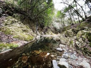
玉川まで走り、鈍川温泉方面に。
そのまま鈍川渓谷沿いに進んでいきます。
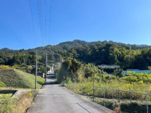
美しい渓谷を見ながら、どんどん進んでいき、釣り堀を越えたあたりで、楢原山登山口の大きな標識が。
山頂の奈良原神社まで8kmと書かれてあります。
ここを登っていきます。
1.5車線ぐらいで車でも大丈夫ですが、離合と落石に注意です。
あちこち、落石がありました。
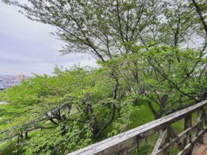
どんどん登っていくと、前方に白い木々が見えてきます。
まさかと思いましたが、樹氷です。
気温は3度ぐらいの感覚でしょうか。寒いはずです。
ガスも出てきて、どんどん神秘的な世界へ。
林道の終点は、奈良原神社の鳥居前の駐車場。
このあたりで標高約900m。
ここから、一気に世界が真っ白になりました。
あちこちに「ここは神域です」と書かれているのですが、ガスの中の樹氷のアーチは、まさに神域としか言いようがありませんでした。
しばらく登ると、県の文化財指定・天然記念物となっている、立派な子持ち杉(2代目・初代)も仰ぎ見ることができます。
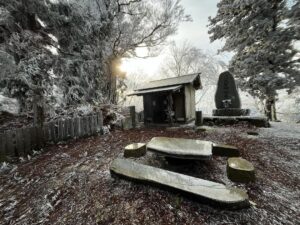
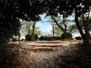
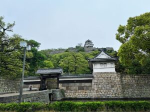
さらに登っていくと、山頂の奈良原神社に。
大きな石碑と本殿が迎えてくれます。
(本殿は扉を開けると本尊があります。知らなかったです。)
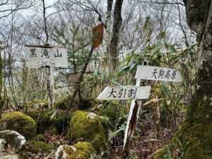
本尊の左手のピークには経塚発掘跡があり、ここが楢原山山頂です。
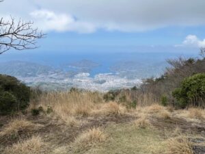
ゆっくり山頂を楽しみたかったのですが、寒すぎたので古権現山に向かいます。

日帰り温泉もありますので帰りはぜひ!


樹氷を楽しみながら走れます


少し上に初代の子持ち杉もあります

玉川中学校が制作されたようです


#楢原山
#ならばらさん
#標高1041m
#奈良原神社
#奈良原権現
#子持ち杉
#神域
#壬生川上神社
#馬神様
#水分神社
#牛神様
#奈良原山経塚
#経塚発掘跡
#愛媛の小山登り
#小山登り
#愛媛県
#今治市
#玉川町
#奥道後玉川県立自然公園
#四国百山
#四国百名山
#愛媛森林浴88ヶ所72番
#鈍川温泉
#湯の谷林道
#林道湯の谷線
I heard that Mt. Narabara can be reached by car almost to the top of the mountain!
So I went there on my scooter.
I thought it would be warm this week, but the temperature reading on Route 317 was 8 degrees Celsius.
Little did I know that it was going to get lower and lower…
Riding to Tamagawa, we headed in the direction of the Nibukawa Hot Springs.
We continued along the Nibukawa Valley.
We continued onward, looking at the beautiful valley, and when we passed a fishing pond, we saw a large sign for the entrance to the Narabara trailhead.
It says that it is 8 km to the Narabara Shrine at the top of the mountain.
We climbed up here.
The road is about 1.5 lanes, so it is safe for cars, but be careful of merging and falling rocks.
There were falling rocks here and there.
As we climbed higher and higher, we saw white trees ahead of us.
I didn’t think it was possible, but it was ice.
The temperature must have been about 3 degrees Celsius. It must have been cold.
The gas started to appear, and we entered a more and more mysterious world.
The last stop on the forest road was the parking lot in front of the torii gate of the Narabara Shrine.
At this point, the altitude is about 900 meters above sea level.
From this point, the world suddenly turned completely white.
There are signs everywhere saying, “This is a Shinto shrine area,” and the arches of ice trees in the gas could only be described as a Shinto shrine area.
Climbing up for a while, we could look up at the magnificent cedar trees (the second and first generations), which are designated as cultural assets and natural monuments by the prefectural government.
Further up the mountain, we came to the Narabara Shrine at the summit.
A large stone monument and the main shrine welcome you.
(The main hall has a door that opens to reveal the principal image of the shrine, which I did not know. I didn’t know that).
On the peak to the left of the main sanctuary is the excavation site of a sutra mound, which is the summit of Mount Narabara.
We wanted to take our time to enjoy the summit, but it was too cold, so we headed for Furugongenzan (Mt. Furugongen).
奈良原神社 神域の樹氷(動画)
楢原山の登山口(林道湯の谷線)
楢原山の登山口(奈良原神社鳥居)
奈良原神社のMAP
楢原山のMAP