無宗天山 絶対に車で登ってはならない山城跡(愛媛県今治市)標高315m
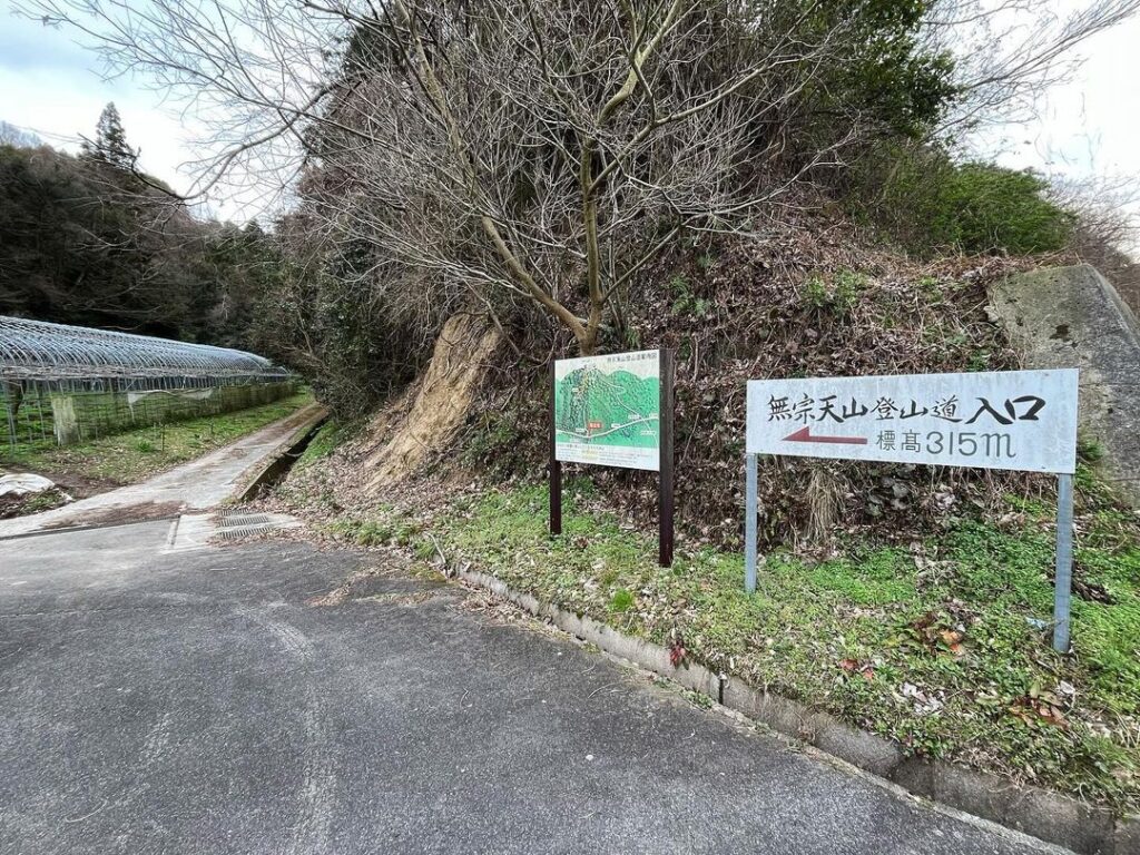
今治から菊間まで抜ける広域農道「で愛ふれ合いロード」を走っていると、突如「無宗天山」の看板を見つけました。
時間は午後4時、標高は315m、行ける!
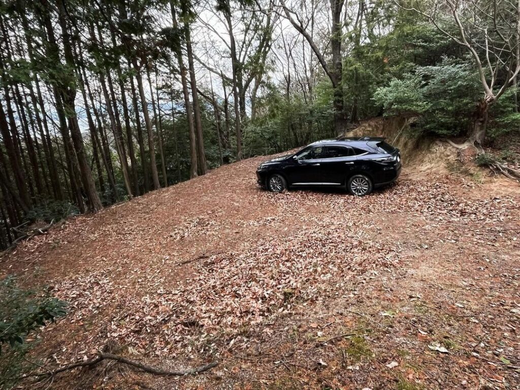
原田登山口の案内板を見ていると、山の途中に(P)のマークが。
途中まで車で行けたら楽勝ですね!
※注)無宗天山には絶対に車で入らないでください。
本当に後悔しました(汗)
転落かJAF案件かなというレベルでしたが、この文章を書いているということで、辛うじて生還しております。
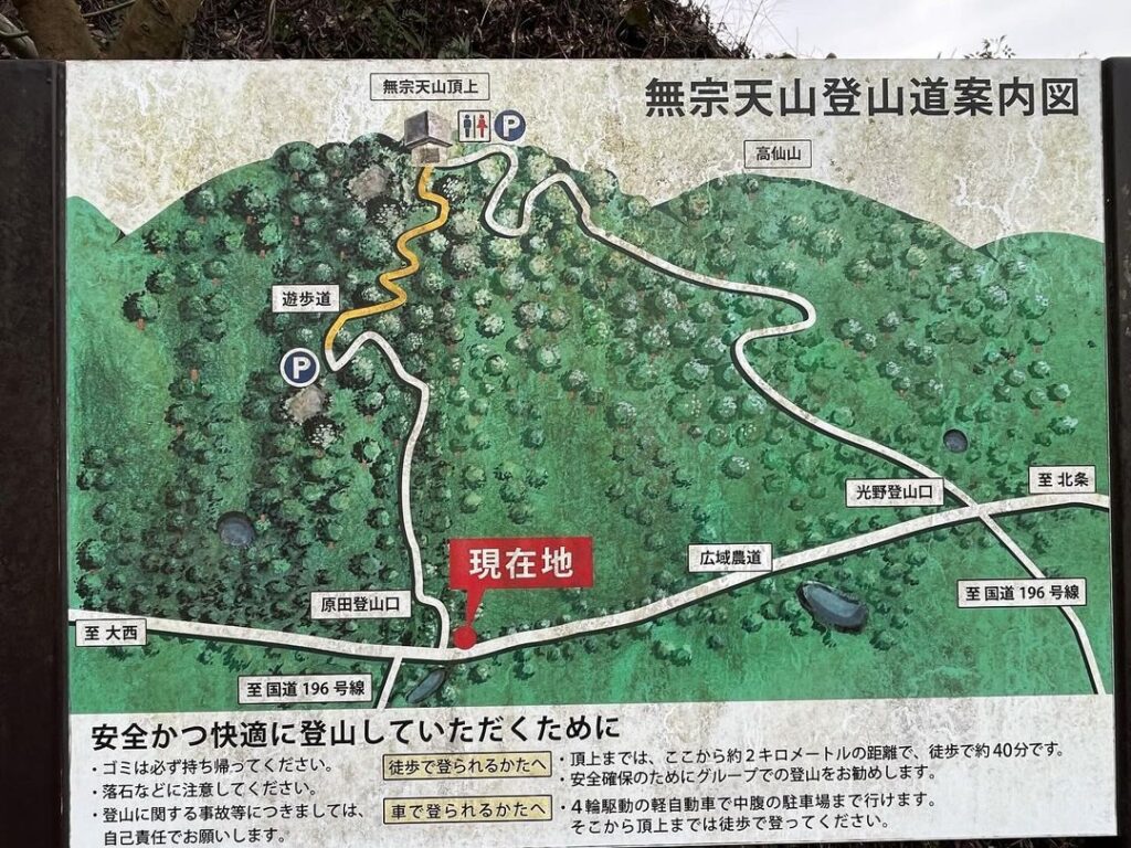
看板をよく読むと「4輪駆動の軽自動車で中腹の駐車場まで行けます。」と書いていますね。
ちょっと甘口な書き方なのでは?
後で見た光野登山口には「4輪駆動の軽自動車以外では上ることができません。」「この登山道は狭小で離合場所がほとんどない上、途中からは未舗装になります。」と、かなりの辛口で書いてありました(汗)
ということで、原田登山口から登り、中腹の駐車場に車を停めて、登り始めます。
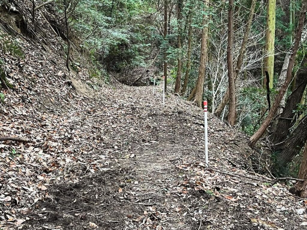
山頂まで800mということで、気軽に考えていたのですが、急傾斜・道が滑る・道がわかりにくい、となかなか厳しい登山道でした。
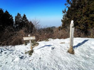
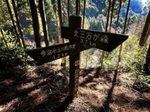
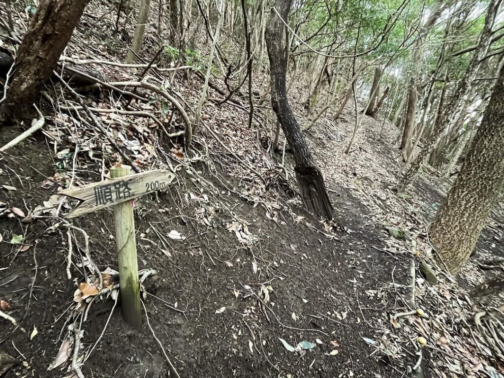
光野登山口からの登山道と合流し、最後の登りに。
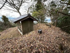
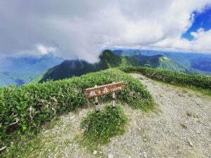
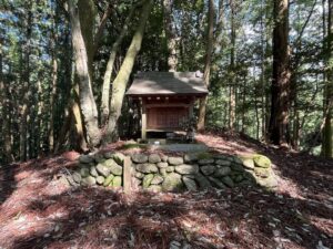
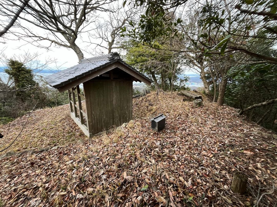
山頂には無宗天神社のお堂がありました。
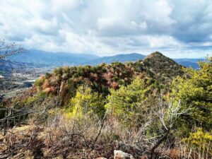
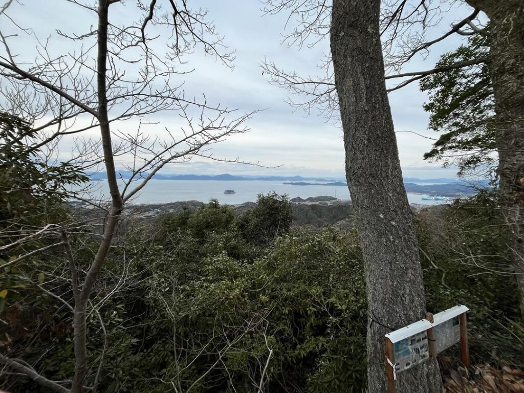
本来は眺望が良いのだと思うのですが、木々でちょっと見えにくい感じです。
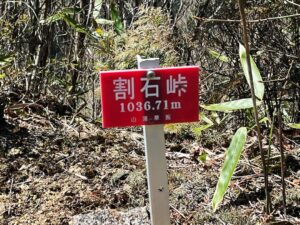
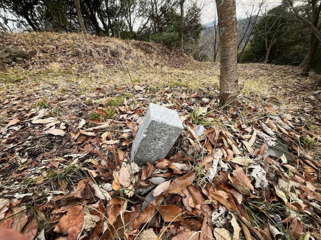
社の少し前あたりに三角点もありました。
ここに山城である無宗天城があったとのことです。
登られる方は、ぜひ、登山口から「徒歩」で登りましょう!
書き方が甘いので注意が必要です
登って良いのは四駆の軽自動車のみです!
※四駆の軽自動車以外では登ったらダメ!
ここ以外にUターンポイントはありません
※四駆の軽自動車以外では登ったらダメ!
ここから山頂まで徒歩で800m
なんとか道はわかりますが、滑りやすいので要注意です
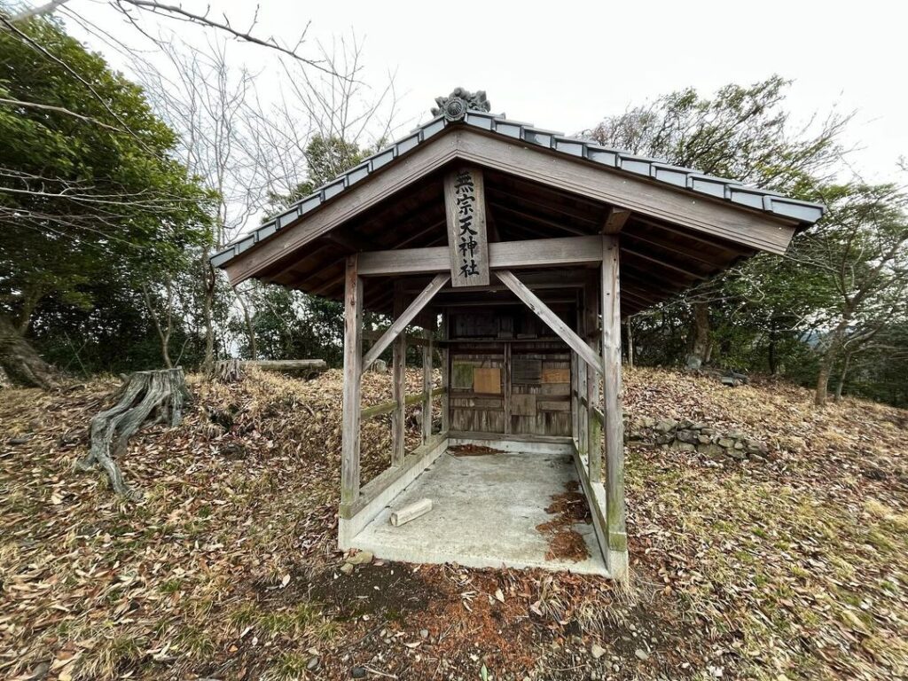
最高点はお堂の裏あたりです
木々が茂っているのでこのくらい
#無宗天山
#むしょうでさん
#むそうでさん
#標高315m
#無宗天神社
#無宗天城
#愛媛の小山登り
#小山登り
#愛媛県
#今治市
#菊間町
#原田登山口
#光野登山口
#で愛ふれ合いロード
Driving along the Deai Fureai Road, a wide-area farm road that runs from Imabari to Kikuma, I suddenly spotted a sign for “Mushoudezan” (Mt. Mushoude).
The time was 4:00 p.m., the elevation was 315 meters, and I could go there!
Looking at the information board at the Harada trailhead, I saw a (P) mark halfway up the mountain.
It would be a piece of cake if we could drive to the halfway point!
*Note: Never drive into Mushodsan.
I really regretted it .
It was at the level of a fall or a JAF case, but the fact that I am writing this text means that I barely made it back alive.
If you read the sign carefully, it says, “You can reach the parking lot in the middle of the mountain with a 4-wheel drive mini-car.” It says, “You can reach the parking lot in the middle of the hillside by a 4-wheel drive light vehicle.
Isn’t that a little too generous?
Later, I saw a sign at the Mitsuno trailhead that says, “Only light vehicles with 4-wheel drive are allowed up the trail. The trail is narrow with few places to merge, and it is unpaved from the halfway point. The description was quite dry.
So we climbed up from the Harada trailhead, parked our car at the parking lot in the middle of the mountain, and began our ascent.
We thought it would be easy since it was only 800 meters to the summit, but it was quite a tough trail with steep slopes, slippery paths, and difficult to find the way.
We joined the trail from the Mitsuno trailhead for the final ascent.
At the summit was the hall of the Mushoten Shrine.
The view was supposed to be good, but the trees made it a little difficult to see.
There was also a triangular point a little before the shrine.
It is said that Mushodesan, a mountain castle, once stood here.
If you are going to climb the mountain, please climb on foot from the trailhead!