大登山 スクーター登山&藪漕ぎ(愛媛県喜多郡内子町)標高364.2m
小田川沿いに内子に戻ってきて、ふと見上げるときれいなお山が。
AR山ナビ調べてみると、大登山とのこと。
YAMAPで調べると、山頂ギリギリまで道が続いているようです。
ということで、スクーター登山!
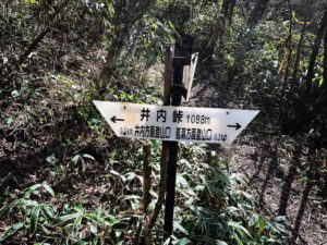
いくつか分岐がありますが、ナビに従って登っていきます。
というか、この山、どうしてこんなに道が整備されているのでしょう?
というぐらい山頂付近まで登れました。
ここから山頂に向かって、倒れた竹を潜って入っていきます。
しばらくは良い道だったのですが、ものすごい草藪がスタート。
なんとなく踏み跡があるので進んでみますが、全く進めないほどの藪。
YAMAPの山頂を目指して近づいていますが、すぐそこのはずなのに、近づいても近づいても草藪に阻まれます。
もうここまで!ということで、諦めることに。
たぶん、数mぐらいなのだろうけど。
草で全く眺望も楽しめず。
一応、三角点があるらしいので、機会があれば冬か初春にでも再チャレンジしてみます。

google mapで確認すると山頂近くまで道が!


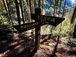
山頂は反対方向

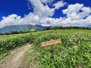
気持ちの良い広場がありました
木々で周囲の山々は見えず

竹で塞がれていますが、一応道はあります


なんとなく踏み跡らしきものがあったので突入します

直進は無理なので、右手に回り込んでみます

もう無理なので諦めました
ここを山頂とします!

草が枯れた頃だと三角点が見つけられそうです

大判山にはいつか行かないとです
#大登山
#おおとざん
#標高364.2m
#スクーター登山
#愛媛の小山登り
#小山登り
#愛媛県
#喜多郡
#内子町
#藪漕ぎ
Returning to Uchiko along the Oda River, I looked up and saw a beautiful mountain.
When I checked the AR mountain navigation system, I found it to be a Mt.Oto.
Yamap, and it seems that the trail continues to the very top of the mountain.
So we climbed the mountain by scooter!
There are several branches, but we followed the navigation system and climbed up.
Why are the roads so well maintained on this mountain?
I was able to climb up to the summit.
From here, we entered the mountain through fallen bamboos toward the summit.
The path was good for a while, but then we started to see a huge thicket of grass.
There were some kind of footprints, so we tried to go on, but the bushes were so thick that we could not go on at all.
We are approaching the summit of Yamap, but even though it should be right there, we are blocked by the grass and bushes whether we get close or not.
This is it! So we decided to give up.
Maybe it is only a few meters away.
We could not enjoy the view at all because of the weeds.
I heard that there is a triangulation point there, so I will try again in winter or early spring if I have a chance.