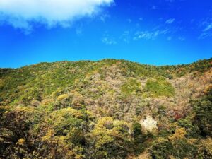
秋葉山 秋葉山おむろ からの眺望が最高です!(愛媛県伊予市)標高631m
明神山に登ったら、セットで登りたいのが秋葉山です。
秋葉山は明神山の西に位置しています。
明神山登山口から林道柆野カヤマ線を15分ほど歩くと、秋葉山登山口に。
とはいうものの、登山口は知っていないと全くわからないレベルです。
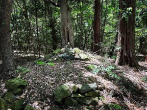
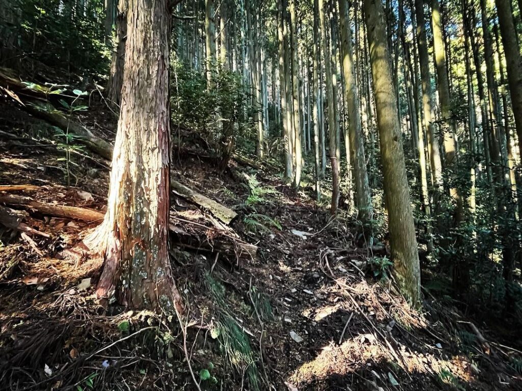
岩の斜面が始まる少し前の、小さな石が崩れたように積み重なっている場所が登山口です。
ここから入ると、右側に道が続いているのがわかります。
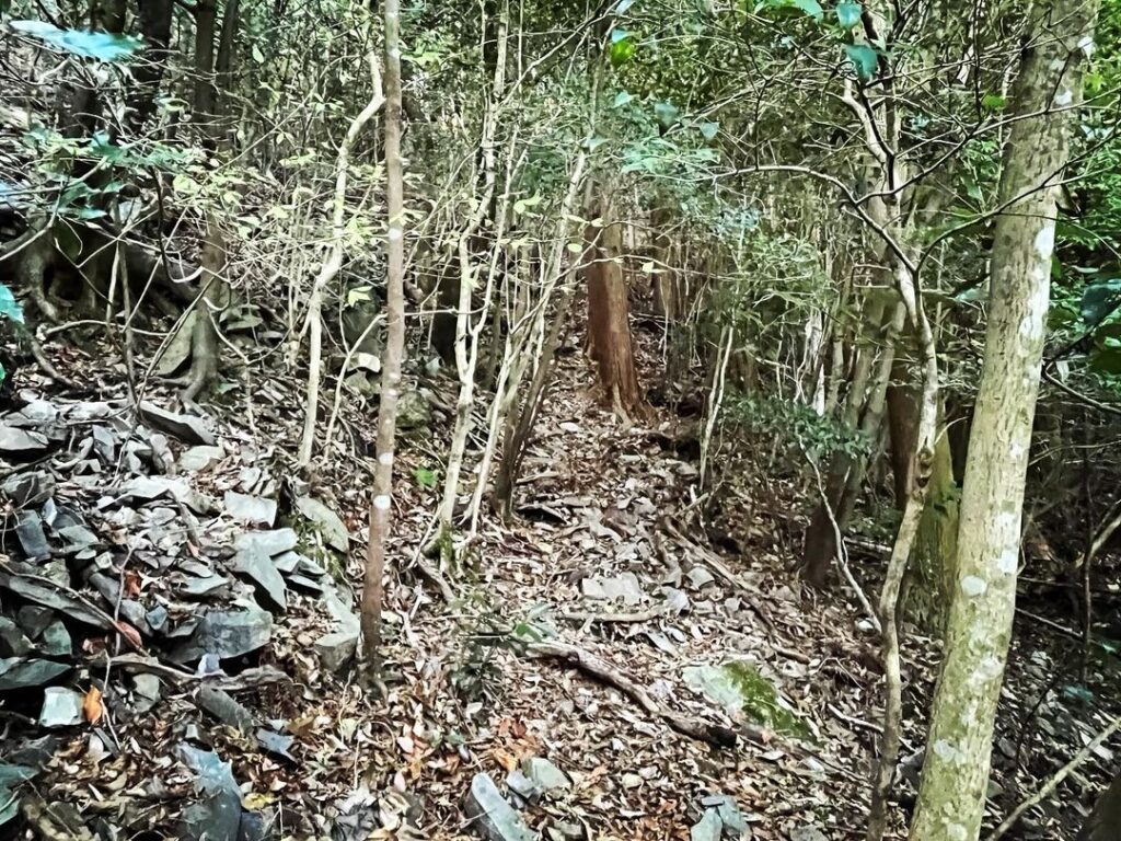
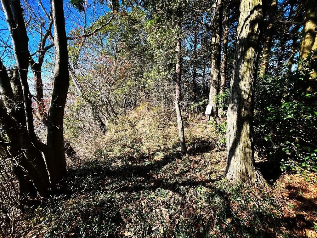
この道を、ひたすら歩いていきます。
道は歩きいやすいのです。
YAMAPで確認すると、秋葉山山頂の西側から入り、東側に抜けていきますが、迷わずどんどん進みましょう。
(わたしは不安で南側から直登してしまい、大変な目に・・・)
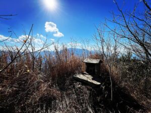
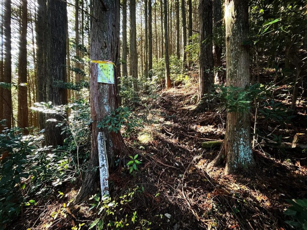
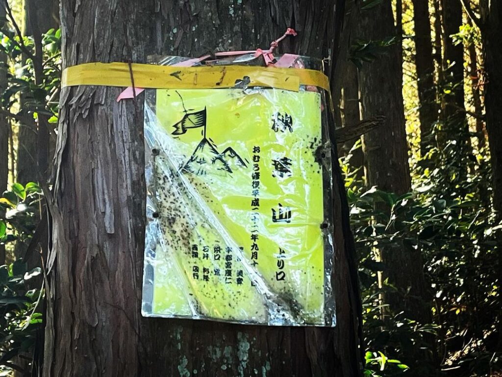
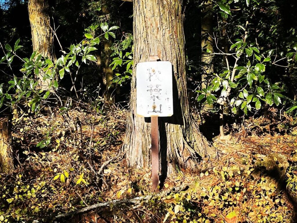
しばらく歩くと、東側の尾根に、黄色い「秋葉山 上り口」の案内が木に縛り付けられているのが見えます。
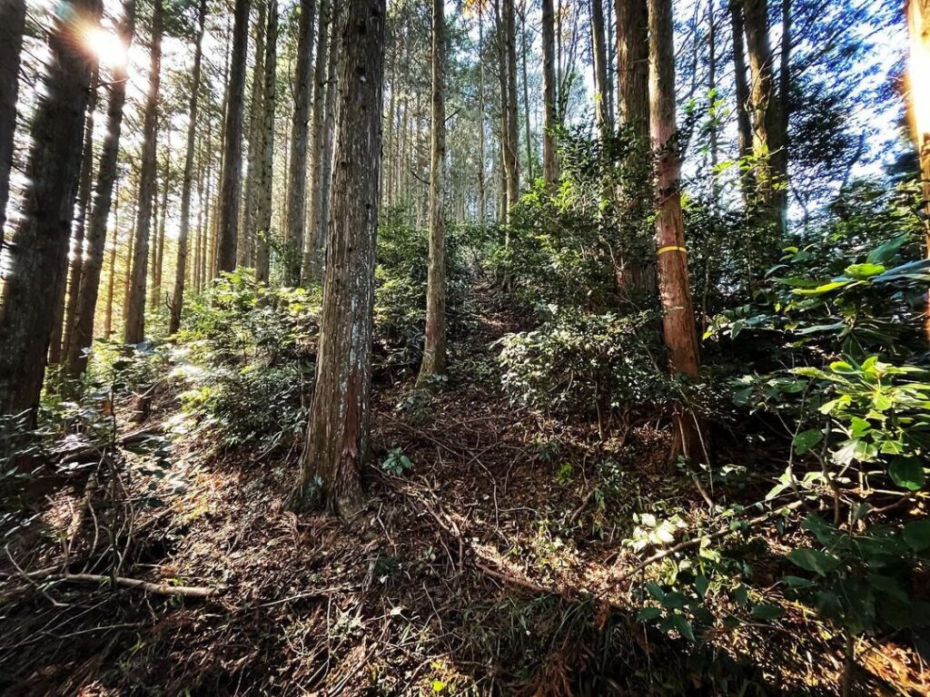
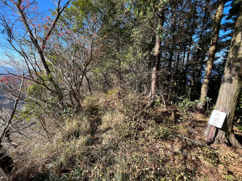
ここから尾根を登っていきます。
こちらもわかりやすい一本道ですので、どんどん登っていきましょう。
山頂付近は道がくねくねと曲がりますが、迷うことはありません。
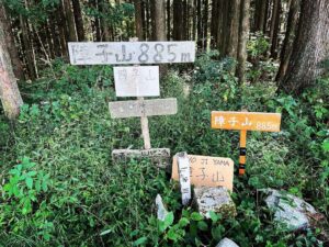
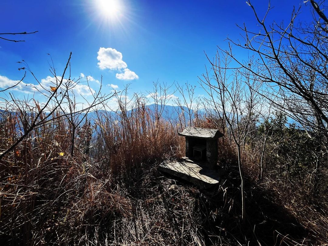
山頂は小さな広場になっています。
三角点はありませんが、秋葉山の標識が迎えてくれます。
さらに進んでみましょう。
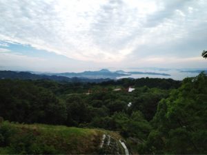
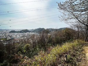
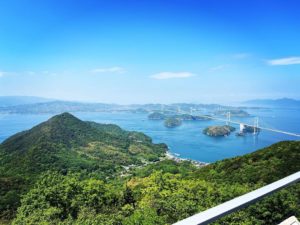
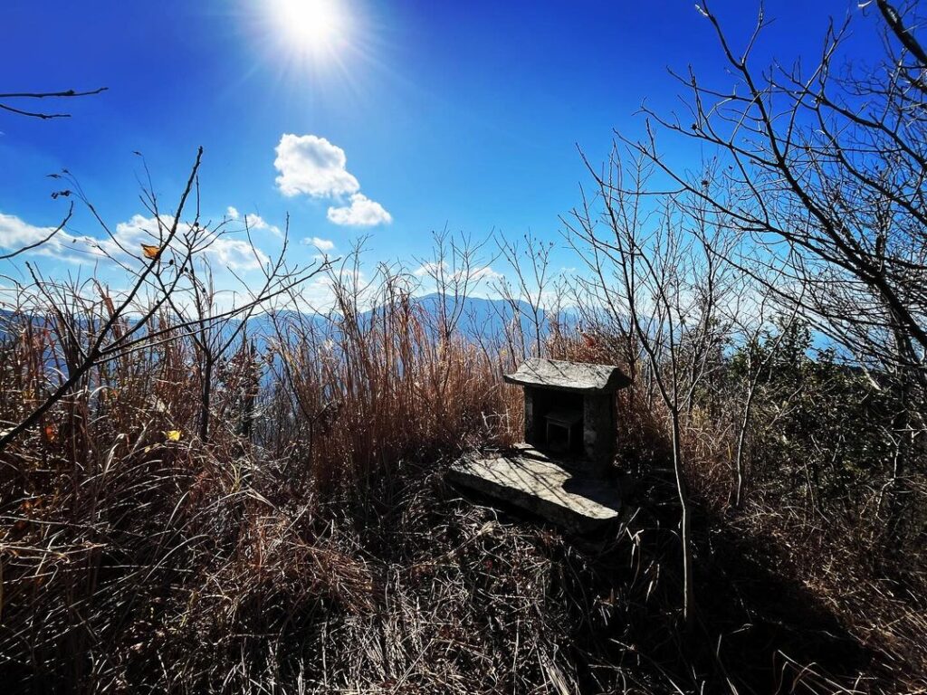
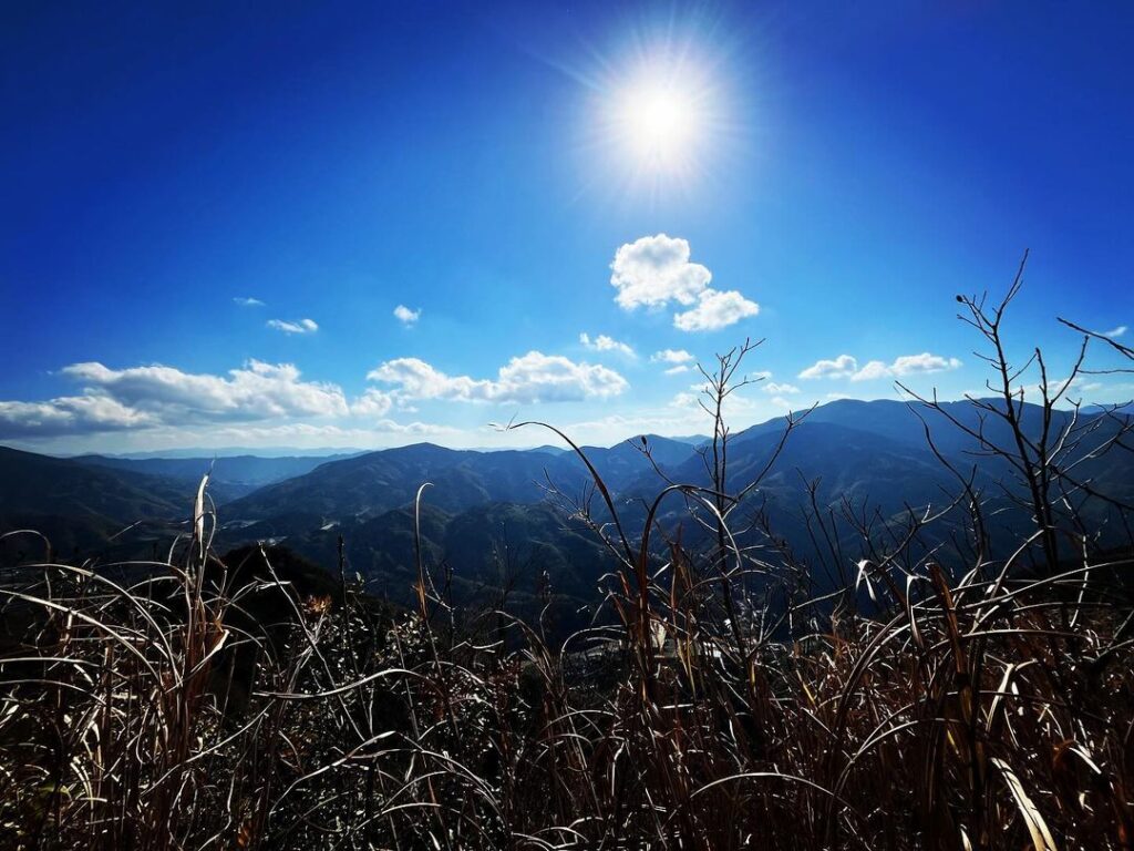
山頂から西側に少しくだると「秋葉山おむろ」という祠が。
実は、ここが眺望ポイント。
パノラマの景色を堪能することができます。
登山口からの距離は短いのですが、眺望のご褒美のある山でした。
さらに、近くに立烏帽子岳があるのですが、今回は満足したので終了です。
さて、土砂崩れだらけの林道柆野カヤマ線を戻ります。
見落としやすいのでMAPと照らし合わせてください
とにかく、道に沿って真っすぐ進みましょう
(私は途中で直登してしまい、大変な目に遭いました・・・)
少し草が他界のですが、ここは眺望が良いのですね
#秋葉山
#あきばさん
#標高631m
#双海秋葉山
#愛媛の小山登り
#小山登り
#愛媛県
#伊予市
#林道柆野カヤマ線
#何ヶ所も土砂崩れ
#落石
#秋葉山おむろ
#秋葉山御室
#立烏帽子岳
#たてえぼしだけ
After climbing Mt. Myojin, you may want to climb Mt.
Mt. Akiba is located to the west of Mt. Myojin.
A 15-minute walk from the Myojinzan trailhead along the forest road Kuino Kayama Line will take you to the Akibasan trailhead.
However, the trailhead is not at all obvious unless you know it.
Just before the rocky slope begins, the trailhead is a place where small stones are piled up as if they had collapsed.
Entering from here, you will see a path leading off to the right.
You will continue walking along this path.
The path is easy to walk on.
According to Yamap, the trail starts from the west side of the summit of Akibayama and goes through to the east side.
(I was so anxious that I went straight up from the south side and got into trouble…)
After walking for a while, you will see a yellow “Mt. Akibayama Ascent” sign tied to a tree on the ridge on the east side.
From here we will climb up the ridge.
This is also an easy-to-follow straight path, so keep going up.
The path twists and turns near the summit, but you will not get lost.
The summit is a small open space.
There is no triangulation point, but you will be greeted by the Akibayama sign.
Let’s go further.
A little further down on the west side from the summit, you will find a shrine called “Akibayama Omuro”.
Actually, this is the view point.
You can enjoy the panoramic view.
Although the distance from the trailhead is short, it is a mountain with a rewarding view.
Furthermore, there is Tateeboshidake nearby, but this time we were satisfied, so we finished.
Now, we will return to the landslide-ridden forest road Yino Kayama Line.
秋葉山の登山口1
秋葉山の登山口2(黄色い標識の場所)
秋葉山のMAP
秋葉山おむろのMAP