永納山 愛媛県で唯一の古代山城跡 4つの頂上に素晴らしい眺望(愛媛県西条市・愛媛県今治市)標高132.4m
古代山城は、古代日本(律令制以前)の山城のことを言うそうです
。
西日本を中心に25ヶ所、そのうち四国に3ヶ所、そのうち愛媛県に1ヵ所。
それが永納山城です。
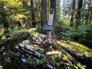
世田山に登ろうと世田薬師にやってきたところ、目の前に永納山の案内看板。
これは登らねば!ということで登ってきました。
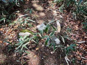
南部登口(西側登り口)から登っていき尾根に。
ここからはずっと尾根道です。
この尾根が城壁跡なのだとか。
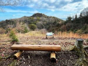
まずは南部頂上(標高92.0m)へ。
ベンチが設置されていますが、永納山までの尾根道を一望できます。
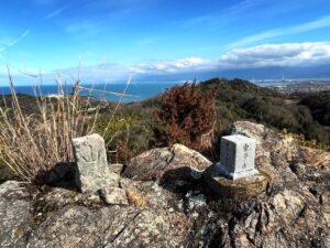
続いて東南部頂上(標高103.5m)へ。
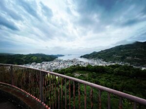
石鎚山側の素晴らしい眺望を楽しめます。
ここから真っ直ぐな鞍部の尾根道。
瀬戸内海を眺めながら尾根道を歩きます。
再び登り始めると、すぐに東部頂上(標高102.3m)へ。
ここからが最後の登り。
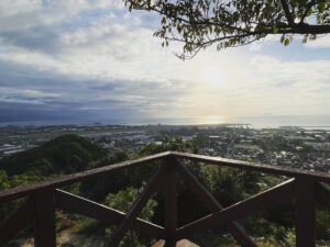
少し登ると、永納山山頂(標高132.4m)です。
世田山、しまなみ海道の来島海峡大橋、今治平野、瀬戸内海の島々、石鎚山方面。
ここからは全方向のパノラマの眺望が楽しめます。
思いがけず登った低山でしたが、素晴らしい小山でした。
4ヶ所の頂上、素晴らしい景色!
世田山登山の前後にぜひ登ってみてください!


パンフレットやマップが置いてありますのでぜひ!


#永納山
#えいのうさん
#標高132m
#地理院地図
#標高128m
#永納山城跡
#愛媛の小山登り
#小山登り
#愛媛県
#西条市
#今治市
#世田薬師
#南部頂上
#南東部頂上
#東部頂上
#医王山
#古代山城
#こだいさんじょう
#三角点
Ancient Yamashiro is said to be a mountain castle in ancient Japan.
There are
There are 25 such castles mainly in western Japan, 3 of which are located in Shikoku, and 1 of which is in Ehime Prefecture.
That is Einousan castle.
When I came to Seta Yakushi to climb Mt. Seta, I saw a signboard for Mt.Einou.
I had to climb it! So we climbed up.
We climbed up from the southern entrance (west side entrance) to the ridge.
From here, the path continues along the ridge.
This ridge is said to be the remains of the castle wall.
First, we went to the southern summit (elevation 92.0 m).
There is a bench on which you can enjoy a panoramic view of the ridge road up to Mt.Einou.
Next, go to the southeast summit (elevation 103.5m).
Ishizuchi side, where you can enjoy a wonderful view of the mountain.
From here, a straight saddle ridge trail.
Walk along the ridge path while enjoying the view of the Seto Inland Sea.
The trail climbs again and soon reaches the eastern summit (elevation: 102.3 meters).
This is the final ascent.
A little further up is the summit of Mount Einou (132.4 m above sea level).
Seta, the Kurushima Kaikyo Bridge on the Shimanami Kaido, the Imabari Plain, the islands of the Seto Inland Sea, and Mt.Ishizuchi.
From here, you can enjoy panoramic views in all directions.
It was a low mountain that I climbed unexpectedly, but it was a wonderful little mountain.
Four summits, great views!
Please try climbing before or after climbing Mt. Seto!
永納山山頂からの眺望(動画)
永納山の登り口
永納山の登山口(南部登口(西側登り口))
永納山のMAP